Transit Coverage & Commute Patterns in Leawood
| Metric | Leawood, KS |
|---|---|
| Average Commute Time | 21 minutes |
| Work From Home | 2.7% |
| Long Commute (60+ min) | 23.5% |
| Transit Type | Bus service present |
| Walkable Infrastructure | High pedestrian-to-road ratio in pockets |
How People Get Around Leawood
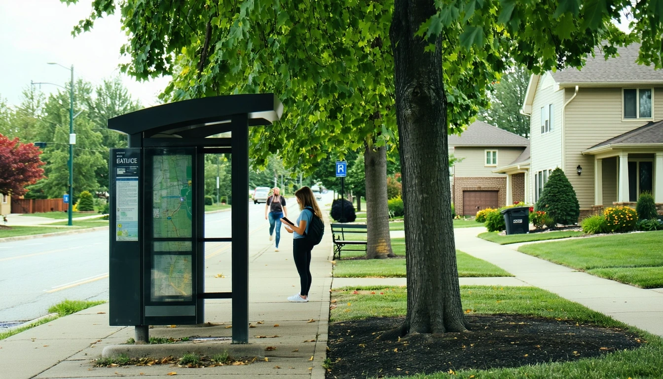
Leawood operates as a car-first suburb with selective pockets of pedestrian-friendly infrastructure and limited bus service. Most residents drive for nearly all trips—work commutes, errands, school runs, and social activities. The city’s layout reflects classic suburban development: residential neighborhoods spread across a wide area, commercial corridors clustered along major roads, and distances that make walking or transit impractical for most daily routines.
What newcomers often misunderstand is that Leawood’s walkability exists in isolated zones, not as a citywide system. The pedestrian-to-road ratio exceeds typical suburban thresholds in certain areas, meaning sidewalks, crossings, and pedestrian paths are present and well-maintained in those pockets. But this doesn’t translate into transit viability or car-free living. Even in the most walkable parts of Leawood, households still depend on vehicles to reach work, access healthcare, or connect to destinations outside their immediate neighborhood.
The dominant mobility pattern here is driving, supplemented by localized walking for specific errands in well-served commercial clusters. Transit plays a marginal role, and remote work remains rare—only 2.7% of the workforce works from home, well below national averages. This means nearly everyone in Leawood is commuting regularly, and the infrastructure is built to support that reality.
Public Transit Availability in Leawood
Public transit in Leawood centers around bus service, with no rail options present. The bus network provides limited coverage, primarily serving corridors that connect Leawood to nearby employment centers and regional destinations. For residents living near these routes, transit can function as a supplemental option for specific trips—commuting to a single workplace along a served corridor, accessing medical appointments in nearby districts, or reaching regional hubs without parking hassle.
But transit’s utility drops sharply outside these narrow use cases. Coverage doesn’t extend uniformly across Leawood’s residential areas, and the network isn’t designed to support multi-stop errands, off-peak travel, or trips that require transfers. Households relying on transit for daily logistics—grocery runs, school pickups, evening activities—face significant friction. The system works best for commuters with fixed schedules and destinations aligned to existing routes, not for families managing complex household routines.
Leawood’s transit infrastructure reflects its role as a suburban bedroom community rather than a transit-oriented urban core. The bus service exists, but it doesn’t replace the need for a car. It supplements driving for a small subset of residents whose commute patterns happen to align with available routes.
Driving & Car Dependence Reality
Driving isn’t optional in Leawood—it’s structural. The city’s geography, density, and land-use patterns all reinforce car dependence. Residential neighborhoods sit separated from commercial districts, schools are spread across the city rather than clustered walkably, and even areas with strong pedestrian infrastructure don’t connect seamlessly to transit or regional destinations.
Parking is abundant and typically free at most destinations, which removes one of the friction points that might otherwise encourage transit use. Commute flexibility—the ability to leave early, stay late, or make stops on the way home—depends on having a vehicle. Households without cars face significant logistical challenges, even in Leawood’s more walkable pockets.
This car reliance isn’t about preference or lifestyle choice. It’s a direct result of how Leawood is built. The infrastructure prioritizes vehicle access, and daily life is organized around the assumption that residents can drive. Families, professionals, and retirees alike structure their routines around car ownership, and the city’s layout makes alternatives impractical for most.
Commuting Patterns & Daily Mobility
The typical commute in Leawood lasts 21 minutes, which reflects proximity to employment centers in the Kansas City metro rather than internal job density. Most residents commute outward to nearby districts for work, rather than staying within Leawood itself. This creates a pattern where mornings and evenings see heavy outbound and inbound traffic, but midday mobility remains light.
A notable 23.5% of workers experience long commutes exceeding 60 minutes, suggesting that while many residents enjoy short, predictable drives, a significant minority faces extended travel times. These longer commutes often involve crossing into different parts of the metro, navigating congestion, or working in districts poorly served by direct routes. For these households, commute time becomes a daily cost in flexibility and predictability, even if fuel expenses remain moderate.
Daily mobility in Leawood typically involves single-destination trips rather than multi-stop errands clustered on foot or via transit. Grocery shopping, medical appointments, and social activities all require separate car trips. The city’s high food and grocery density means errands are accessible, but accessibility here means “reachable by car within a few minutes,” not “walkable from home.” Households benefit from convenience, but that convenience depends entirely on vehicle access.
Who Transit Works For — and Who It Doesn’t
Transit in Leawood works for a narrow slice of residents: those living near bus corridors with workplaces or regular destinations directly along those routes. This might include professionals commuting to a single office in a nearby district, students traveling to regional campuses, or retirees accessing medical facilities in served areas. For these households, bus service can reduce driving frequency and provide a predictable, low-effort commute option.
Transit doesn’t work for families managing multiple daily stops, households with irregular schedules, or residents living in areas without nearby bus access. Parents coordinating school pickups, grocery runs, and after-school activities can’t rely on transit. Shift workers, freelancers, or anyone with variable hours face service gaps that make buses impractical. And renters or homeowners in peripheral neighborhoods often find themselves too far from routes to make transit a realistic option, even for occasional use.
The distinction isn’t between renters and owners—it’s between those whose daily routines align with the existing transit network and those whose routines don’t. In Leawood, the latter group is much larger. Most households, regardless of housing type, depend on cars because their lives don’t fit the limited structure transit provides.
Transportation Tradeoffs in Leawood
Choosing between transit and driving in Leawood isn’t a balanced tradeoff—it’s a question of whether your specific commute and daily routine happen to align with the limited bus network. For the small number of households where alignment exists, transit offers predictability and removes the need to navigate traffic or parking. For everyone else, driving provides the flexibility, coverage, and control necessary to manage daily life.
Driving in Leawood means accepting fuel costs, vehicle maintenance, and the time spent behind the wheel. But it also means freedom to make multi-stop trips, adjust schedules on the fly, and access the full range of services and destinations across the metro. Transit, where viable, reduces some of those costs but introduces constraints: fixed routes, limited hours, and the inability to deviate from planned trips.
The real tradeoff isn’t financial—it’s structural. Households choosing where to live in Leawood are effectively choosing their transportation dependence. Living near a bus corridor with a compatible commute opens up transit as a supplement. Living elsewhere locks in car dependence. Both paths are viable, but only one offers optionality.
FAQs About Transportation in Leawood (2026)
Is public transit usable for daily commuting in Leawood?
Public transit is usable for a small subset of commuters whose workplaces align with existing bus routes. For most residents, transit doesn’t provide the coverage, frequency, or flexibility needed for daily commuting, especially if the commute involves multiple stops or destinations outside served corridors.
Do most people in Leawood rely on a car?
Yes. The vast majority of Leawood residents depend on cars for commuting, errands, and daily logistics. The city’s layout, low transit coverage, and geographic spread make car ownership effectively necessary for most households.
Which areas of Leawood are easiest to live in without a car?
Areas with high pedestrian infrastructure and proximity to bus routes offer the best chance of reducing car dependence, but even in these pockets, most households still need a vehicle for trips outside the immediate neighborhood. Full car-free living is impractical across Leawood.
How does commuting in Leawood compare to nearby cities?
Leawood’s 21-minute average commute reflects its proximity to regional employment centers and relatively low internal congestion. Compared to denser urban cores, Leawood offers shorter, more predictable drives. Compared to more transit-rich cities, Leawood offers fewer alternatives to driving.
Does Leawood have bike infrastructure for commuting?
Bike infrastructure exists in some pockets, with moderate bike-to-road ratios detected in certain areas. However, cycling infrastructure is not comprehensive or connected citywide, limiting its utility for daily commuting or errands beyond localized recreational use.
How Transportation Fits Into the Cost of Living in Leawood
Transportation in Leawood isn’t just a line item—it’s a structural factor that shapes housing decisions, time allocation, and household logistics. Choosing where to live in Leawood means choosing your commute length, your access to walkable errands, and your dependence on a vehicle. These choices ripple into monthly expenses, budget planning, cost breakdown, affecting not just fuel and maintenance costs but also flexibility, predictability, and daily friction.
Households evaluating Leawood should consider transportation as part of the broader cost structure, not as an isolated expense. A shorter commute or proximity to bus service can reduce time costs and provide optionality. A longer commute or peripheral location increases driving dependence and limits alternatives. Both paths are common in Leawood, but understanding which one fits your routine is essential to making the city work financially and logistically.
For detailed context on how transportation costs interact with housing, utilities, and other expenses, see the monthly budget guide. Transportation in Leawood is predictable and manageable for most households, but it requires planning, vehicle access, and realistic expectations about what transit can and can’t provide.
How this article was built: In addition to public economic data, this article incorporates location-based experiential signals derived from anonymized geographic patterns—such as access density, walkability, and land-use mix—to reflect how day-to-day living actually feels in Leawood, KS.