Can you live in Falls Church without a car? The answer depends less on what’s technically possible and more on where in the city you land, where you work, and how you structure daily life. Falls Church sits in a transportation middle ground: rail access and walkable pockets exist, but nearly half of all commuters face long trips that often pull them beyond what transit can easily serve. Understanding how mobility actually works here—not just what’s available on a map—shapes everything from housing choice to daily friction.
How People Get Around Falls Church
Falls Church operates as a hybrid mobility environment. The pedestrian-to-road ratio exceeds what you’d find in purely car-oriented suburbs, and rail service provides a real alternative for certain commute patterns. At the same time, 42.3% of workers face long commutes, and only 6.1% work from home—suggesting that most residents leave the city for employment, often to destinations that don’t align neatly with transit routes.
What newcomers often misunderstand is that Falls Church isn’t uniformly walkable or uniformly car-dependent. The city contains walkable pockets where pedestrian infrastructure is dense, errands are accessible on foot, and rail stations anchor daily movement. Outside those zones, driving becomes the default. The development pattern reflects this: mixed building heights, both residential and commercial land use present, and a street network that supports multiple modes without fully committing to any single one.
The result is a city where transportation strategy varies block by block. Core areas near rail function more like urban neighborhoods; peripheral sections behave more like traditional suburbs. Your experience depends heavily on which Falls Church you’re living in.
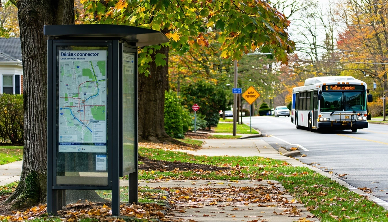
Public Transit Availability in Falls Church
Public transit in Falls Church often centers around systems such as Metro, which provides rail service into and out of the city. Rail presence is confirmed and plays a meaningful role for residents whose commutes align with station locations and service patterns. For trips into Washington, D.C., or to other Metro-connected employment centers, transit offers a viable alternative to driving.
Transit works best in the walkable pockets near stations, where the pedestrian infrastructure supports the first-mile and last-mile connections that make rail practical. Food and grocery density in these areas exceeds high thresholds, meaning residents can structure errands around walking rather than needing a car for every trip. The cycling infrastructure—also notably present—adds another layer of mobility for those comfortable biking to stations or around the city.
Where transit falls short is in coverage beyond the core. Long commutes often involve destinations that aren’t on the rail network, requiring either a car or multi-transfer bus trips that stretch travel time significantly. Late hours and weekend service can also limit flexibility, particularly for households with irregular schedules or multiple daily stops. Transit in Falls Church is real and functional, but it’s not comprehensive.
Driving & Car Dependence Reality
For many Falls Church residents, driving remains necessary. The 42.3% long commute rate suggests that a large share of workers travel to employment centers that either lack transit connections or require travel times that make driving the only practical option. Family logistics—school drop-offs, activity shuttles, grocery runs to specific stores—often require the flexibility and cargo capacity that only a car provides.
Parking in Falls Church generally reflects suburban norms: most housing includes dedicated spaces, and street parking pressures are localized rather than citywide. The tradeoff isn’t parking scarcity; it’s the ongoing exposure to fuel prices (currently $3.84 per gallon), maintenance, insurance, and the time cost of sitting in traffic during peak hours.
Car dependence here isn’t about sprawl in the exurban sense. It’s about the mismatch between where people live and where they work, combined with daily patterns that require multi-stop flexibility. Even residents who can walk to groceries or bike to the Metro often keep a car for everything else.
Commuting Patterns & Daily Mobility
The typical commute in Falls Church averages 27 minutes, but that figure masks significant variation. Residents commuting into D.C. via Metro may experience predictable, transit-friendly trips. Those driving to jobs in Tysons, Reston, or other auto-oriented employment hubs face different realities: longer distances, traffic variability, and limited alternatives.
Daily mobility in Falls Church often involves layered strategies. Someone might walk to the Metro for work but drive on weekends. Another household might bike locally for errands but rely on a car for anything beyond the immediate neighborhood. The mixed land use and notable bike infrastructure support this flexibility, but they don’t eliminate the need for a vehicle in most cases.
Who benefits from proximity? Residents working in D.C. or other Metro-accessible locations, particularly those living near stations in the walkable core. Who absorbs commute friction? Households with jobs in suburban office parks, irregular hours, or multi-location daily patterns that don’t align with fixed transit routes.
Who Transit Works For — and Who It Doesn’t
Transit in Falls Church fits a specific profile. It works well for individuals or couples without children, particularly renters in the walkable pockets near rail stations, whose jobs are Metro-accessible and whose errands can be handled on foot or by bike. The broadly accessible food and grocery options in these areas reduce the need for car-based shopping trips, and the pedestrian infrastructure makes walking feel practical rather than precarious.
Transit becomes harder for families with school-age children, especially those managing multiple daily stops or activities that don’t cluster near home. It’s also less viable for residents whose work requires driving (sales, service calls, site visits) or whose employers are located in areas with poor transit connections. Peripheral neighborhoods, even within Falls Church, often lack the density of pedestrian infrastructure that makes transit a realistic daily option.
Homeowners, particularly those in single-family zones, tend to default to car ownership regardless of transit availability. The investment in housing often comes with the expectation of vehicle access, and the layout of these neighborhoods—while not hostile to walking—doesn’t always support car-free living in practice.
Transportation Tradeoffs in Falls Church
Choosing between transit and driving in Falls Church isn’t about cost alone; it’s about control, predictability, and flexibility. Transit offers fixed costs (fares, passes) and eliminates fuel price exposure, but it also imposes schedule constraints and limits spontaneity. Driving provides flexibility and door-to-door convenience but introduces variability—fuel prices shift, traffic patterns change, and maintenance needs arise unpredictably.
For households that can make transit work, the tradeoff often favors predictability and reduced stress. For those whose daily patterns require a car, the question becomes how much driving is necessary versus optional. Living in a walkable pocket near rail doesn’t eliminate car ownership for most families, but it can reduce how often the car is needed, lowering overall exposure to fuel and maintenance costs without eliminating them.
The real tradeoff in Falls Church is between housing location and transportation flexibility. Proximity to rail and walkable errands often comes with higher housing costs, while more affordable peripheral locations typically require full car dependence. Neither choice is inherently better; both involve accepting different kinds of friction.
FAQs About Transportation in Falls Church (2026)
Is public transit usable for daily commuting in Falls Church?
Yes, if your job is Metro-accessible and you live near a station in one of the walkable core areas. Rail service is present and functional for trips into D.C. and other connected employment centers. For jobs in auto-oriented suburbs or locations without transit links, driving becomes necessary.
Do most people in Falls Church rely on a car?
Most households own cars, even those near transit. The 42.3% long commute rate and the variety of employment destinations beyond the city mean that driving remains the primary mode for many residents. Transit serves as a real alternative for some, but it’s not the dominant pattern citywide.
Which areas of Falls Church are easiest to live in without a car?
The walkable pockets near Metro stations, where pedestrian infrastructure is dense and food and grocery options are broadly accessible. These areas support daily life on foot or by bike, though most residents still keep a car for trips outside the immediate neighborhood.
How does commuting in Falls Church compare to nearby cities?
Falls Church offers better pedestrian infrastructure and rail access than many purely suburban areas, but it doesn’t match the transit saturation of D.C. itself. The 27-minute average commute reflects a mix of short Metro trips and longer drives to outlying employment centers. The city functions as a transitional zone between urban and suburban mobility patterns.
Can you bike for transportation in Falls Church?
Yes, particularly in areas where the bike-to-road ratio is high. Cycling infrastructure is notably present and supports both recreational riding and practical trips to stations or local errands. However, biking as a primary mode depends on route safety, distance to destinations, and personal comfort with traffic.
How Transportation Fits Into the Cost of Living in Falls Church
Transportation in Falls Church isn’t just a line item; it’s a structural factor that shapes housing decisions, time allocation, and daily flexibility. Living near rail in a walkable pocket may reduce driving frequency, but it doesn’t eliminate the need for a vehicle for most households. Living farther out may lower housing costs but increases car dependence and the time spent commuting.
The interplay between where money goes and how you move through the city is direct. Households that can reduce driving save on fuel, maintenance, and parking, but they often pay more for proximity. Those who drive daily absorb fuel price volatility and commute time but may gain housing affordability or space.
Understanding how transportation works in Falls Church—where transit is viable, where it’s not, and what driving really requires—helps clarify which neighborhoods and commute patterns fit your household. The city offers real options, but none of them are universal. The right choice depends on where you work, how you structure daily life, and what kinds of friction you’re willing to accept.
How this article was built: In addition to public economic data, this article incorporates location-based experiential signals derived from anonymized geographic patterns—such as access density, walkability, and land-use mix—to reflect how day-to-day living actually feels in Falls Church, VA.
—