Can you live in Holly Springs without a car? For most households, the honest answer is no—but the reasons why reveal more about how this town is structured than about what’s missing. Holly Springs sits in a region where jobs, services, and daily destinations spread across multiple municipalities, and while transportation options in Holly Springs include bus service and surprisingly strong cycling infrastructure in parts of town, the reality is that most people drive most of the time. Understanding how mobility works here means looking past what’s technically available and focusing on what actually shapes daily life: commute distances, neighborhood design, and the friction between where people live and where they need to be.
How People Get Around Holly Springs
Holly Springs is a low-rise suburban town with pockets of walkable infrastructure and notable cycling presence, but the dominant pattern is car-first. The town’s development reflects typical Research Triangle growth: residential subdivisions built quickly to accommodate regional employment centers that lie elsewhere. What newcomers often misunderstand is that Holly Springs isn’t isolated—it’s part of a multi-city commute shed where driving connects you to Raleigh, Cary, Durham, and the Research Triangle Park job corridor.
The average commute here runs 28 minutes, but that figure masks a more telling reality: 49.7% of commuters face what’s classified as a long commute, meaning they’re traveling well beyond town boundaries for work. Only 5.8% work from home, far below the post-pandemic national average, which suggests that many Holly Springs residents hold jobs that require physical presence at regional employers. The town’s layout—low-density residential areas with commercial corridors—means that even local errands often require a car, though certain neighborhoods near mixed-use corridors offer more walkable access to groceries and services.
Cycling infrastructure stands out as more developed than you’d expect in a suburban town of this type. The bike-to-road ratio exceeds typical thresholds, meaning dedicated lanes, paths, or shared routes exist throughout parts of Holly Springs. This doesn’t replace car dependence for most households, but it does create recreational options and short-trip alternatives for those living near connected routes. Pedestrian infrastructure follows a similar pattern: walkable pockets exist, particularly in areas where residential and commercial land use mix, but these zones don’t cover the whole town. If you’re choosing a neighborhood, proximity to these pockets determines whether you can walk to a coffee shop or pharmacy—or whether every errand requires ignition.
Public Transit Availability in Holly Springs
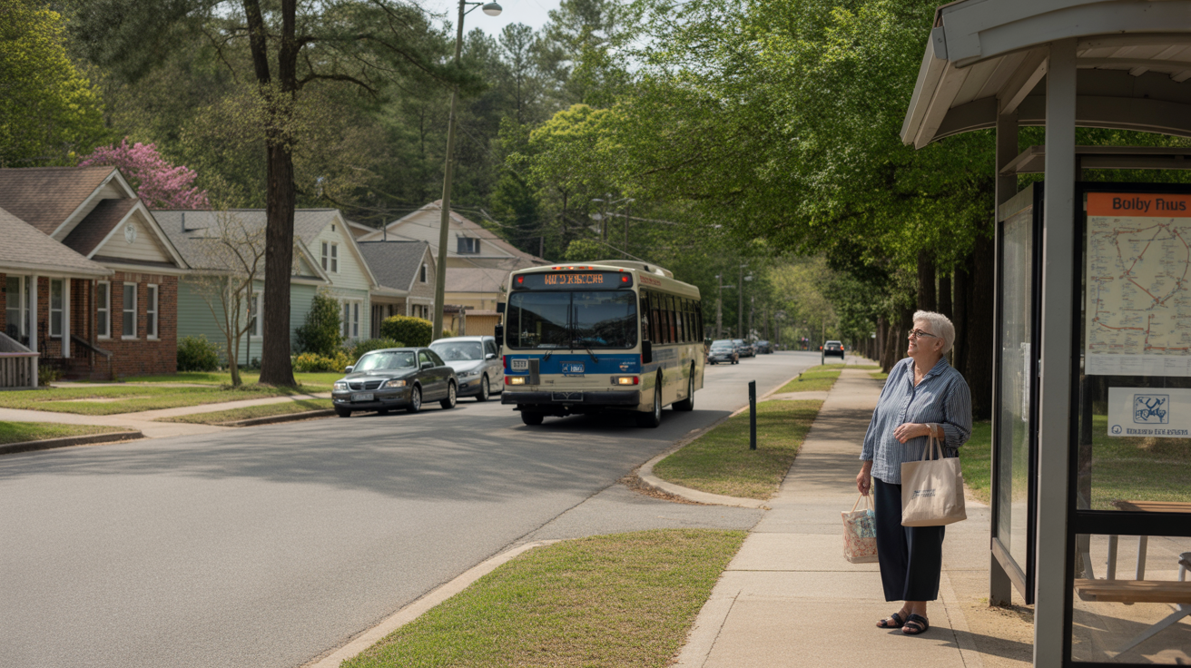
Public transit in Holly Springs centers around bus service, with no rail access. The presence of bus stops indicates that regional transit systems extend routes into town, but coverage remains limited compared to urban cores. Transit works best for commuters whose destinations align with fixed routes and schedules—typically those traveling to major employment centers or institutional hubs in the Research Triangle area. For residents living near a bus corridor and working along a predictable route, transit can reduce driving frequency and offer a lower-stress commute option.
Where transit falls short is in flexibility and coverage. Suburban street networks don’t lend themselves to frequent, grid-based service, and many newer subdivisions sit too far from main corridors to make bus access practical. Evening and weekend service tends to be lighter, which limits transit’s usefulness for shift workers, families managing multiple stops, or anyone whose schedule doesn’t align with peak commuting hours. Holly Springs also lacks the density that supports high-frequency service, so wait times and transfer logistics become friction points for households trying to rely on transit for daily errands or non-work trips.
The role transit plays here is supplemental, not primary. It connects certain neighborhoods to regional job centers, but it doesn’t replace the need for a car in most households. For renters or younger workers living near a bus line and commuting to a single fixed location, transit can work. For families managing school drop-offs, weekend activities, or multi-stop errands, it doesn’t.
Driving & Car Dependence Reality
Driving isn’t just common in Holly Springs—it’s structurally necessary for most households. The town’s geography spreads residential areas across a low-rise landscape where commercial services cluster along a few main corridors. Parking is abundant and free in most contexts, which removes one of the usual friction points that discourages driving in denser cities. Commute flexibility matters here: if your job, your partner’s job, your kids’ schools, and your grocery store all sit in different directions, a car is the only tool that makes the logistics work.
Sprawl isn’t a pejorative in this context—it’s a descriptor. Holly Springs grew quickly to accommodate families seeking newer homes and good schools within reach of Research Triangle employment. That growth pattern prioritized single-family subdivisions over mixed-use density, which means that even short trips—picking up prescriptions, grabbing takeout, dropping off dry cleaning—usually involve driving. The tradeoff is space, privacy, and lower housing density, but the cost is time and fuel spent on mobility.
For households with two working adults, car dependence often means two vehicles. One-car households face scheduling constraints that limit job flexibility, extracurricular options, and errands. The infrastructure assumes car access: wide roads, ample parking, drive-through services, and commercial centers designed around parking lots rather than sidewalks.
Commuting Patterns & Daily Mobility
Commuting in Holly Springs typically means leaving town. The 28-minute average commute reflects trips to Raleigh, Cary, or Research Triangle Park, and the fact that nearly half of commuters fall into the “long commute” category suggests that many residents absorb significant travel time to access regional job markets. Single-job commuters—those driving to one fixed location five days a week—benefit from predictable routes and can optimize timing to avoid peak congestion. Multi-stop commuters, especially parents managing school and daycare logistics, face more complex routing and tighter time windows.
Flexibility becomes a key variable. Remote work, even part-time, reduces transportation pressure and opens up housing options farther from job centers. But with only 5.8% of Holly Springs workers fully remote, most households structure their day around the commute. Proximity to major corridors—US-1, NC-55—determines how much of that 28-minute average you’ll actually experience. Living near these routes shortens the commute; living deep in a subdivision adds time on local streets before you even reach the highway.
Daily mobility isn’t just about work. Errands in Holly Springs tend to cluster along commercial corridors where grocery stores, pharmacies, and services concentrate. If you live near one of these corridors, you can consolidate trips. If you don’t, each errand becomes its own drive. The town’s food and grocery density falls into a medium band, meaning options exist but aren’t uniformly distributed. Some neighborhoods enjoy walkable access to a grocery store; others require a drive of several miles.
Who Transit Works For — and Who It Doesn’t
Transit in Holly Springs works for a narrow slice of households: those living near a bus route, commuting to a destination the route serves, and working a schedule that aligns with service hours. This typically includes younger renters, single commuters, or couples who can manage with one car because one partner uses transit. It also works for households prioritizing lower transportation costs and willing to trade time and convenience for reduced driving.
Transit doesn’t work well for families with children, especially those managing school schedules, after-school activities, or daycare logistics. It doesn’t work for shift workers whose hours fall outside peak service times. It doesn’t work for households living in newer subdivisions where bus access requires a drive to a park-and-ride or transfer point. And it doesn’t work for anyone whose job, errands, or lifestyle require multi-stop flexibility that fixed routes can’t accommodate.
Renters living in older, denser parts of town closer to commercial corridors have better odds of making transit work than homeowners in newer subdivisions. But even in the best-case scenario, transit serves as a commute tool, not a full replacement for car ownership. Most transit-reliant households in Holly Springs still need occasional car access, whether through a second vehicle, carpool arrangements, or ride services.
Transportation Tradeoffs in Holly Springs
The choice between transit and driving in Holly Springs isn’t really a choice for most people—it’s a constraint shaped by where you live and where you work. Driving offers control, flexibility, and the ability to manage complex schedules, but it comes with exposure to fuel prices (currently $3.90/gal), maintenance costs, insurance, and the time spent behind the wheel. Transit offers predictability and lower direct costs, but it requires proximity to routes, schedule alignment, and acceptance of limited coverage.
For households weighing these tradeoffs, the question isn’t whether transit is “good enough”—it’s whether your specific situation aligns with what transit can actually do. If you’re a single commuter working in Raleigh along a bus line, transit might work. If you’re a family managing two jobs, two kids, and weekend errands across town, it won’t. The infrastructure in Holly Springs assumes car access, and most households adapt accordingly.
Cycling and walking offer partial alternatives for short trips in certain neighborhoods. If you live in one of the town’s walkable pockets near a commercial corridor, you can reduce car dependence for errands, coffee runs, or casual dining. If you’re near connected bike infrastructure, you can use cycling for recreation or short commutes. But these options supplement driving—they don’t replace it.
FAQs About Transportation in Holly Springs (2026)
Is public transit usable for daily commuting in Holly Springs?
It depends entirely on where you live and work. If you’re near a bus route and commuting to a destination the route serves—typically Raleigh or another Research Triangle hub—transit can work for weekday commutes. But coverage is limited, and most neighborhoods don’t have practical bus access. For families or anyone managing multiple stops, transit isn’t a realistic primary option.
Do most people in Holly Springs rely on a car?
Yes. The town’s layout, commute patterns, and errand infrastructure all assume car access. Nearly half of commuters face long commutes to regional job centers, and daily errands typically require driving to commercial corridors. One-car households face scheduling constraints; most families use two vehicles.
Which areas of Holly Springs are easiest to live in without a car?
Neighborhoods near commercial corridors with mixed-use development offer the best chance of reducing car dependence. Areas with walkable access to grocery stores, pharmacies, and services—and proximity to bus routes—make transit or walking more viable. But even in these pockets, most households still need a car for commuting or errands outside the immediate area.
How does commuting in Holly Springs compare to nearby cities?
Holly Springs sits in a regional commute shed where many residents travel to jobs in Raleigh, Cary, or Research Triangle Park. The 28-minute average commute reflects this pattern, and the high percentage of long commutes suggests that Holly Springs functions as a bedroom community for regional employment centers. Compared to living closer to those job hubs, commuting from Holly Springs adds time and distance.
Can you bike or walk for errands in Holly Springs?
In certain neighborhoods, yes. Holly Springs has notable cycling infrastructure and walkable pockets where residential and commercial land use mix. If you live near one of these areas, you can bike or walk for some errands. But the town’s overall layout remains car-oriented, and most households still drive for groceries, appointments, and other daily needs.
How Transportation Fits Into the Cost of Living in Holly Springs
Transportation in Holly Springs isn’t just a budget line—it’s a structural factor that shapes where you can live, how you manage time, and what housing tradeoffs make sense. The town’s car-dependent layout means that most households absorb the cost of at least one vehicle, and many need two. That exposure includes fuel, insurance, maintenance, and depreciation, but it also includes the less visible cost of time spent commuting and running errands.
For households evaluating a month of expenses in Holly Springs: what it feels like, transportation pressure compounds housing decisions. Living farther from job centers might lower rent or mortgage costs, but it increases commute time and fuel consumption. Living closer to walkable corridors might reduce driving frequency, but those neighborhoods often come with higher housing costs. The tradeoff isn’t just financial—it’s about how you spend your day and how much control you have over your schedule.
Understanding how people actually move through Holly Springs—by car, by bus in limited contexts, by bike in certain pockets—helps clarify what “affordable” really means here. A lower rent in a subdivision far from services might cost more in time and transportation than a higher rent near a commercial corridor. The town’s infrastructure rewards car ownership, and most households plan accordingly.
How this article was built: In addition to public economic data, this article incorporates location-based experiential signals derived from anonymized geographic patterns—such as access density, walkability, and land-use mix—to reflect how day-to-day living actually feels in Holly Springs, NC.