
Federal Way Transit & Commute Snapshot
| Metric | Value |
|---|---|
| Average Commute Time | 33 minutes |
| Long Commute (60+ min) | 53.6% |
| Work From Home | 17.2% |
| Gas Price | $4.72/gal |
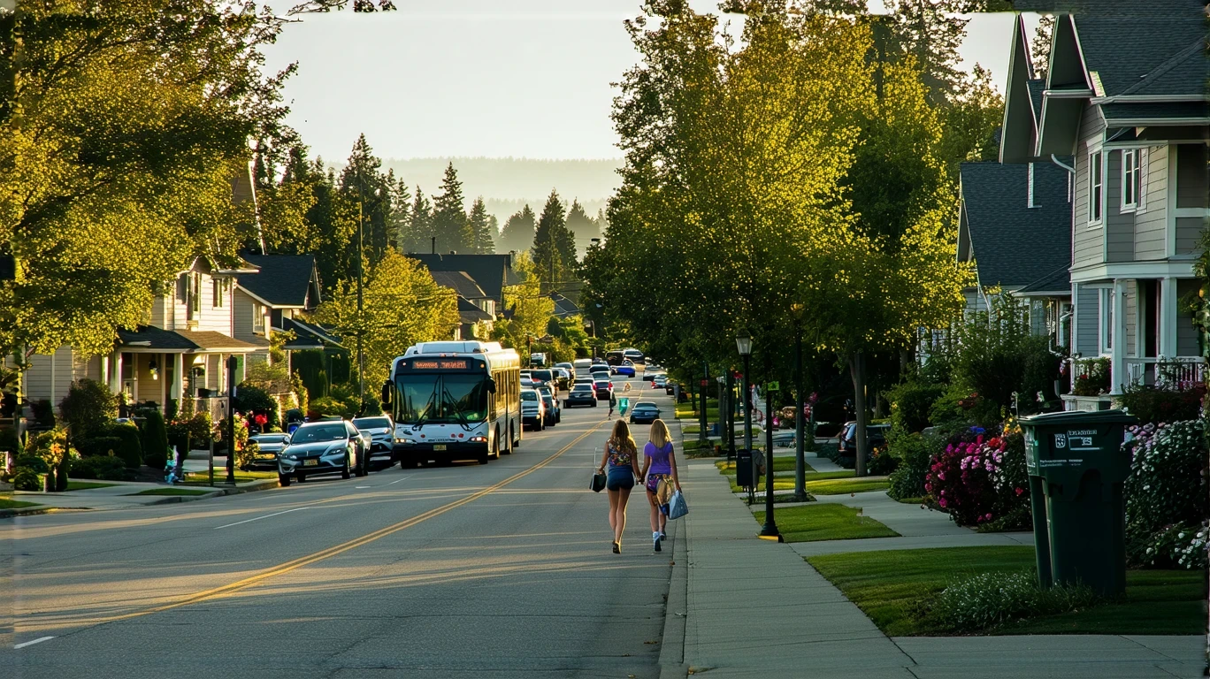
How People Get Around Federal Way
Understanding transportation options in Federal Way means recognizing a city caught between suburban car dependence and emerging transit infrastructure. Federal Way sits along the I-5 corridor south of Seattle, a position that shapes how residents move through daily life. While rail service has arrived and certain pockets show walkable development patterns, the majority of households still structure their routines around driving. The average commute runs 33 minutes, and more than half of all commuters face trips exceeding an hour—a reality that reflects both the city’s role as a bedroom community and the dispersed nature of job sites across the Puget Sound region.
Newcomers often assume Federal Way functions like inner Seattle, where transit can replace car ownership. That assumption breaks quickly. Federal Way’s development pattern includes denser, mixed-use corridors near transit stations alongside sprawling residential zones where sidewalks thin and bus service becomes sparse. Only 17.2% of residents work from home, meaning the vast majority must solve the commute problem daily. For some, rail transit delivers a viable solution. For others, the car remains non-negotiable.
The city’s layout creates distinct mobility experiences depending on where you live. Neighborhoods near the transit spine benefit from rail access, higher pedestrian infrastructure density, and proximity to grocery and food establishments. Move a mile west or east, and the infrastructure shifts: longer blocks, fewer crosswalks, and a street network designed for through-traffic rather than local errands. This isn’t a failure of planning—it’s the inheritance of decades of auto-oriented growth now being retrofitted with transit nodes. The question isn’t whether Federal Way has transportation options. It’s whether those options align with where you live and where you need to go.
Public Transit Availability in Federal Way
Public transit in Federal Way often centers around systems such as Sound Transit’s Link light rail, which extended south to serve the city and connect residents to Seattle, SeaTac Airport, and other regional destinations. The presence of rail service marks a structural shift in how some residents can organize their lives, particularly those commuting to dense job centers along the Link corridor. Rail works best for linear, predictable trips during peak hours—the daily commute to downtown Seattle, the airport run, the reverse commute to Tacoma. It does not solve last-mile problems, weekend errands, or trips that require multiple transfers.
Bus service supplements rail, with routes serving arterials and connecting neighborhoods to the transit spine. Coverage exists, but frequency and span vary widely by corridor. High-traffic routes see regular service during commute windows; lower-demand areas may wait 30 to 60 minutes between buses. Evening and weekend service thins considerably, a pattern common in suburban transit systems where ridership drops outside traditional commute hours. For households relying solely on transit, this creates planning friction: errands must align with schedules, spontaneity shrinks, and backup plans become necessary.
Transit works best in Federal Way’s denser corridors, where mixed-use development, higher building forms, and pedestrian infrastructure create an environment where walking to a station or stop feels practical. These pockets—often near commercial nodes or along the light rail line—support a car-light or car-free lifestyle for certain household types. Outside these zones, transit becomes supplemental rather than primary. Families in single-family neighborhoods, residents needing to serve multiple dispersed locations, or anyone working non-standard hours will find transit coverage insufficient for daily needs.
Driving & Car Dependence Reality
For most Federal Way residents, the car remains the central tool for managing daily life. The street network prioritizes vehicle flow, parking is abundant and typically free, and the distances between home, work, and errands often exceed what transit can serve efficiently. Even households with access to rail frequently own a car for weekend trips, bulk shopping, or reaching job sites not served by the Link line. The infrastructure assumes car ownership: wide arterials, limited crosswalks outside commercial cores, and residential streets without sidewalks in older developments.
Driving in Federal Way means navigating I-5 congestion during peak hours, a reality that shapes commute strategy. Residents heading north to Seattle or south to Tacoma face bottlenecks that can extend a 15-mile trip into a 45-minute crawl. Those who can shift their schedule to avoid rush hour gain significant time; those who cannot absorb the delay as a fixed cost. Parking at the destination—particularly in Seattle—adds another layer of complexity and expense, though Federal Way itself rarely imposes parking constraints.
Car dependence also means exposure to fuel prices, which currently sit at $4.72 per gallon in the region. This doesn’t translate into a specific monthly cost without knowing commute distance and vehicle efficiency, but it does create ongoing budget pressure for households driving long distances daily. Maintenance, insurance, registration, and depreciation layer on top, making car ownership a substantial fixed cost even before the first mile is driven. For households weighing monthly expenses, transportation infrastructure determines whether that cost is optional or mandatory.
Commuting Patterns & Daily Mobility
Federal Way’s commute patterns reflect its position as a regional connector rather than a self-contained employment hub. Many residents commute north to Seattle, south to Tacoma, or east toward the I-405 corridor, creating a dispersed job geography that no single transit line can fully serve. The 33-minute average commute time masks wide variation: some households live within walking distance of a Link station and reach downtown Seattle in under 40 minutes door-to-door, while others face multi-leg journeys involving a drive to a park-and-ride, a bus transfer, and a final walk.
More than half of all commuters—53.6%—experience trips lasting an hour or more, a figure that signals either long distances, congested routes, or both. This isn’t unusual for outer-ring suburbs in major metros, but it does impose a time cost that shapes household decisions. Long commutes reduce flexibility for childcare pickups, limit participation in evening activities, and create fatigue that affects quality of life. For some, the tradeoff is worth it: lower housing costs in Federal Way offset the commute burden. For others, the calculus doesn’t hold, and they either move closer to work or seek remote arrangements.
Daily mobility in Federal Way also involves errands, and here the city’s structure creates differentiated experiences. Residents in denser, mixed-use areas near transit stations benefit from high concentrations of grocery stores, restaurants, and services within walking or biking distance. Pedestrian infrastructure in these pockets supports short trips without a car, reducing the need to drive for every gallon of milk. In contrast, residents in lower-density zones often must drive to reach the same amenities, as food and grocery establishments cluster along commercial arterials rather than distributing evenly across neighborhoods.
Who Transit Works For — and Who It Doesn’t
Transit in Federal Way works best for single commuters or couples without children who live near a Link station and work along the light rail corridor. These households can structure their routines around fixed schedules, tolerate longer trip times in exchange for avoiding traffic, and don’t need to make multi-stop trips involving daycare, grocery runs, and after-school pickups. Renters in newer, denser developments near transit nodes often find this lifestyle viable, particularly if they prioritize walkability and are willing to use rideshare or carshare for occasional trips beyond the transit network.
Transit becomes less practical for families with children, especially those managing complex logistics across dispersed locations. School catchment areas rarely align with transit routes, extracurricular activities happen in the evenings when bus frequency drops, and bulk grocery shopping with young kids on a bus or train introduces friction most households choose to avoid. Homeowners in peripheral neighborhoods—where lot sizes are larger and densities lower—typically find transit inaccessible or impractical, as the nearest stop may require a drive or a long walk along streets without sidewalks.
Shift workers, healthcare employees, and anyone with non-standard hours face additional challenges. Transit service in Federal Way, like most suburban systems, concentrates on peak commute windows. Early morning or late evening trips often require long waits or aren’t served at all, forcing reliance on a car even for households that could otherwise use transit. Similarly, residents whose jobs require travel to multiple sites during the day—sales reps, home health aides, contractors—cannot function without a vehicle, regardless of where they live.
The presence of notable bike infrastructure and high pedestrian-to-road ratios in certain areas creates a third option for some residents: a hybrid approach combining biking or walking for local errands with driving or transit for longer trips. This works best in the city’s more vertical, mixed-use corridors, where destinations cluster and street design accommodates non-car movement. Outside these pockets, biking remains recreational rather than practical for daily transportation, as arterials prioritize speed over safety and distances between origins and destinations stretch beyond comfortable cycling range for most people.
Transportation Tradeoffs in Federal Way
Choosing between transit and driving in Federal Way isn’t a simple cost comparison—it’s a tradeoff between predictability, control, flexibility, and exposure to different kinds of friction. Transit offers insulation from traffic congestion and parking costs, but imposes schedule constraints and limits spontaneity. Driving provides door-to-door convenience and the ability to chain trips efficiently, but exposes households to fuel price volatility, maintenance costs, and the time drain of sitting in I-5 traffic.
For households that can make transit work, the primary benefit is reduced exposure to the variable costs of car ownership. Fuel, maintenance, and parking become optional rather than mandatory, though many transit-reliant households still own a car for trips the system doesn’t serve. The tradeoff is time: transit trips often take longer than driving the same route, particularly for destinations requiring transfers or located off the main corridor. Whether that time cost is acceptable depends on how a household values flexibility versus cost control.
Driving, meanwhile, offers maximum flexibility but creates ongoing financial exposure. Fuel prices at $4.72 per gallon don’t fluctuate as wildly as they did a decade ago, but they still represent a line item that rises and falls with regional and global markets. Maintenance and insurance are more predictable, but they’re also non-negotiable for anyone who depends on a car daily. The real cost of driving in Federal Way isn’t just the gas—it’s the cumulative burden of keeping a vehicle operational and the time lost to congestion during peak hours.
The tradeoff also includes lifestyle implications. Households that rely on transit tend to live in denser, more vertical neighborhoods where walkability supports daily errands and reduces car dependence. Those who prioritize driving often choose lower-density areas with larger homes and yards, accepting longer commutes and higher transportation costs in exchange for more space. Neither choice is wrong, but each comes with structural consequences that shape daily routines, time allocation, and financial exposure.
FAQs About Transportation in Federal Way (2026)
Is public transit usable for daily commuting in Federal Way?
Public transit is usable for daily commuting in Federal Way if you live near a Link light rail station and work along the rail corridor, particularly in Seattle or SeaTac. Rail service provides a reliable, congestion-free option for linear commutes during peak hours. Outside the rail line, bus service exists but varies in frequency and span, making it less practical for households needing consistent, all-day access. Transit works best for single commuters with predictable schedules, not for families managing multiple stops or residents in peripheral neighborhoods.
Do most people in Federal Way rely on a car?
Yes, most people in Federal Way rely on a car for daily transportation. The city’s development pattern, dispersed job geography, and suburban street network all assume car ownership. Even households with access to transit often keep a car for errands, weekend trips, or reaching destinations the system doesn’t serve efficiently. The infrastructure—wide arterials, ample parking, limited sidewalks in some areas—reinforces car dependence as the default mobility mode for the majority of residents.
Which areas of Federal Way are easiest to live in without a car?
The easiest areas to live without a car in Federal Way are the denser, mixed-use corridors near Link light rail stations. These neighborhoods feature higher pedestrian infrastructure density, proximity to grocery stores and restaurants, and direct rail access to Seattle and other regional destinations. Residents in these pockets can walk or bike for daily errands and use transit for longer trips. Outside these zones, car-free living becomes significantly harder due to lower density, reduced transit frequency, and longer distances between home and essential services.
How does commuting in Federal Way compare to nearby cities?
Commuting in Federal Way involves longer average times and higher long-commute percentages than many inner-ring suburbs, reflecting the city’s position as a bedroom community serving the broader Puget Sound region. The 33-minute average commute and 53.6% long-commute rate indicate that many residents travel significant distances to reach job sites, often navigating I-5 congestion. Compared to Seattle, Federal Way offers less transit density but more parking availability and lower housing costs. Compared to more distant suburbs, Federal Way benefits from rail access that shortens trips to the urban core.
Does Federal Way have good bike infrastructure?
Federal Way has notable bike infrastructure in certain areas, with bike-to-road ratios exceeding high thresholds in parts of the city. This suggests the presence of bike lanes, paths, or trails that support cycling as a transportation option, particularly in denser corridors. However, bike infrastructure is not evenly distributed: arterials designed for high-speed car traffic often lack safe cycling facilities, and lower-density residential areas may have limited connectivity. Biking works best for local trips within walkable pockets, not for long commutes or trips across the city’s full geography.
How Transportation Fits Into the Cost of Living in Federal Way
Transportation in Federal Way is not just a budget line—it’s a structural factor that determines where you can live, how you spend your time, and what kinds of tradeoffs you’re willing to accept. Households that can access and rely on transit reduce their exposure to car ownership costs but accept longer trip times and reduced flexibility. Households that depend on driving gain convenience and control but absorb ongoing fuel, maintenance, and time costs, particularly during peak congestion windows.
The city’s mixed infrastructure—rail service in some corridors, car-oriented design in others—means transportation costs and experiences vary widely depending on where you live. Renters near Link stations can structure a car-light lifestyle, while families in peripheral neighborhoods will find a vehicle non-negotiable. This isn’t a question of preference; it’s a function of how the city is built and where jobs, schools, and services are located.
For a fuller picture of how transportation intersects with housing, utilities, and other monthly spending categories, the budget breakdown article provides the numeric context this piece intentionally avoids. What matters here is understanding that transportation in Federal Way is not a single choice but a set of tradeoffs shaped by infrastructure, geography, and household needs. The right answer depends on where you live, where you work, and what kind of friction you’re willing to manage daily.
How this article was built: In addition to public economic data, this article incorporates location-based experiential signals derived from anonymized geographic patterns—such as access density, walkability, and land-use mix—to reflect how day-to-day living actually feels in Federal Way, WA.
—