“I used to think I’d need a car for everything out here,” says Marcus, a software engineer who moved to Lynnwood two years ago. “Then I realized the light rail stop was a ten-minute walk from my apartment. Now I only drive on weekends.”
That experience captures the mobility reality in Lynnwood: it’s neither a car-free urban core nor a sprawling suburb where driving is the only option. Instead, transportation options in Lynnwood reflect a transitional landscape—one where rail access, walkable pockets, and cycling infrastructure coexist with car-dependent residential zones. How you get around depends heavily on where you live, where you work, and how your daily routines are structured.
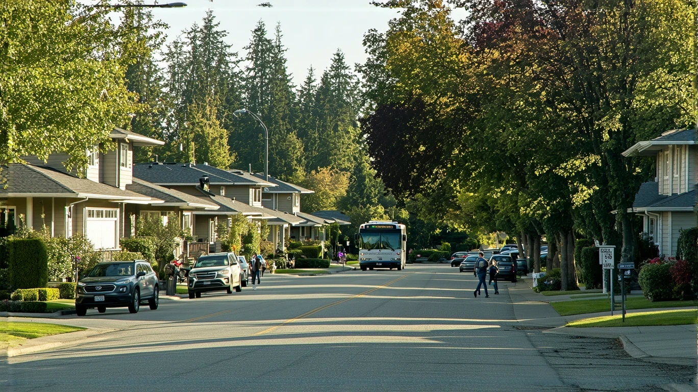
How People Get Around Lynnwood
Lynnwood sits in a zone of suburban evolution. The pedestrian-to-road ratio here exceeds thresholds typical of car-only suburbs, meaning sidewalks, crosswalks, and pedestrian paths are woven into the street network more densely than you’d find in purely auto-oriented developments. At the same time, both residential and commercial land uses are present throughout the city, creating pockets where errands, transit access, and daily needs align without requiring a car for every trip.
The result is a mixed mobility pattern. Some residents—especially those near transit stations or in denser corridors—move through their day on foot, by bike, or via public transit. Others, particularly those in single-family neighborhoods on the city’s edges, still depend on a car for most trips. Newcomers often misjudge Lynnwood as uniformly car-dependent, only to discover that proximity to a light rail station or a walkable commercial corridor changes the equation entirely.
What distinguishes Lynnwood from older, fully car-oriented suburbs is infrastructure that supports multiple modes. Bike-to-road ratios here are high, indicating that cycling routes are present and integrated into the broader network. Food and grocery density exceeds high thresholds, meaning daily errands are accessible on foot or by bike in many parts of the city. This isn’t a place where you’re forced into one transportation mode—but it’s also not a place where all modes work equally well everywhere.
Public Transit Availability in Lynnwood
Public transit in Lynnwood often centers around systems such as Sound Transit, which provides rail service connecting the city to Seattle and other regional destinations. The presence of rail infrastructure is significant: it enables car-free commuting for residents who live within walking or biking distance of a station, and it offers a predictable, weather-independent alternative to driving during peak hours.
Transit works best in Lynnwood’s denser corridors and near station areas, where land use supports higher foot traffic and where the distance between home, work, and errands can be covered without a car. For someone living in a mixed-use building near a transit stop, the system becomes a practical daily tool. For someone in a quieter residential neighborhood several miles from the nearest station, transit may still be useful for occasional trips but less viable for routine commuting.
Coverage gaps remain. Late-night service, cross-town routes that don’t pass through a central hub, and connections to employment centers outside the main rail corridor can be limited. Transit in Lynnwood is not comprehensive—it’s targeted. It serves specific travel patterns well and leaves others dependent on driving or ride-sharing. The key is understanding which pattern matches your own routine.
Driving & Car Dependence Reality
Despite the presence of rail and walkable infrastructure, driving remains necessary for many Lynnwood residents. Single-family zones, which make up a significant portion of the city’s housing stock, are often set back from commercial corridors and transit lines. Parking is abundant and typically free, which removes one of the friction points that discourages car ownership in denser cities.
Car dependence in Lynnwood is shaped by geography and layout, not just preference. If your home, workplace, and grocery store form a triangle that’s not served by a single transit line, driving becomes the path of least resistance. If you have children in school, manage multiple errands in a day, or work irregular hours, the flexibility of a car often outweighs the convenience of transit—even when transit is available.
Gas prices in the area currently sit at $5.39 per gallon, which adds a layer of exposure for households that drive frequently. But the tradeoff isn’t just financial—it’s also about time, predictability, and control. Driving allows you to move on your own schedule, manage complex logistics, and avoid the constraints of fixed routes and timetables. For many households, that tradeoff still tips in favor of owning a car.
Commuting Patterns & Daily Mobility
Commuting in Lynnwood varies widely depending on destination and mode. Residents who work in Seattle and live near a light rail station often structure their routines around transit, avoiding the unpredictability of highway traffic and the cost of downtown parking. The rail connection makes this pattern viable in a way that bus-only systems often don’t, because frequency and travel time are more consistent.
For those commuting to job centers outside the main transit corridor—Bellevue, Everett, or other suburban employment hubs—driving is typically the default. Multi-stop commutes, where someone drops off children, picks up groceries, or manages errands on the way to or from work, also favor car use. Transit works best for linear, predictable trips; it struggles with the branching, variable patterns that define many households’ daily mobility.
Proximity matters more than mode. Someone living a mile from their workplace in Lynnwood might walk or bike regardless of transit availability. Someone commuting fifteen miles in any direction will likely drive unless a direct rail line exists. The city’s layout rewards those who can align their housing and employment within a narrow geographic band, and it penalizes those who can’t.
Who Transit Works For — and Who It Doesn’t
Transit in Lynnwood is most practical for renters in mixed-use buildings near rail stations, especially those commuting to Seattle for work. These households benefit from the intersection of density, access, and destination alignment. They can walk to the station, ride to a job in the urban core, and return home without ever needing a car. For this group, transit isn’t a compromise—it’s a structural advantage.
Families in single-family homes, particularly those with school-age children or multiple daily obligations, face a different reality. Even if a rail station is nearby, the need to manage drop-offs, pickups, weekend activities, and bulk shopping often makes car ownership non-negotiable. Transit can supplement driving in these households, but it rarely replaces it.
Retirees and older adults may find transit useful for discretionary trips—medical appointments, social visits, errands—but only if stations and stops are within comfortable walking distance and if mobility limitations don’t make transfers or waiting outdoors prohibitive. For this group, transit viability is less about system design and more about physical proximity and accessibility.
The dividing line isn’t income or preference—it’s spatial fit. Transit works when your daily geography aligns with the network. When it doesn’t, driving fills the gap.
Transportation Tradeoffs in Lynnwood
Choosing between transit and driving in Lynnwood means weighing predictability against flexibility. Rail transit offers consistent travel times, immunity to traffic congestion, and freedom from parking costs. It also locks you into fixed schedules, limits your ability to make unplanned stops, and requires that your origin and destination both lie near the network.
Driving offers control, convenience, and the ability to manage complex daily logistics. It also exposes you to fuel price volatility, traffic unpredictability, and the ongoing costs of insurance, maintenance, and registration. In Lynnwood, where gas prices sit above $5 per gallon, frequent drivers feel that exposure more acutely than those in lower-cost regions.
Biking occupies a middle ground. The city’s bike infrastructure supports cycling for errands and short commutes, especially in areas with high bike-to-road ratios. But weather, distance, and the need to carry cargo or passengers limit its role as a primary transportation mode for most households. It works best as a complement to transit or driving, not a replacement.
The tradeoff isn’t binary. Many Lynnwood households use multiple modes depending on the trip: rail for commuting, a car for weekend errands, a bike for nearby tasks. The city’s infrastructure supports that flexibility, but only if you’re positioned to take advantage of it.
FAQs About Transportation in Lynnwood (2026)
Is public transit usable for daily commuting in Lynnwood?
Yes, if you live near a rail station and commute to a destination along the transit corridor, such as Seattle. Rail service provides a predictable, car-free option for these trips. For commutes to other suburban job centers or areas not served by rail, driving is typically more practical.
Do most people in Lynnwood rely on a car?
Many do, especially those in single-family neighborhoods or those with multi-stop daily routines. However, residents in denser areas near transit stations and commercial corridors often manage daily life with minimal or no car use, depending on their work location and household structure.
Which areas of Lynnwood are easiest to live in without a car?
Neighborhoods within walking distance of light rail stations and areas with high concentrations of grocery stores, restaurants, and services support car-free or car-light living most effectively. These areas combine transit access with walkable errands, reducing the need to drive for routine tasks.
How does commuting in Lynnwood compare to nearby cities?
Lynnwood benefits from rail connectivity that some neighboring suburbs lack, making it more viable for car-free commuting to Seattle. However, it’s less walkable overall than Seattle itself and more car-dependent than denser urban cores. Compared to purely auto-oriented suburbs, Lynnwood offers more transportation options, but those options are unevenly distributed across the city.
Can you bike safely in Lynnwood for daily errands?
Cycling infrastructure is present and more developed than in many comparable suburbs, with bike routes integrated into the road network. Safety and practicality depend on the specific route, weather conditions, and distance. Biking works well for short trips in areas with dedicated infrastructure, but it’s less practical for longer commutes or trips requiring cargo transport.
How Transportation Fits Into the Cost of Living in Lynnwood
Transportation in Lynnwood isn’t just about getting from one place to another—it’s a structural factor that shapes monthly expenses, budget planning, cost breakdown, housing choice, and daily time allocation. Where you live relative to transit, work, and services determines whether you can avoid car ownership, reduce fuel costs, or gain back hours spent in traffic.
Households that align their housing with transit access often trade higher rent or home prices for lower transportation costs and greater schedule predictability. Those in car-dependent areas may pay less for housing but absorb the ongoing costs of fuel, maintenance, and vehicle ownership. Neither choice is inherently better—both involve tradeoffs between upfront cost, convenience, and long-term exposure.
Understanding how mobility works in Lynnwood helps you make housing decisions that reflect your actual daily patterns, not assumptions about what “suburban” or “transit-accessible” should mean. The city offers multiple pathways, but only if you know which infrastructure serves your routine and which gaps you’ll need to fill on your own.
How this article was built: In addition to public economic data, this article incorporates location-based experiential signals derived from anonymized geographic patterns—such as access density, walkability, and land-use mix—to reflect how day-to-day living actually feels in Lynnwood, WA.