Transportation Structure in Westfield, IN
| Mode | Coverage Pattern | Primary Use Case |
|---|---|---|
| Personal Vehicle | Universal | Daily commuting, errands, flexibility |
| Cycling Infrastructure | Notable throughout parts of city | Recreation, short trips, supplemental mobility |
| Pedestrian Paths | Concentrated in pockets | Neighborhood-level walking, limited errand access |
| Public Transit | Limited to no local service | Not a primary mobility option |
How People Get Around Westfield
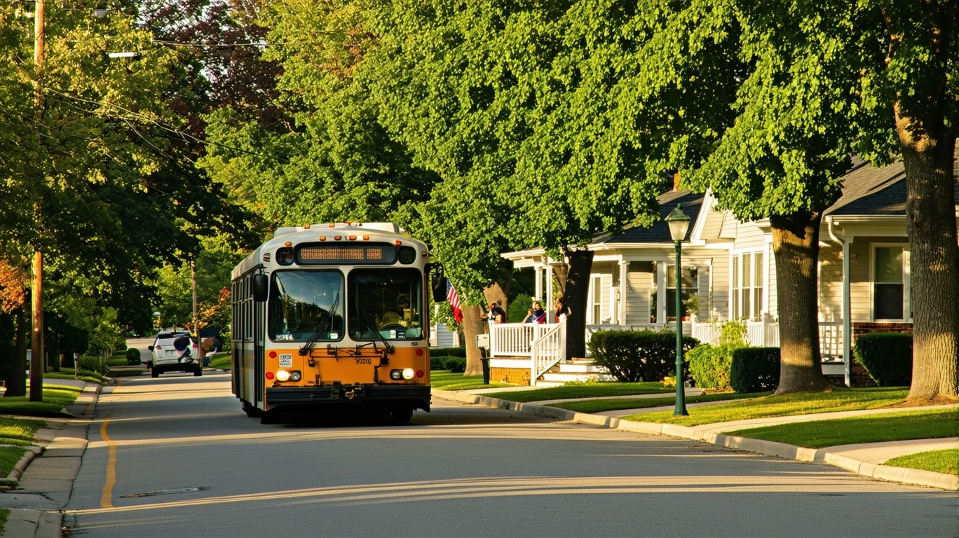
Understanding transportation options in Westfield starts with recognizing what kind of place this is: a northern Indianapolis suburb built around personal vehicle access, with notable infrastructure for cycling and walking that supplements—but doesn’t replace—car dependency. Newcomers often assume that proximity to Indianapolis means viable public transit connections, but Westfield’s transportation structure reflects its suburban development pattern rather than urban transit networks.
The dominant mobility pattern here is car-first. Most households own at least one vehicle, and daily life—commuting to work, running errands, accessing services—assumes you’re driving. What distinguishes Westfield from purely car-dependent suburbs is the presence of cycling infrastructure and walkable pockets where pedestrian-to-road ratios are notably high. These features create supplemental mobility options for recreation, short trips within neighborhoods, and active transportation choices, but they don’t eliminate the practical need for a car.
What newcomers usually misunderstand is the difference between infrastructure and independence. Westfield has invested in bike lanes and pedestrian paths, which makes it appealing for families who value outdoor activity and neighborhood walkability. But that infrastructure doesn’t extend to replacing a vehicle for work commutes, grocery runs, or accessing services outside your immediate corridor. The city’s layout—residential neighborhoods clustered around commercial corridors rather than distributed mixed-use zones—means that even with good local paths, most destinations require driving.
Public Transit Availability in Westfield
Public transit does not play a structural role in daily mobility for most Westfield residents. The city’s transportation network is designed around personal vehicles, and transit service—if available—functions as a limited supplement rather than a primary option. This isn’t a gap in planning; it reflects the suburban density and land-use patterns that define the area.
For residents hoping to rely on public transportation for commuting to Indianapolis or accessing regional employment centers, the reality is that transit coverage and frequency are not designed to support car-free living. Households that depend on transit access for work, medical appointments, or daily errands will face significant friction. The infrastructure that does exist—cycling paths and pedestrian-friendly pockets—serves neighborhood-level mobility, not regional connectivity.
Where transit tends to fall short is predictability and coverage. Suburban environments like Westfield are built around dispersed residential zones and corridor-based commercial access, which makes fixed-route transit service difficult to sustain. Late hours, weekend service, and connections to areas outside the immediate metro region are typically minimal or nonexistent. Residents who’ve lived in cities with robust transit networks will notice the difference immediately.
Driving & Car Dependence Reality
Driving is not optional in Westfield—it’s the baseline assumption for daily life. The city’s layout, with residential neighborhoods separated from commercial corridors and employment centers, means that nearly every routine activity involves a car. Grocery stores, schools, medical facilities, and workplaces are accessible by vehicle within minutes, but reaching them on foot or by bike requires either living in one of the walkable pockets near a commercial corridor or accepting significant time and distance tradeoffs.
Parking is abundant and rarely a source of friction. Homes typically include driveways or garages, and commercial areas are designed with large surface lots. This removes one of the pain points common in denser urban areas, but it also reinforces car dependency—there’s no structural pressure to reduce vehicle reliance because the infrastructure makes driving easy and convenient.
Sprawl and commute flexibility are two sides of the same coin here. Westfield’s suburban geography means that commuting to Indianapolis or other regional employment centers is common, and driving offers the flexibility to manage multi-stop trips, adjust schedules, and avoid the rigidity of fixed transit routes. But that flexibility comes with exposure to fuel costs, vehicle maintenance, insurance, and the time cost of commuting. The tradeoff isn’t between convenience and cost—it’s between control and dependency.
Commuting Patterns & Daily Mobility
Commuting in Westfield typically follows a single-job, car-based pattern. Most residents drive to work, either within the northern Indianapolis metro area or to employment centers in Westfield itself. The city’s position as a suburban node means that commutes can vary widely depending on where you work—some residents have short, local commutes, while others absorb longer drives into Indianapolis or surrounding counties.
Multi-stop commutes—dropping kids at school, running errands, picking up groceries—are structured around vehicle access. The corridor-clustered layout of food and grocery options means that errand runs are often consolidated into driving loops rather than walkable circuits. This is efficient if you own a car and can batch trips, but it creates friction for anyone trying to manage daily logistics without one.
Who benefits from proximity versus who absorbs commute friction depends largely on where you live within Westfield and where you work. Residents living near commercial corridors and employed locally experience minimal commute burden. Those commuting to Indianapolis or regional job centers face longer drives, and without transit alternatives, that time and fuel cost is unavoidable. The city’s walkable pockets and cycling infrastructure offer some relief for neighborhood-level trips, but they don’t change the commute equation for employment access.
Who Transit Works For — and Who It Doesn’t
Transit in Westfield, to the extent it exists, works for almost no one as a primary mobility solution. The infrastructure and service levels are not designed to support car-free living, and households that depend on public transportation for daily commuting or errands will struggle. This isn’t a matter of preference—it’s a structural reality shaped by density, land use, and regional connectivity.
Renters and younger households sometimes assume that suburban proximity to a metro area means access to metro-area transit, but Westfield’s transportation network doesn’t extend that far. Core neighborhoods in Indianapolis may offer transit options, but peripheral suburban areas like Westfield are built around personal vehicle access. Renters without cars face limited housing and employment options, and the walkable pockets that do exist are not distributed evenly across the city.
Owners and families benefit most from Westfield’s transportation structure because it aligns with car ownership and the flexibility that comes with it. The cycling infrastructure and pedestrian-friendly zones add quality-of-life value—kids can bike to parks, adults can walk in their neighborhoods—but these features supplement rather than replace the need for a vehicle. Households that prioritize car-light or car-free lifestyles will find Westfield’s infrastructure insufficient for that goal.
Transportation Tradeoffs in Westfield
The primary tradeoff in Westfield is between control and cost. Driving offers near-total control over timing, routing, and multi-stop logistics, which is why it dominates daily mobility here. You’re not waiting for a bus, adjusting your schedule to match transit hours, or walking long distances in weather extremes. But that control comes with ongoing exposure to fuel prices, maintenance, insurance, and vehicle depreciation—costs that are unavoidable if you need a car to function.
Transit, where it exists, offers predictability in operating cost but sacrifices flexibility and coverage. For most Westfield residents, this tradeoff doesn’t pencil out because transit service levels are too limited to rely on. The result is that nearly everyone defaults to driving, and the transportation cost structure becomes a fixed part of household budgets rather than a variable you can optimize.
Cycling and walking infrastructure introduce a third option, but only for specific trip types. Recreational rides, neighborhood errands, and short-distance travel benefit from Westfield’s notable bike and pedestrian paths. These modes reduce vehicle dependence for some trips, but they don’t replace the car for commuting, regional access, or weather-dependent logistics. The tradeoff here is time and convenience versus marginal cost savings—you’re not eliminating transportation costs, just shifting some trips to lower-cost modes.
FAQs About Transportation in Westfield (2026)
Is public transit usable for daily commuting in Westfield?
No. Public transit does not function as a viable commuting option for most Westfield residents. The city’s transportation structure is built around personal vehicle access, and transit service levels—if available—are not designed to support car-free commuting to work, school, or services.
Do most people in Westfield rely on a car?
Yes. Car ownership is the baseline assumption for daily life in Westfield. The city’s layout, with residential neighborhoods separated from commercial corridors and employment centers, makes driving the primary mode for commuting, errands, and accessing services.
Which areas of Westfield are easiest to live in without a car?
No area of Westfield is designed to support car-free living. Some neighborhoods feature walkable pockets with higher pedestrian infrastructure density, and cycling paths are notable throughout parts of the city, but these features supplement car access rather than replace it. Households without vehicles will face significant friction regardless of location.
How does commuting in Westfield compare to nearby cities?
Westfield’s commuting structure reflects its role as a northern Indianapolis suburb. Residents commuting into Indianapolis or regional employment centers rely entirely on personal vehicles, with no meaningful transit alternatives. Compared to core Indianapolis neighborhoods, Westfield offers less congestion and more parking ease, but longer distances and no public transportation fallback.
Does Westfield’s cycling infrastructure reduce the need for a car?
Not for most households. Westfield has notable cycling infrastructure with bike-to-road ratios that exceed typical suburban levels, which makes it appealing for recreation and short neighborhood trips. But cycling doesn’t replace vehicle access for commuting, grocery runs, or regional travel. It’s a supplemental option, not a primary mobility solution.
How Transportation Fits Into the Cost of Living in Westfield
Transportation in Westfield is a structural cost factor, not a discretionary budget line. Because the city is built around car dependency, vehicle ownership, fuel, insurance, and maintenance become unavoidable expenses for nearly every household. The presence of cycling and pedestrian infrastructure adds quality-of-life value and creates opportunities to reduce vehicle use for some trips, but it doesn’t eliminate the baseline need for a car.
How mobility affects housing choice is significant. Living near one of Westfield’s commercial corridors reduces errand-related driving and can make neighborhood-level walking or cycling more practical. But proximity doesn’t change the commute equation if you work outside Westfield, and it doesn’t provide access to public transit. The tradeoff is between convenience within your neighborhood and the time cost of commuting to regional employment centers.
For a fuller picture of how transportation costs interact with housing, utilities, and your monthly budget in Westfield, the monthly budget breakdown provides numeric context on where vehicle-related expenses typically land relative to other household costs. Transportation isn’t the largest line item for most families here, but it’s one of the least flexible—you can’t opt out of driving without fundamentally limiting where you can live and work.
The clearest guidance is this: plan for car ownership. Westfield’s infrastructure supports active transportation for recreation and some short trips, but it doesn’t replace the need for a vehicle. Households that arrive expecting transit options or car-light living will face immediate friction. Those who embrace the car-dependent structure and take advantage of the cycling and walking paths as supplements will find Westfield’s transportation network predictable, manageable, and aligned with suburban family life.
How this article was built: In addition to public economic data, this article incorporates location-based experiential signals derived from anonymized geographic patterns—such as access density, walkability, and land-use mix—to reflect how day-to-day living actually feels in Westfield, IN.