Transit Coverage & Mobility Overview: Summerlin South, NV
| Mobility Dimension | Status in Summerlin South |
|---|---|
| Pedestrian Infrastructure | Walkable pockets present; pedestrian-to-road ratio exceeds high threshold |
| Public Transit | Bus service available; no rail transit |
| Cycling Infrastructure | Some pockets with bike infrastructure; bike-to-road ratio in medium band |
| Errands Accessibility | Corridor-clustered; food and grocery density in medium band |
| Urban Form | Low-rise; mixed residential and commercial land use present |
Source: Derived from anonymized geographic patterns and public infrastructure data
How People Get Around Summerlin South
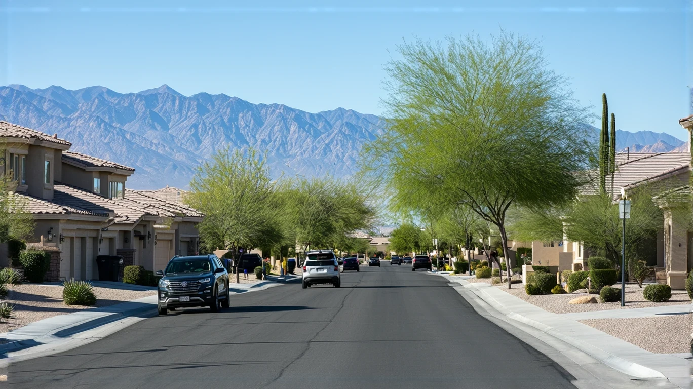
Understanding transportation options in Summerlin South starts with recognizing the community’s suburban structure. This is a low-rise, planned community where residential neighborhoods and commercial corridors exist side by side, but the distances between daily destinations—and the layout of the street network—make driving the default for most households. Newcomers often assume that walkable pockets and bus service mean transit can replace a car. In practice, Summerlin South’s mobility depends heavily on where you live, where you work, and how many stops your day requires.
The pedestrian infrastructure here is better than in many suburban areas. Sidewalks, crosswalks, and pathways are woven throughout parts of the community, and the ratio of pedestrian routes to road network is substantial. But that doesn’t mean you can walk to everything. Grocery stores, medical offices, and schools tend to cluster along specific corridors rather than distribute evenly across neighborhoods. If your home sits outside those corridors, even a short errand can require a drive.
Bus service is present, but it doesn’t blanket the community. Routes connect key corridors and provide access to the broader Las Vegas metro, but frequency, coverage, and evening service are limited. For someone whose routine aligns with bus schedules and whose destinations sit along serviced routes, transit can work. For families managing school pickups, multi-stop errands, or jobs with variable hours, a car remains essential.
Public Transit Availability in Summerlin South
Public transit in Summerlin South often centers around systems such as the Regional Transportation Commission of Southern Nevada (RTC), which operates bus routes connecting residential areas to commercial hubs and employment centers in the Las Vegas metro. These routes provide baseline access, particularly for residents living near major corridors, but they do not eliminate the need for a car in most households.
Transit works best along the community’s main arteries, where commercial activity, mixed-use development, and higher foot traffic create natural transit-friendly zones. If you live within walking distance of a bus stop on one of these corridors and your daily destinations align with the route map, you can reduce your reliance on driving. But if your home is tucked into a residential pocket, or if your job, childcare, or regular errands fall outside the serviced network, transit becomes a supplement rather than a solution.
Evening and weekend service is typically lighter than weekday midday coverage, which limits transit’s usefulness for shift workers, service industry employees, and anyone whose schedule doesn’t align with traditional commute windows. There is no rail service in Summerlin South, so all public transit relies on buses, which are subject to traffic, road construction, and the same congestion that affects drivers.
The absence of rail also means that long-distance commutes into central Las Vegas or neighboring employment hubs take longer on transit than they would by car. For households weighing whether to go car-free or car-light, the question isn’t whether buses exist—it’s whether the routes, frequency, and coverage align with the specific rhythm of daily life.
Driving & Car Dependence Reality
In Summerlin South, driving isn’t just convenient—it’s structurally embedded in how the community functions. The low-rise suburban form, the spacing between residential and commercial zones, and the corridor-based distribution of grocery stores and services all point toward car dependence. Even in neighborhoods with good pedestrian infrastructure, the distances involved and the lack of dense, walkable commercial nodes mean that most errands require a vehicle.
Parking is generally abundant and free, which removes one of the friction points that discourages driving in denser urban areas. Grocery stores, medical offices, schools, and retail centers all offer dedicated parking, and residential streets and driveways provide ample space for household vehicles. This makes car ownership practical and low-stress, but it also reinforces the expectation that everyone drives.
For families, driving is nearly unavoidable. School drop-offs, after-school activities, weekend errands, and medical appointments rarely align with a single bus route or a walkable loop. The ability to chain multiple stops into a single trip—picking up groceries, dropping off dry cleaning, and stopping at the pharmacy—depends on having a car. Public transit can’t replicate that flexibility, and ride-hailing services add up quickly when used for routine logistics.
Gas prices in the area currently sit at $5.01 per gallon, which is a meaningful line item for households that drive daily. But the cost of fuel is only part of the equation. Car ownership also brings insurance, maintenance, registration, and depreciation. These fixed costs don’t disappear even if you reduce your mileage, which is why going car-light—rather than car-free—is the more realistic goal for most households in Summerlin South.
Commuting Patterns & Daily Mobility
Commuting in Summerlin South varies widely depending on where you work and what your daily routine looks like. Some residents work within the community or nearby in the western Las Vegas metro, which keeps commutes short and manageable. Others travel into central Las Vegas or beyond, which adds time, fuel costs, and exposure to traffic variability.
The structure of the workday matters as much as the distance. A single-destination commute—home to office and back—can sometimes be managed with transit if the route is direct and the schedule is predictable. But many households juggle multiple stops: dropping kids at school, commuting to work, picking up groceries, and managing evening activities. That kind of multi-stop day is nearly impossible without a car, and it’s a common pattern in suburban communities like Summerlin South.
Flexibility is another factor. Jobs with fixed hours and predictable locations are easier to plan around, whether you’re driving or using transit. But gig work, variable shifts, client visits, or jobs that require carrying tools or materials all tilt heavily toward car dependence. The ability to leave when you need to, take a different route, or make an unplanned stop is a form of control that transit can’t provide.
For households where one adult works locally and another commutes into Las Vegas, a two-car setup is common. It’s not always about preference—it’s about logistics. When school schedules, work hours, and errands don’t overlap neatly, having two vehicles becomes the path of least resistance.
Who Transit Works For — and Who It Doesn’t
Transit in Summerlin South works best for a specific slice of households: those who live near serviced corridors, work along or near a bus route, have flexible or predictable schedules, and don’t need to manage complex daily logistics. This might include a single professional with a downtown Las Vegas job, a student commuting to a nearby campus, or a retiree using transit for occasional errands and appointments.
It works less well—or not at all—for families with school-age children, households with multiple jobs or variable shifts, and anyone whose daily routine involves stops that don’t align with the bus network. The corridor-clustered distribution of grocery stores and services means that even if you live near a bus stop, your nearest grocery store might not be on the same route, or it might require a transfer and a long walk with bags.
Renters in mixed-use areas near commercial corridors have the best shot at reducing car dependence, especially if they’re willing to use ride-hailing or bike infrastructure for short trips. But even in those pockets, most households still keep a car for weekend errands, larger shopping trips, and anything that involves leaving the immediate area.
Homeowners in residential neighborhoods farther from the main corridors face a different reality. The low-rise suburban form and the spacing of services mean that walking or biking to transit isn’t always practical, and once you’re driving to the bus stop, the advantage of transit disappears. For these households, the car isn’t optional—it’s the only tool that makes daily life manageable.
Transportation Tradeoffs in Summerlin South
Choosing between transit and driving in Summerlin South isn’t a question of cost alone—it’s a question of control, predictability, and time. Driving offers flexibility: you leave when you want, take the route that makes sense, and handle multiple stops without waiting or transferring. Transit offers lower direct costs and eliminates the fixed expenses of car ownership, but it comes with schedule constraints, limited coverage, and longer trip times for anything that isn’t a straight shot along a serviced corridor.
For households that can align their routines with the bus network, transit reduces exposure to fuel price swings and removes the burden of parking, maintenance, and insurance. But that alignment requires compromise. You plan your day around the bus schedule, not the other way around. You accept longer travel times. You limit errands to what you can carry or what’s accessible on foot from a bus stop.
For households that can’t make those compromises—because of kids, job demands, or the need to move quickly between dispersed locations—driving is the only practical option. The tradeoff isn’t financial; it’s operational. A car gives you the ability to respond to the unexpected, to chain errands efficiently, and to manage a complex household without constantly negotiating schedules and routes.
The real cost of car dependence isn’t just the monthly expense—it’s the loss of alternatives. In Summerlin South, the infrastructure and layout assume that everyone drives, which means that households without a car face friction at every turn. That’s not a moral judgment; it’s a structural reality shaped by decades of planning decisions that prioritized low-density development and auto-oriented design.
FAQs About Transportation in Summerlin South (2026)
Is public transit usable for daily commuting in Summerlin South?
Public transit is usable for some daily commutes, particularly if you live near a serviced corridor and work along a direct bus route into Las Vegas or another nearby employment center. But coverage is limited, frequency is lower than in denser urban areas, and evening or weekend service is lighter. For households with predictable schedules and destinations that align with the bus network, transit can work. For families, shift workers, or anyone managing multi-stop days, it’s usually not sufficient on its own.
Do most people in Summerlin South rely on a car?
Yes. The low-rise suburban form, the corridor-based distribution of services, and the limited reach of public transit all point toward high car dependence. Even in neighborhoods with good pedestrian infrastructure, the distances between home, work, school, and errands typically require driving. Most households own at least one vehicle, and two-car households are common, especially among families.
Which areas of Summerlin South are easiest to live in without a car?
The easiest areas to live without a car are those near major commercial corridors where bus service, grocery stores, and mixed-use development overlap. If you’re within walking distance of a bus stop and your daily destinations sit along serviced routes, you can reduce or eliminate the need for a car. But even in these pockets, most residents still keep a vehicle for flexibility, weekend trips, and errands that fall outside the transit network.
How does commuting in Summerlin South compare to nearby cities?
Commuting in Summerlin South is shaped by its position within the Las Vegas metro. Residents who work locally or in nearby western suburbs tend to have shorter, more predictable commutes. Those who travel into central Las Vegas or beyond face longer drives and exposure to metro-area traffic. Compared to denser parts of Las Vegas with more transit options, Summerlin South offers less public transportation coverage but more parking availability and less congestion within the community itself.
Can you get by with one car in Summerlin South?
Some households can manage with one car, particularly if both adults work near each other, have aligned schedules, or if one person works from home. But the corridor-clustered layout and the need to manage school, work, and errands across dispersed locations often push households toward a two-car setup. It’s less about preference and more about logistics—when daily routines don’t overlap neatly, a second vehicle reduces friction and scheduling conflicts.
How Transportation Fits Into the Cost of Living in Summerlin South
Transportation in Summerlin South isn’t just a line item—it’s a structural factor that shapes where you can live, how you manage time, and what kind of flexibility you have in daily life. The community’s car-oriented design means that for most households, owning and operating a vehicle is a baseline cost, not an optional one. That cost includes fuel, insurance, maintenance, and depreciation, and it doesn’t scale down easily even if you drive less.
But transportation also affects other parts of the budget. Living near a bus corridor might allow you to reduce car dependence, but those areas often come with higher rents or home prices because of the added convenience. Living farther out might lower housing costs, but it increases driving distance and fuel exposure. The tradeoff between housing affordability and transportation access is one of the most important decisions households make when choosing where to live in Summerlin South.
For a fuller picture of how transportation costs interact with housing, utilities, and other monthly expenses, see Your Monthly Budget in Summerlin South: Where It Breaks. That article walks through the complete cost structure and shows how mobility choices ripple through the rest of the budget.
The key takeaway is this: in Summerlin South, transportation isn’t just about getting from point A to point B. It’s about control, predictability, and the ability to manage a complex household in a low-density suburban environment. For most households, that means owning a car. For some, it means owning two. And for a small number of households whose routines align with the bus network and who live near serviced corridors, it means finding a workable balance between transit, walking, and occasional driving. Understanding which category you fall into—before you move—makes the transition smoother and the budget more predictable.
How this article was built: In addition to public economic data, this article incorporates location-based experiential signals derived from anonymized geographic patterns—such as access density, walkability, and land-use mix—to reflect how day-to-day living actually feels in Summerlin South, NV.
—