“I thought I could take the bus to work when I moved here. That lasted about two weeks before I realized I needed a car for everything else—groceries, my kid’s soccer, even just meeting friends across town.”
That’s the commute reality most newcomers to Riverview discover quickly. While public transit exists, the structure of daily life here is built around driving. Understanding how people actually get around—and why—matters more than knowing whether a bus stop is nearby.
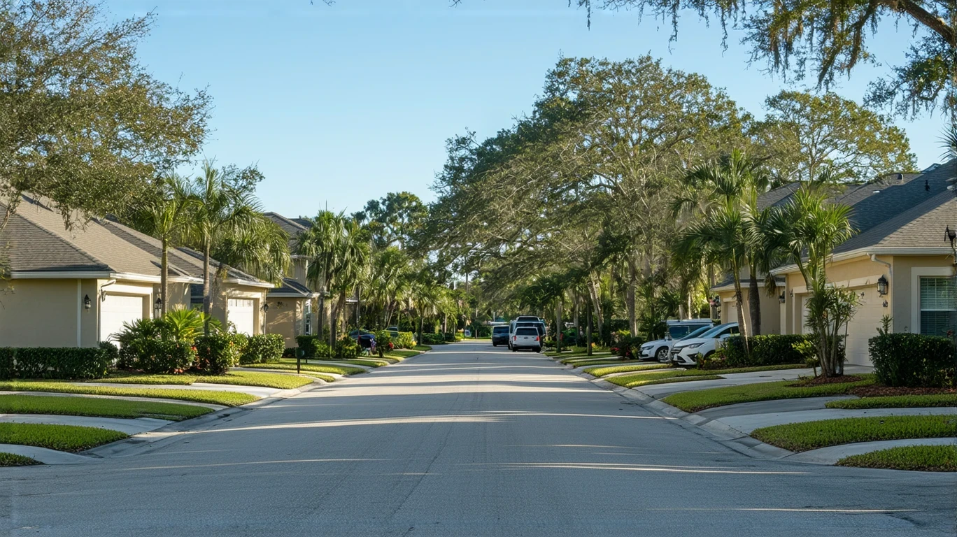
How People Get Around Riverview
Riverview operates as a car-first suburb within the Tampa metro area. The city’s low-rise development pattern and corridor-based commercial layout mean that most daily destinations—work, school, shopping, healthcare—require a vehicle to reach efficiently. While bus service is present and some neighborhoods feature pedestrian infrastructure in pockets, the dominant mobility pattern is driving.
What newcomers often misunderstand is that proximity to a bus route doesn’t necessarily translate to transit viability. Riverview’s geography spreads residential areas across a wide footprint, with commercial activity clustered along major corridors rather than distributed throughout neighborhoods. This creates a structural gap: even if you live near a walkable pocket, your job, your child’s school, or your preferred grocery store may not be.
The city’s mixed land use—residential and commercial zones coexisting—does create opportunities for short, local trips on foot or bike in certain areas. But for the majority of households, day-to-day costs and logistics assume car ownership and regular driving.
Public Transit Availability in Riverview
Public transit in Riverview often centers around systems such as Hillsborough Area Regional Transit (HART), which provides regional bus service connecting Riverview to the broader Tampa metro area. Bus stops are present throughout parts of the city, but coverage is uneven and route structures prioritize major corridors over neighborhood penetration.
Transit tends to work best for residents living near high-traffic commercial corridors and commuting to destinations along established routes—typically downtown Tampa or other regional employment centers. For these households, bus service can reduce driving frequency, though schedule constraints and transfer requirements add time and complexity.
Where transit falls short is in peripheral residential areas, late-night or weekend service, and multi-stop trips that don’t align with linear route structures. Families managing school drop-offs, errands, and activities find that transit rarely accommodates the layered logistics of suburban household life. The result is that even households with access to bus service often default to driving for reliability and control.
Driving & Car Dependence Reality
Driving isn’t just common in Riverview—it’s structurally necessary for most households. The city’s layout, with residential neighborhoods separated from employment centers and commercial districts, makes car ownership the baseline assumption for daily mobility.
Parking is generally abundant and free in most contexts, which removes one friction point common in denser cities. But that ease comes with tradeoffs: longer distances between destinations, higher exposure to fuel price volatility, and the time cost of navigating traffic during peak hours. The average commute in Riverview is 34 minutes, and over 60% of workers face long commutes, reflecting the geographic spread between where people live and where they work.
Car dependence also shapes housing decisions. Households prioritize proximity to major roads and highways, knowing that daily life will involve frequent driving. This creates a feedback loop: the more car-oriented the infrastructure, the less viable alternative modes become, even for households who might prefer them.
Commuting Patterns & Daily Mobility
Most Riverview residents structure their commutes around single-destination work trips, but the reality of suburban life often involves multi-stop patterns—dropping kids at school, running errands, picking up groceries—all of which compound time and distance. With only 14.7% of workers able to work from home, the majority absorb commute friction regularly.
The 34-minute average commute reflects not just distance but also the time cost of navigating suburban road networks and regional highways. For households commuting into Tampa or other metro employment centers, this time investment becomes a daily constant, shaping schedules, childcare arrangements, and household logistics.
Proximity to work matters, but so does proximity to schools, healthcare, and commercial services. Households who cluster these destinations reduce cumulative drive time, but that alignment is difficult to achieve in a spread-out geography. The result is that most residents accept driving as the cost of suburban flexibility and space.
Who Transit Works For — and Who It Doesn’t
Public transit in Riverview realistically serves a narrow slice of households: those living near bus corridors, commuting to destinations along established routes, and able to absorb the time cost of longer, less direct trips. Renters in core areas near commercial corridors may find transit viable for work commutes, especially if their schedule aligns with service hours.
Transit doesn’t work well for families managing complex logistics—school runs, after-school activities, weekend errands—or for workers whose jobs require flexibility, off-hours availability, or travel to multiple sites. It also falls short for households in peripheral neighborhoods, where bus service is sparse or nonexistent.
The distinction isn’t about preference; it’s about fit. A single professional commuting to downtown Tampa along a direct route may find bus service adequate. A parent coordinating two school drop-offs, a grocery run, and a pediatrician appointment will almost certainly need a car. Riverview’s infrastructure rewards the latter and tolerates the former.
Transportation Tradeoffs in Riverview
Choosing between transit and driving in Riverview isn’t a cost comparison—it’s a tradeoff between control and constraint. Driving offers predictability: you leave when you want, stop where you need to, and adjust on the fly. Transit offers lower direct involvement but requires schedule adherence, route alignment, and acceptance of longer trip times.
For most households, driving wins on flexibility and reliability. The ability to manage multi-stop trips, accommodate last-minute changes, and avoid transfer delays outweighs the exposure to fuel prices and vehicle maintenance. Transit works when your life fits the route map, but Riverview’s geography makes that alignment rare.
The deeper tradeoff is between housing location and transportation tradeoffs. Living closer to work or transit corridors may reduce drive time but often comes with higher housing costs or fewer space options. Living farther out offers affordability and square footage but locks in longer commutes and car dependence. Neither choice is wrong, but both carry structural consequences that shape daily life and long-term costs.
FAQs About Transportation in Riverview (2026)
Is public transit usable for daily commuting in Riverview?
Public transit is usable for a subset of commuters—those living near bus corridors and traveling to destinations along established routes. For most households, especially those managing multi-stop trips or living in peripheral areas, transit doesn’t provide the coverage or frequency needed for reliable daily commuting.
Do most people in Riverview rely on a car?
Yes. The city’s suburban layout, corridor-based commercial development, and limited transit coverage make car ownership the practical baseline for most households. Even residents with access to bus service often drive for errands, school logistics, and non-work trips.
Which areas of Riverview are easiest to live in without a car?
Areas near commercial corridors with walkable infrastructure and bus access offer the best chance of reducing car dependence, though even these zones typically require occasional driving. Peripheral residential neighborhoods are almost entirely car-dependent.
How does commuting in Riverview compare to nearby cities?
Riverview’s 34-minute average commute and high percentage of long commutes reflect its role as a suburban community within the Tampa metro area. Compared to denser urban centers, commute times are longer and car dependence is higher. Compared to more rural areas, Riverview offers better access to regional employment centers, but that access still requires driving.
Can you bike for daily errands in Riverview?
Biking is viable in pockets where cycling infrastructure exists and destinations are close together, but the city’s overall layout and traffic patterns make biking a supplemental option rather than a primary mode for most households. Heat, distance, and road design all limit biking’s practicality for routine errands.
How Transportation Fits Into the Cost of Living in Riverview
Transportation in Riverview isn’t just a line item—it’s a structural factor that shapes housing decisions, time budgets, and household flexibility. The need for a car affects where you can live, how much space you can afford, and how you manage daily logistics. It also creates ongoing exposure to fuel prices, maintenance costs, and the time cost of commuting.
Understanding getting around Riverview means recognizing that mobility and housing are linked. Choosing a home closer to work may reduce commute time but shift costs elsewhere. Choosing a home with more space farther out locks in longer drives and higher transportation involvement. Neither choice eliminates costs—they just redistribute them.
For a fuller picture of how transportation fits into monthly expenses, see the Monthly Budget article, which breaks down where money goes and how different household types manage trade-offs. The key is to approach transportation not as an isolated expense but as part of the broader structure of living in Riverview—one that rewards planning, flexibility, and realistic expectations about what works here.
How this article was built: In addition to public economic data, this article incorporates location-based experiential signals derived from anonymized geographic patterns—such as access density, walkability, and land-use mix—to reflect how day-to-day living actually feels in Riverview, FL.