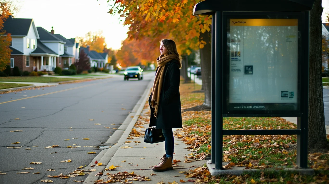
You wake up early on a Tuesday, grab your bag, and walk three blocks to the bus stop near the edge of your neighborhood. The shelter is clean, the bench dry, and the route map posted clearly—but you’re also checking your phone to confirm the schedule. The bus arrives within a few minutes of the posted time, and you settle in for a ride that will take you to a transfer point closer to downtown Minneapolis. It’s predictable, affordable, and requires no parking strategy. But it also means your errands after work will need to wait until tomorrow, because the return route doesn’t align well with a grocery stop. This is transportation options in Maple Grove: structured enough to work for some people, but not flexible enough to replace a car for most.
Maple Grove sits northwest of the Twin Cities core, a suburban city shaped by residential development, commercial corridors, and a street network built primarily around driving. That doesn’t mean public transit is absent—bus service does operate here, and cycling infrastructure is more present than many assume. But the role transit plays is narrow. It works well for specific commutes, particularly those headed into Minneapolis or St. Paul on predictable schedules. For daily errands, evening plans, or multi-stop days, most households still rely on a car.
How People Get Around Maple Grove
The dominant mobility pattern in Maple Grove is car-first. The city’s layout reflects decades of suburban growth, with residential neighborhoods separated from commercial centers by arterial roads and parking lots. Most people drive because the infrastructure makes it the fastest, most flexible option. But that’s not the whole story.
Pedestrian infrastructure exists in pockets throughout the city—sidewalks, crosswalks, and paths that support walking within neighborhoods or to nearby parks. The pedestrian-to-road ratio is higher than you’d expect in a car-oriented suburb, meaning that once you’re in a neighborhood, walking is often practical. Cycling infrastructure is also notably present, with bike lanes and paths woven into parts of the city. The bike-to-road ratio exceeds typical suburban thresholds, suggesting that for residents who live near those routes, biking is a real option for recreation or short trips.
But here’s the friction: food and grocery options are clustered along commercial corridors, not distributed evenly across neighborhoods. That means even if you can walk or bike within your immediate area, reaching a grocery store, pharmacy, or restaurant often requires either a longer trip or a car. The infrastructure supports active transportation in specific contexts, but it doesn’t eliminate car dependence for daily errands.
Newcomers often misunderstand this. They see bike lanes and sidewalks and assume Maple Grove is more walkable than it is. In practice, those amenities work best for recreation, exercise, or hyperlocal trips—not for replacing a car. The city’s structure still funnels most errands and commutes onto roads designed for vehicles.
Public Transit Availability in Maple Grove
Public transit in Maple Grove often centers around systems such as Metro Transit, which operates bus routes connecting the city to the broader Twin Cities metro. These routes primarily serve commuters traveling to Minneapolis, St. Paul, or other regional employment centers. Coverage is strongest along major corridors—places where residential density and commuter demand justify regular service.
Transit works best for people whose destinations align with existing routes and whose schedules match service hours. If you’re commuting downtown for a standard workday, bus service can be reliable and predictable. If you’re trying to reach a suburban office park, run errands after 7 p.m., or make multiple stops in a single trip, transit falls short. The network isn’t designed for that kind of flexibility.
Where transit tends to work well: neighborhoods near bus stops along main roads, trips with a single destination, and commuters who can build their day around a fixed schedule. Where it falls short: peripheral residential areas, late-night or weekend travel, and any trip that requires transfers or doesn’t follow a direct corridor. There’s no rail service here, so all transit is bus-based, which limits speed and frequency compared to cities with light rail or commuter rail options.
This isn’t a criticism of the service itself—it’s a reflection of Maple Grove’s geography and density. The city is spread out, and transit coverage reflects that. For households that can use it, it’s a real option. For everyone else, it’s supplemental at best.
Driving & Car Dependence Reality
Driving is necessary for daily life in Maple Grove, not because transit is unavailable, but because the city’s layout makes cars the most practical tool for most tasks. Grocery stores, schools, medical offices, and retail centers are distributed across the city in ways that assume car access. Parking is abundant and usually free, which removes one of the friction points that makes driving costly or inconvenient in denser cities.
For families, car dependence is nearly universal. Dropping kids at school, running errands, and managing weekend activities all require the flexibility that only a car provides. For single adults or couples without children, the calculus is more variable—if you live near a bus route and work downtown, you might be able to limit car use. But even then, most people keep a vehicle for trips that transit doesn’t cover.
Commute flexibility is one of the hidden advantages of car dependence here. You’re not locked into a schedule, you can make stops on the way home, and you can reach destinations that aren’t on a bus line. The tradeoff is exposure to fuel costs, maintenance, insurance, and the time spent in traffic during peak hours. But for most households, that tradeoff feels worth it because the alternative—structuring your entire day around transit schedules—creates more friction than it removes.
Commuting Patterns & Daily Mobility
Commuting in Maple Grove typically follows one of two patterns: either a single-destination commute into Minneapolis or St. Paul, or a multi-stop day that requires a car. The average commute is 24 minutes, which is manageable but not short. About 33.7% of workers face longer commutes, often because they’re traveling to suburban job centers that aren’t well-served by transit. Only 3.9% of workers work from home, which is lower than the national average and suggests that most people are making that trip daily.
For people commuting downtown, transit can work. The trip takes longer than driving, but it’s predictable, and you avoid parking costs and the stress of navigating city traffic. For people commuting to suburban office parks, retail centers, or industrial areas, transit is rarely viable. Those destinations are spread out, and bus routes don’t cover them efficiently.
Daily mobility also depends on household structure. Single-job households with no kids can often build routines around transit or a single car. Families with multiple jobs, school schedules, and activity commitments almost always need at least one vehicle, and often two. The city’s layout doesn’t support the kind of spontaneous, multi-stop errands that define family life without a car.
Who Transit Works For — and Who It Doesn’t
Transit in Maple Grove works best for renters living near bus corridors who commute to downtown Minneapolis or St. Paul on a predictable schedule. If your job starts at 8 or 9 a.m., ends at 5 or 6 p.m., and you don’t need to make stops on the way home, bus service can replace a car for that specific trip. You’ll save on parking, avoid traffic stress, and reduce wear on a vehicle if you own one.
Transit doesn’t work well for families, homeowners in peripheral neighborhoods, or anyone whose day involves multiple stops. If you need to pick up kids, run errands, or work non-standard hours, the lack of frequency and coverage makes transit impractical. If you live more than a few blocks from a bus stop, the time cost of walking to the stop and waiting often exceeds the time saved by not driving.
The difference between core and peripheral neighborhoods matters here. Residents closer to commercial corridors and main roads have better access to transit and are more likely to live within walking distance of a bus stop. Residents in quieter, more residential areas often have no transit access at all, or access that requires a drive to a park-and-ride lot—which defeats the purpose for most people.
This isn’t about whether transit “should” work for everyone. It’s about recognizing that Maple Grove’s infrastructure creates different realities for different households. If your life fits the narrow band where transit is viable, it’s a real benefit. If it doesn’t, you’ll need a car, and that shapes both your monthly expenses and your daily routines.
Transportation Tradeoffs in Maple Grove
Choosing between transit and driving in Maple Grove isn’t about cost alone—it’s about predictability, control, and flexibility. Transit offers lower direct costs and removes the need to navigate parking or traffic. Driving offers speed, convenience, and the ability to structure your day without depending on schedules or routes that may not align with your needs.
For commuters, the tradeoff is time versus stress. Transit takes longer but removes the cognitive load of driving in traffic. Driving is faster but exposes you to congestion, parking challenges, and the ongoing costs of fuel and maintenance. For errands, the tradeoff is even starker: transit rarely works, so the question becomes whether you can structure your life to minimize trips, or whether you’ll need a car to maintain flexibility.
Households that rely on transit often do so because they’ve built their routines around it. They live near a bus stop, work downtown, and plan errands for weekends or evenings when they can borrow a car or use a rideshare service. Households that rely on cars do so because the alternative would require sacrificing too much convenience or time. Neither choice is inherently better—it depends on what you’re optimizing for and what constraints you’re willing to accept.
FAQs About Transportation in Maple Grove (2026)
Is public transit usable for daily commuting in Maple Grove?
Yes, if your commute follows a route served by bus lines and your schedule aligns with service hours. Transit works best for trips into Minneapolis or St. Paul during standard work hours. For suburban job centers, off-peak shifts, or multi-stop days, transit is less practical.
Do most people in Maple Grove rely on a car?
Yes. The city’s layout, errand distribution, and commute patterns make cars the dominant mode of transportation. Even households with access to transit often keep a vehicle for trips that buses don’t cover efficiently.
Which areas of Maple Grove are easiest to live in without a car?
Neighborhoods near major bus corridors and within walking distance of grocery stores or commercial centers offer the most flexibility. Peripheral residential areas with limited transit access and fewer nearby amenities require a car for most daily tasks.
How does commuting in Maple Grove compare to nearby cities?
Maple Grove’s average commute of 24 minutes is moderate for the Twin Cities metro. Cities closer to downtown Minneapolis or St. Paul tend to have shorter commutes and better transit access. More distant suburbs often face longer drives with even less transit coverage.
Can you rely on biking or walking for errands in Maple Grove?
Biking and walking work well within neighborhoods or along specific corridors where infrastructure is present. But because grocery stores and services are clustered along commercial roads rather than distributed evenly, most errands still require a car or a longer trip by bike.
How Transportation Fits Into the Cost of Living in Maple Grove
Transportation isn’t just a line item in a budget—it’s a structural factor that shapes where you live, how you spend your time, and what tradeoffs you accept. In Maple Grove, the reality is that most households need a car, and that need influences housing choice, commute length, and daily routines. If you can use transit, you gain flexibility in where you allocate money. If you can’t, transportation becomes a fixed cost that limits other decisions.
The city’s infrastructure supports some active transportation, and bus service provides a real alternative for specific commutes. But the dominant pattern is car dependence, and that pattern is reinforced by the way housing, jobs, and services are distributed across the city. Understanding that pattern helps you make better decisions about where to live, how to structure your commute, and what kind of mobility fits your household.
For a fuller picture of how transportation costs interact with housing, utilities, and other expenses, see A Month of Expenses in Maple Grove: What It Feels Like. Transportation is one piece of a larger system, and the decisions you make about getting around ripple through the rest of your financial life.
How this article was built: In addition to public economic data, this article incorporates location-based experiential signals derived from anonymized geographic patterns—such as access density, walkability, and land-use mix—to reflect how day-to-day living actually feels in Maple Grove, MN.