“I thought living near the TRAX line would mean I could ditch my car. And honestly, for getting to work downtown? It’s been great. But groceries, my kid’s soccer practice, weekend errands—I still drive for all of that. The train solves one trip, not the whole day.”
That’s the transportation reality in Sandy, UT in 2026: rail access exists and genuinely works for specific commute patterns, but the city’s layout still demands a car for most households’ daily logistics. Understanding transportation options in Sandy means recognizing that transit viability and car dependence aren’t opposites here—they coexist, and which one dominates your life depends heavily on where you live and how your household actually moves through the day.
This article explains how people actually get around Sandy, what public transit can and can’t do, and which household types benefit from rail access versus those who absorb the full friction of car dependency. If you’re deciding whether Sandy’s transportation structure fits your life, this is where that decision gets made.
How People Get Around Sandy
Sandy operates as a car-first city with rail transit serving as a meaningful supplement for corridor residents, not a replacement for driving. The dominant mobility pattern reflects the city’s suburban form: most daily trips—errands, school runs, weekend activities—require a car because destinations are spread across a layout built around road access, not walkable proximity.
What newcomers often misunderstand is that Sandy’s transit infrastructure isn’t evenly distributed. Rail service exists, and in the areas it reaches, it genuinely changes commute options. But those corridors represent pockets of the city, not the whole experience. Outside those zones, getting around means driving, and the infrastructure assumes you will. Parking is abundant, roads are wide, and commercial centers orient toward car access.
The city’s structure creates two distinct mobility realities. Residents near rail stations with walkable errands access live in a fundamentally different transportation environment than those in lower-density neighborhoods where every trip starts with a car. Both groups live in Sandy, but their daily friction, time costs, and flexibility look nothing alike.
Public Transit Availability in Sandy
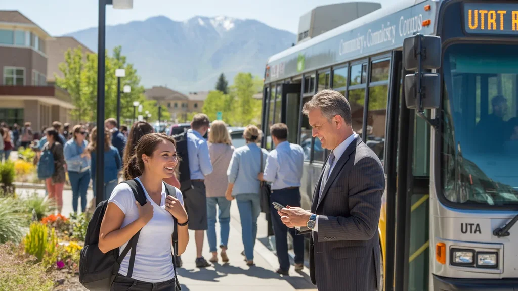
Public transit in Sandy centers around rail service, with the TRAX light rail system providing the primary structured transit option. The presence of rail stations creates genuine commute alternatives for residents within reasonable distance of those stops, particularly for trips to downtown Salt Lake City or other points along the line.
Transit works best in Sandy’s commercial corridors where residential density, errands accessibility, and station proximity align. In these areas, a household can realistically structure a commute around rail service, especially if work destinations sit along the same line. The infrastructure supports this use case: stations offer parking, service runs frequently enough during peak hours, and the trip avoids the variability of highway traffic.
Where transit falls short is coverage. Rail serves specific corridors, not the whole city, and bus service—while present—operates on a scale that doesn’t replicate the reach or frequency needed to replace car ownership for most households. If your daily destinations don’t align with existing routes, or if your schedule requires off-peak travel, transit stops being a practical option and becomes a theoretical one.
Late hours and weekend service also constrain transit’s role. Families managing multiple stops, shift workers, or anyone whose routine doesn’t fit a traditional commute window will find that transit availability doesn’t match their actual mobility needs. The system exists, but it’s optimized for a narrow slice of trip types.
Driving & Car Dependence Reality in Sandy
For most Sandy residents, driving isn’t a preference—it’s a structural requirement. The city’s layout disperses schools, grocery stores, medical offices, and recreational facilities across a geography that assumes car access. Even in areas with high errands accessibility, the distance between home and those errands often exceeds comfortable walking range, especially in summer heat or winter cold.
Parking abundance reinforces car dependence. Unlike denser cities where parking scarcity creates friction, Sandy’s commercial centers, residential developments, and public facilities provide ample parking, removing any logistical barrier to driving. This makes car ownership the path of least resistance for daily life, even for households that could theoretically use transit for one or two trips per week.
Sprawl shapes commute flexibility in both directions. Residents who work in Sandy but live elsewhere face limited transit options for reverse commutes. Residents who live in Sandy but work in dispersed suburban job centers—tech parks, industrial zones, retail clusters—find that transit doesn’t serve those destinations at all. The car becomes the only tool that handles the full range of trips a household actually makes.
This isn’t about personal choice or lifestyle preference. It’s about infrastructure. Sandy’s transportation network was built to prioritize road access, and that priority determines how people move, regardless of whether they’d prefer another option.
Commuting Patterns & Daily Mobility
Commuting in Sandy reflects a mix of single-destination trips and complex multi-stop patterns, and the difference determines whether transit becomes viable or irrelevant. The average commute in Sandy takes 23 minutes, a figure that masks significant variation depending on destination, time of day, and whether the trip aligns with rail corridors.
For residents commuting to downtown Salt Lake City or other TRAX-served destinations, rail transit offers a genuine alternative. These commuters benefit from predictable travel times, no parking costs at the destination, and the ability to avoid highway congestion. This group represents the slice of Sandy’s workforce for whom transit actually works as designed.
But 30.9% of workers in Sandy face long commutes, a share that suggests many residents travel to job centers outside the rail network’s reach. These commuters—heading to suburban office parks, industrial zones, or dispersed retail and service jobs—have no practical transit option. Their commutes require cars, and the time and cost exposure that comes with that dependency.
Only 4.0% of Sandy’s workforce works from home, meaning the vast majority of residents make daily trips that require either transit access or a car. For households managing school drop-offs, daycare pickups, or mid-day errands, even a functional rail commute doesn’t eliminate the need for a vehicle. The car stays in the driveway because the rest of the day’s logistics demand it.
Daily mobility in Sandy isn’t just about commuting—it’s about how a household strings together all the trips a day requires. Proximity to rail helps with one piece of that puzzle, but it rarely solves the whole thing.
Who Transit Works For — and Who It Doesn’t
Transit in Sandy works for a specific household profile: individuals or couples living near rail stations, commuting to destinations along the TRAX line, with flexible schedules that align with service hours and minimal need for mid-day car trips. For this group, rail access reduces commute costs, eliminates parking hassles, and provides a predictable alternative to highway driving.
Renters in corridor neighborhoods often benefit most from this setup. They can prioritize proximity to stations when choosing housing, and their lease flexibility allows them to adjust location if commute patterns change. Single-income households or those with one partner working remotely can structure their day around one car and one transit commute, reducing transportation costs without sacrificing mobility.
Transit doesn’t work for families managing multi-stop logistics. School schedules, activity pickups, and errands don’t align with rail routes or service hours, and the time cost of adding transit to an already complex daily pattern becomes prohibitive. These households need the flexibility and speed that only a car provides, even if they live near a station.
Homeowners in lower-density neighborhoods face a different constraint: distance. Even if their commute destination sits on the TRAX line, the gap between home and station requires a car for the first leg of the trip, eliminating much of transit’s advantage. Park-and-ride lots help, but they don’t replicate the convenience of a true walkable transit commute.
Shift workers, late-hour employees, and anyone whose schedule falls outside peak service windows will find transit unreliable or unavailable. The system’s design assumes traditional work hours, and households operating on different rhythms absorb the full cost and friction of car dependency.
Transportation Tradeoffs in Sandy
Choosing between transit and driving in Sandy isn’t about cost alone—it’s about predictability, control, and how much friction a household can tolerate. Rail transit offers fixed travel times and eliminates the variability of highway congestion, but it requires proximity, schedule alignment, and the willingness to structure your day around service availability.
Driving provides flexibility and speed, especially for multi-stop trips or destinations outside transit corridors. But it exposes households to fuel price swings, parking constraints in denser destinations, and the time cost of traffic during peak hours. For most Sandy residents, this tradeoff resolves in favor of driving because the city’s layout makes transit impractical for the majority of daily trips.
The real tradeoff isn’t transit versus driving—it’s corridor proximity versus space and cost. Households that prioritize transit access pay for it through higher rent or home prices in walkable, rail-adjacent neighborhoods. Those who choose lower-density areas gain space and often lower [housing costs](/sandy-ut/monthly-budget/), but absorb the time and expense of car dependency.
Neither option is inherently better. The right choice depends on how a household’s daily logistics actually work, where jobs and schools sit, and whether the time savings or cost reduction from transit justifies the constraints it imposes on location and schedule.
FAQs About Transportation in Sandy (2026)
Is public transit usable for daily commuting in Sandy?
Yes, but only for specific commute patterns. If you live near a TRAX station and work along the rail line, transit provides a reliable, predictable commute option. For residents outside those corridors or commuting to destinations not served by rail, transit becomes impractical, and driving remains the only viable option.
Do most people in Sandy rely on a car?
Yes. The city’s layout, errands distribution, and limited transit coverage mean that most households depend on a car for daily life, even if they occasionally use rail for commuting. Families, shift workers, and residents in lower-density neighborhoods have no practical alternative to car ownership.
Which areas of Sandy are easiest to live in without a car?
Neighborhoods near TRAX stations with high errands accessibility—where grocery stores, pharmacies, and services sit within walking distance—offer the best chance of reducing car dependency. But even in these areas, most households still own a car for trips that transit doesn’t serve.
How does commuting in Sandy compare to nearby cities?
Sandy’s average commute of 23 minutes sits in a moderate range, but the experience varies widely depending on destination and transit access. Residents commuting to downtown Salt Lake City benefit from rail service, while those traveling to suburban job centers face longer, car-dependent commutes with less predictability.
Can you get by with one car in Sandy?
Some households can, particularly if one partner works from home, uses transit, or has a flexible schedule. But for families with multiple working adults, school-age children, or complex daily logistics, a second car often becomes necessary because the city’s layout and limited transit coverage make single-car households absorb significant time costs and scheduling friction.
How Transportation Fits Into the Cost of Living in Sandy
Transportation in Sandy isn’t just a line item—it’s a structural factor that shapes where you can live, how much time you spend moving through your day, and how much flexibility your household retains. Proximity to rail corridors reduces commute costs and time for some households, but it often comes with higher housing costs that offset those savings. Car dependency, meanwhile, imposes ongoing fuel, maintenance, and insurance expenses, but it unlocks access to lower-cost neighborhoods and greater schedule control.
The transportation decision in Sandy is really a housing decision. Choosing a location near transit access means prioritizing commute predictability and potentially lower transportation costs, but accepting higher rent or home prices and reduced space. Choosing a lower-density neighborhood means prioritizing affordability and square footage, but absorbing the full cost and time burden of driving.
For a clearer picture of how transportation expenses interact with housing, utilities, and other costs, see what a budget has to handle in Sandy. That article breaks down how these categories combine and where households typically feel the most pressure.
The key insight is this: Sandy’s transportation structure works well for a narrow set of circumstances—corridor proximity, rail-aligned commutes, and simple daily logistics. For everyone else, the city’s layout demands a car, and the costs and tradeoffs that come with it. Understanding which group you fall into before you move determines whether Sandy’s transportation reality supports your life or complicates it.
How this article was built: In addition to public economic data, this article incorporates location-based experiential signals derived from anonymized geographic patterns—such as access density, walkability, and land-use mix—to reflect how day-to-day living actually feels in Sandy, UT.
—