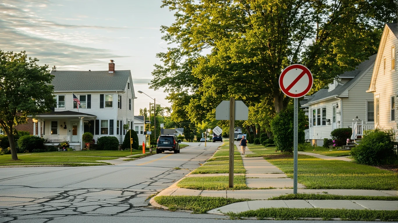
It’s 7:15 a.m., and Maya is standing at a bus stop on Chapel Hill Road, backpack slung over one shoulder, watching the morning traffic roll past. She’s heading to her job at Research Triangle Park, a commute she’s done dozens of times since moving to Morrisville six months ago. The bus arrives on schedule, she taps her card, and settles in for the ride. For Maya, public transit works—not because Morrisville is a transit city, but because her apartment, her job, and the bus route all line up. A mile away, her neighbor is backing out of his driveway for the third time this morning: school drop-off, then the office, then errands later. Same town, completely different transportation reality.
Understanding transportation options in Morrisville means recognizing that this is a place in transition. It’s not a car-free urban core, and it’s not a transit desert either. It’s a suburban community with pockets of walkability, a bus network that serves specific corridors well, and a layout that still assumes most people will drive most of the time. How you get around depends heavily on where you live, where you work, and how much flexibility your schedule allows.
How People Get Around Morrisville
Morrisville is fundamentally a car-first town, but it’s not uniform. The pedestrian-to-road ratio in parts of the city exceeds what you’d find in typical suburban sprawl, meaning there are areas where sidewalks, crosswalks, and pedestrian pathways are genuinely integrated into the street network. These walkable pockets tend to cluster near mixed-use developments and commercial corridors, where residential and commercial land use sit side by side. If you live in one of these areas, you can walk to a grocery store, grab coffee, or pick up prescriptions without getting in the car.
But step outside those zones, and the infrastructure shifts. Residential subdivisions farther from the core are built around cul-de-sacs and collector roads designed to move cars efficiently, not people on foot. Bike infrastructure is notably present—bike-to-road ratios are high compared to many suburbs—but that doesn’t mean every neighborhood is connected by protected lanes. It means that in certain areas, cycling is a real option, especially for recreation or short trips within a district.
Public transit exists, and it’s bus-based. There’s no light rail, no commuter train. The bus network serves key corridors and connects Morrisville to Research Triangle Park, Raleigh, Durham, and other regional employment centers. For people whose lives align with those routes, transit is a practical daily tool. For everyone else, it’s a car town.
Public Transit Availability in Morrisville
Public transit in Morrisville often centers around systems such as GoTriangle and GoCary, which provide regional bus service connecting the Research Triangle area. Coverage is not citywide, and it’s not frequent in the way urban transit systems operate, but it’s present and functional along major corridors.
Transit works best for people commuting to Research Triangle Park, Raleigh-Durham International Airport, or central Raleigh and Durham. Routes tend to follow the main arteries—Chapel Hill Road, Aviation Parkway, and connections to I-40. If your home and workplace both sit near these corridors, and your schedule aligns with bus timing, transit can replace a car for the commute.
Where transit falls short is in coverage of residential subdivisions, evening and weekend service, and multi-stop errands. Buses don’t penetrate every neighborhood, and if you need to make three stops on the way home—daycare, grocery store, dry cleaner—you’re almost certainly driving. Late-night and weekend frequencies are lighter, which limits transit’s usefulness for shift workers, social trips, or spontaneous plans.
Transit in Morrisville is a tool, not a system. It’s there when you need it, if your life is structured in a way that lets you use it.
Driving & Car Dependence Reality
Most people in Morrisville drive, and most households own at least one car. The town’s layout, employment patterns, and daily errands infrastructure all assume car access. Parking is abundant and free in most places. Grocery stores, schools, medical offices, and retail centers are designed with large surface lots. There’s no parking scarcity pressure here.
Car dependence isn’t a failure of planning—it’s a feature of suburban geography. Morrisville sits between Raleigh and Durham, close to Research Triangle Park, and many residents commute in multiple directions. Jobs are dispersed across office parks, research campuses, and regional employment centers that aren’t served by a single transit line. Driving offers the flexibility to reach any of them, on any schedule.
For families, driving is often non-negotiable. School runs, after-school activities, weekend errands, and multi-stop trips don’t fit neatly into a bus schedule. Even in the walkable pockets, most households still keep a car for trips that fall outside the pedestrian-friendly zone.
The tradeoff is predictability and control. Driving means you’re not waiting for a bus, you’re not limited by route coverage, and you’re not adjusting your schedule to match transit timing. But it also means you’re absorbing fuel costs, maintenance, insurance, and the time cost of being behind the wheel.
Commuting Patterns & Daily Mobility
Commuting in Morrisville is shaped by proximity to Research Triangle Park and the broader Research Triangle region. Many residents work in RTP, Raleigh, Durham, or Cary, and commute patterns reflect that geographic spread. Some people drive ten minutes to an office park. Others drive thirty minutes to downtown Raleigh or Durham. A smaller share takes the bus along major corridors.
The town’s location makes it a commuter-friendly base for people working in the Triangle, but it also means that “local” jobs aren’t always the norm. Morrisville itself has employment centers—particularly in tech, logistics, and research—but many residents commute outward.
Daily mobility isn’t just about the commute. It’s about how people structure their day. In areas with high errands accessibility—where food and grocery density exceed typical suburban thresholds—residents can handle daily needs on foot or with short drives. In other parts of town, every errand requires a car trip. That difference shapes how much time people spend in the car, how often they refuel, and how much flexibility they have to adjust plans on the fly.
Who Transit Works For — and Who It Doesn’t
Transit works for people whose commute aligns with the bus network and whose daily life doesn’t require a car for errands, school runs, or evening trips. That typically means:
- Renters in mixed-use areas near Chapel Hill Road or Aviation Parkway, within walking distance of groceries and services
- Solo commuters working in Research Triangle Park or central Raleigh/Durham with standard weekday schedules
- Households willing to structure their day around bus timing and use rideshare or carpool for off-route trips
Transit doesn’t work well for:
- Families with kids in school, especially if drop-off and pickup times don’t align with adult work schedules
- Households in peripheral subdivisions where the nearest bus stop is a mile or more away
- People with irregular hours, multi-stop errands, or jobs in dispersed office parks not served by direct routes
- Anyone who needs evening or weekend mobility and can’t rely on infrequent service
The difference isn’t about preference—it’s about structure. If your home, work, and daily needs all fall within the transit-served zone, you can live without a car or with one car instead of two. If any of those pieces fall outside that zone, driving becomes the default.
Transportation Tradeoffs in Morrisville
Choosing between transit and driving in Morrisville isn’t about cost alone—it’s about control, predictability, and flexibility.
Transit offers lower direct transportation expenses and eliminates the need to own, insure, and maintain a vehicle. It works well for people with fixed schedules and destinations that align with bus routes. But it also means waiting, transferring, and adjusting your day to match the system’s timing. If the bus runs every 30 minutes and you miss it, that’s half an hour of your day.
Driving offers complete flexibility. You leave when you want, stop where you need to, and aren’t constrained by route coverage. But it also means you’re absorbing fuel costs at $3.85 per gallon, paying for insurance and maintenance, and spending time behind the wheel. For households with multiple drivers or complex schedules, that flexibility is worth the expense.
The real tradeoff is between time and money, but also between autonomy and exposure. Transit reduces your transportation cost exposure but increases your schedule constraints. Driving increases your cost exposure but reduces your logistical friction.
In Morrisville, most people choose driving because the layout, employment patterns, and household logistics make it the path of least resistance. But for those whose lives fit the transit network, the bus is a viable, functional alternative.
How this article was built: In addition to public economic data, this article incorporates location-based experiential signals derived from anonymized geographic patterns—such as access density, walkability, and land-use mix—to reflect how day-to-day living actually feels in Morrisville, NC.
FAQs About Transportation in Morrisville (2026)
Is public transit usable for daily commuting in Morrisville?
Yes, if your commute follows a major corridor like Chapel Hill Road or connects to Research Triangle Park, Raleigh, or Durham. Bus service is present and functional along these routes. If you live near a stop and work near a stop, transit can replace driving for the commute. Outside those corridors, or for trips that require multiple stops, driving is more practical.
Do most people in Morrisville rely on a car?
Yes. Morrisville is a car-first town, and most households own at least one vehicle. The layout, employment patterns, and daily errands infrastructure assume car access. Transit exists and works for specific use cases, but the majority of residents drive for commuting, errands, and family logistics.
Which areas of Morrisville are easiest to live in without a car?
Areas near Chapel Hill Road and mixed-use developments with high errands accessibility—where grocery stores, restaurants, and services are within walking distance—are the most car-optional. These walkable pockets have strong pedestrian infrastructure and are often near bus stops. Peripheral subdivisions and residential-only zones require a car for nearly all trips.
How does commuting in Morrisville compare to nearby cities?
Morrisville sits between Raleigh, Durham, and Cary, making it a commuter-friendly base for the Research Triangle. Commutes are generally shorter than living farther out in the suburbs, but longer than living in the urban cores. The town’s proximity to Research Triangle Park is a major advantage for people working there. Compared to Raleigh or Durham, Morrisville has less transit coverage but also less traffic congestion in most areas.
Can you bike for transportation in Morrisville?
In some areas, yes. Bike infrastructure is notably present, with bike-to-road ratios higher than typical suburbs. That means certain corridors and neighborhoods have dedicated lanes or paths that make cycling practical for short trips or recreation. But the network isn’t citywide, and many residential areas aren’t connected by protected routes. Biking works best within specific districts, not as a replacement for a car across the entire town.
How Transportation Fits Into the Cost of Living in Morrisville
Transportation isn’t just a line item—it’s a structural factor that shapes where you live, how you spend your time, and what kind of monthly expenses you carry. In Morrisville, most households absorb the cost of owning and operating at least one vehicle, which includes fuel, insurance, maintenance, and depreciation. Gas prices sit at $3.85 per gallon, and how often you refuel depends on your commute distance and daily errands pattern.
For people who can use transit, transportation costs drop significantly, but only if your housing, work, and daily needs all align with the bus network. That’s a narrow fit, and it requires tradeoffs in schedule flexibility and geographic choice.
The broader cost-of-living picture in Morrisville includes housing, utilities, and household logistics, all of which interact with transportation. Living closer to work or transit might mean higher rent but lower fuel costs. Living farther out might mean cheaper housing but longer drives and more time in the car. For a fuller breakdown of how these pieces fit together, see the Monthly Spending in Morrisville: The Real Pressure Points article.
Transportation in Morrisville is what you make of it. If your life fits the walkable pockets and bus corridors, you can reduce your car dependence and the costs that come with it. If it doesn’t, you’ll drive—and that’s not a failure, it’s just the reality of suburban geography. The key is understanding which pattern fits your household, your commute, and your day-to-day logistics, and planning accordingly.