Transit & Commute Snapshot: Milpitas, CA
| Metric | Value |
|---|---|
| Average Commute Time | 26 minutes |
| Long Commute (60+ min) Rate | 40.5% |
| Work From Home Rate | 7.4% |
| Gas Price | $4.64/gal |
| Rail Transit | Present |
| Pedestrian Infrastructure | Walkable pockets (high density in parts of city) |
| Cycling Infrastructure | Notable (present throughout parts of city) |
How People Get Around Milpitas
Understanding transportation options in Milpitas means recognizing a city caught between two realities: rail-accessible corridors with walkable pockets, and a commute pattern that sends many residents far beyond local transit coverage. Milpitas sits at the southern edge of the Bay Area’s transit spine, close enough to San Jose and Silicon Valley job centers to benefit from rail service, but spread out enough that car ownership remains the default for most households.
Newcomers often assume Milpitas functions like a dense urban node or a purely suburban bedroom community. It’s neither. The city has developed unevenly, with some neighborhoods clustered around transit stations and commercial corridors where pedestrian infrastructure is dense and errands are broadly accessible on foot, while other areas remain car-oriented, with limited sidewalk connectivity and few destinations within walking distance. This unevenness shapes daily life: where you live in Milpitas determines whether transit is a practical tool or an occasional backup.
The numbers tell part of the story. The average commute in Milpitas is 26 minutes, but that figure masks wide variation. More than two in five residents—40.5%—face commutes longer than an hour, suggesting many travel to dispersed job sites or endure multi-leg journeys that require transfers or driving. Only 7.4% of workers operate from home, meaning nearly everyone is moving through the city or beyond it daily. For those whose jobs align with rail corridors, transit can anchor a predictable routine. For everyone else, driving absorbs time, fuel costs, and flexibility.
Public Transit Availability in Milpitas
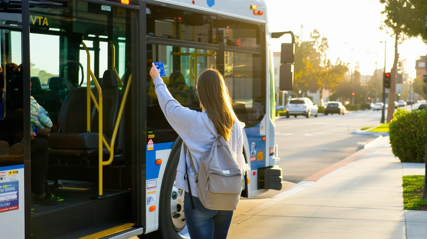
Public transit in Milpitas often centers around systems such as VTA light rail, which connects the city to San Jose, Santa Clara, and other regional employment hubs. Rail service provides structured, predictable access along fixed corridors, making it viable for commuters whose destinations fall within a short walk or bus connection from a station. For residents living near transit stops in denser pockets of the city, rail can reduce or eliminate the need for daily driving, particularly for work commutes to major job centers.
But rail coverage is linear, not comprehensive. Transit works best for those traveling along established routes during peak hours. It tends to fall short for intra-city errands, late-evening trips, or destinations that require multiple transfers. Peripheral neighborhoods—those farther from station areas—often lack the density of sidewalks, crossings, and nearby services that make car-free living practical. In these areas, transit becomes supplementary rather than primary, useful for occasional trips but not sufficient for daily mobility.
Bus service typically fills gaps left by rail, offering broader geographic reach but with tradeoffs in frequency and directness. Residents may encounter regional bus options that connect Milpitas to neighboring cities, though coverage varies by area and time of day. For households prioritizing transit access, proximity to a rail station or high-frequency bus corridor is the determining factor. For those outside these zones, transit availability drops sharply.
Driving & Car Dependence Reality
For most Milpitas residents, driving is not optional. Even in walkable pockets where errands are accessible on foot and rail stations are nearby, car ownership provides the flexibility required for multi-stop trips, weekend errands, and travel beyond the city’s transit corridors. Parking is generally available and uncontested, reflecting a built environment designed around vehicle access. Driveways, garages, and surface lots dominate residential and commercial areas alike.
The city’s layout reinforces car dependence. While some neighborhoods feature mixed land use and pedestrian-friendly infrastructure, many areas are separated by wide arterial roads, long blocks, and gaps in sidewalk connectivity. Reaching a grocery store, school, or medical clinic often requires driving, even if the destination is less than two miles away. For families managing multiple daily trips—school drop-offs, after-school activities, grocery runs—driving becomes the only practical solution.
High gas prices in California amplify the cost exposure for car-dependent households. At $4.64 per gallon, frequent driving translates into sustained fuel expenses that renters and owners alike must absorb. Unlike transit, which offers predictable costs through passes or fare structures, driving introduces variability: maintenance, insurance, registration, and fuel costs fluctuate and compound. For households with two working adults or those commuting to distant job sites, these costs accumulate quickly.
Commuting Patterns & Daily Mobility
Commuting in Milpitas reflects the city’s position as both a residential base and a regional connector. Many residents commute to jobs in San Jose, Fremont, or deeper into Silicon Valley, where employment density far exceeds what Milpitas itself offers. Rail service supports these linear, single-destination commutes, particularly for workers whose offices sit near transit hubs. For this group, the 26-minute average commute is achievable and often predictable.
But the 40.5% long-commute rate reveals a different pattern: a substantial share of residents face extended travel times, often because their jobs require driving to dispersed locations, navigating multi-leg transit routes, or commuting during off-peak hours when service frequency drops. These commuters absorb not just time but unpredictability—traffic congestion, delayed transfers, or the need to leave early to ensure on-time arrival.
Daily mobility extends beyond work commutes. Running errands, attending appointments, and managing household logistics all require movement through the city. In neighborhoods with high food and grocery density, these tasks can be handled on foot or by bike. In car-oriented areas, every errand demands a trip, and every trip requires planning around parking, traffic, and time. The structure of daily life in Milpitas depends heavily on where you live and whether your routine aligns with transit corridors or requires the flexibility only a car provides.
Who Transit Works For — and Who It Doesn’t
Transit in Milpitas serves a specific subset of residents well: those living near rail stations, commuting to jobs along established corridors, and willing to structure their routines around fixed schedules. Solo commuters without dependents, renters prioritizing lower transportation costs, and households in walkable pockets with access to nearby groceries and services can often reduce or eliminate car dependency. For this group, transit offers predictability, lower costs, and freedom from parking and fuel volatility.
Transit fits less well for families managing multiple daily trips, households in peripheral neighborhoods, and workers whose jobs require flexibility or travel to dispersed sites. Parents coordinating school drop-offs, after-school activities, and weekend errands find that transit’s fixed routes and schedules don’t align with the complexity of family logistics. Similarly, workers in industries requiring site visits, irregular hours, or travel beyond rail coverage must rely on cars for practical mobility.
Renters near transit stations often benefit most from Milpitas’ rail access, particularly if they’re willing to trade space or neighborhood choice for proximity to a stop. Owners in peripheral areas, by contrast, typically assume car ownership as a baseline, with transit serving as an occasional supplement rather than a primary mode. The difference isn’t preference—it’s geography. Where you live determines whether transit is a tool you use daily or a system you rarely touch.
Transportation Tradeoffs in Milpitas
Choosing between transit and driving in Milpitas means weighing predictability against flexibility. Transit offers fixed costs, scheduled service, and freedom from parking and fuel exposure. It works best for linear commutes, solo travelers, and those whose daily routines fit within rail and bus coverage. Driving offers control, flexibility, and the ability to reach any destination at any time, but introduces variability in fuel costs, maintenance, and time lost to traffic.
For households near rail stations in walkable pockets, the tradeoff tilts toward transit. These residents can handle daily errands on foot, commute predictably to regional job centers, and avoid the compounding costs of car ownership. For those in peripheral neighborhoods or with complex daily logistics, driving becomes non-negotiable. The question isn’t which mode is better—it’s which mode your location and routine demand.
Cycling infrastructure adds a third option for some residents. Milpitas features notable bike infrastructure in parts of the city, making short trips and recreational rides feasible for those comfortable navigating mixed traffic. But cycling remains supplementary for most households, useful for errands or exercise but insufficient as a primary transportation mode, particularly for longer commutes or trips requiring cargo capacity.
FAQs About Transportation in Milpitas (2026)
Is public transit usable for daily commuting in Milpitas?
Yes, if your job sits along a rail corridor and you live near a station. Rail service connects Milpitas to San Jose and other regional hubs, making transit viable for linear commutes to major employment centers. Outside these corridors, transit becomes less practical, and driving typically fills the gap.
Do most people in Milpitas rely on a car?
Yes. While rail access and walkable pockets reduce car dependency for some residents, the majority of households own and use cars for daily mobility. The 40.5% long-commute rate and dispersed job sites mean many residents require the flexibility only driving provides.
Which areas of Milpitas are easiest to live in without a car?
Neighborhoods near rail stations with high pedestrian infrastructure density and nearby groceries and services. These areas allow residents to handle errands on foot and commute predictably via transit. Peripheral neighborhoods with lower density and fewer nearby destinations require cars for practical daily living.
How does commuting in Milpitas compare to nearby cities?
Milpitas benefits from rail access and a relatively moderate average commute time of 26 minutes, but the high long-commute rate suggests many residents travel farther than the average implies. Compared to denser urban nodes, Milpitas offers more space and lower housing density, but less comprehensive transit coverage. Compared to purely suburban cities, Milpitas provides better rail connectivity but similar car dependence outside transit corridors.
Does Milpitas have good cycling infrastructure?
Cycling infrastructure is present throughout parts of the city, with bike-to-road ratios exceeding typical suburban standards. This makes short trips and recreational cycling feasible in certain areas, though cycling remains supplementary for most households rather than a primary transportation mode.
How Transportation Fits Into the Cost of Living in Milpitas
Transportation in Milpitas is not just a line item—it’s a structural factor that shapes housing choice, daily routines, and financial exposure. Households near rail stations in walkable pockets can reduce transportation costs by relying on transit and foot travel, but they often pay a premium for proximity. Those in peripheral neighborhoods face lower housing costs but absorb higher fuel expenses, longer commutes, and the compounding costs of car ownership.
The tradeoff between housing and transportation is unavoidable. Living near transit reduces mobility costs but limits housing options and often increases rent or purchase prices. Living farther from transit expands housing choices and may lower monthly payments, but introduces fuel volatility, maintenance expenses, and time lost to commuting. Neither path is inherently better—each fits different household priorities and constraints.
For a fuller picture of how transportation intersects with housing, utilities, and other expenses, see What a Budget Has to Handle in Milpitas, which breaks down the monthly cost structure and explains where money actually goes.
Milpitas offers real transit access in specific corridors and walkable pockets, but car ownership remains the default for most residents. Understanding where you’ll live, where you’ll work, and how you’ll move daily is essential to making transportation work within your broader financial plan. The city rewards those who can align their routines with rail service and pedestrian infrastructure, but it doesn’t penalize those who can’t—it simply requires them to plan for the costs and time that driving demands.
How this article was built: In addition to public economic data, this article incorporates location-based experiential signals derived from anonymized geographic patterns—such as access density, walkability, and land-use mix—to reflect how day-to-day living actually feels in Milpitas, CA.
—