Transit & Mobility Overview: Glastonbury, CT
| Mobility Dimension | Characteristic | What It Means |
|---|---|---|
| Pedestrian Infrastructure | Concentrated pockets | Walkability exists in specific areas, not uniformly distributed |
| Cycling Infrastructure | Limited presence | Bike routes exist but cover selective corridors |
| Errands Accessibility | Corridor-clustered | Grocery and food options concentrate along main roads |
| Land Use Pattern | Mixed residential/commercial | Some neighborhoods integrate homes and businesses |
| Dominant Mode | Car-oriented with walkable zones | Driving necessary for most trips; walking viable in select areas |
How People Get Around Glastonbury
Understanding transportation options in Glastonbury starts with recognizing the town’s fundamental structure: it’s built for cars, but not uniformly so. Unlike fully suburban sprawl where every errand requires driving, Glastonbury has developed pockets where pedestrian infrastructure supports walking to nearby shops and services—but those pockets don’t connect into a continuous network. The result is a mobility landscape where your daily transportation experience depends heavily on which part of town you live in and where you need to go.
Most residents rely on personal vehicles for the majority of trips. The town’s layout, with commercial activity concentrated along specific corridors rather than distributed evenly, means that even short errands often require driving if you’re not living directly near one of those corridors. What newcomers frequently misunderstand is that Glastonbury isn’t a place where you can easily substitute walking or biking for driving across the board—it’s more accurate to think of it as a car-dependent town with selective walkable zones that reduce, but don’t eliminate, the need for a vehicle.
The pedestrian infrastructure that does exist tends to cluster in areas where residential and commercial land uses mix. In these zones, sidewalks, crosswalks, and shorter block patterns make it practical to walk to a grocery store, coffee shop, or restaurant. But step outside these corridors, and the infrastructure shifts: wider roads, longer distances between destinations, and fewer pedestrian crossings make driving the default. This isn’t a judgment on planning—it’s simply the reality of how the town has developed, and it shapes daily life in concrete ways.
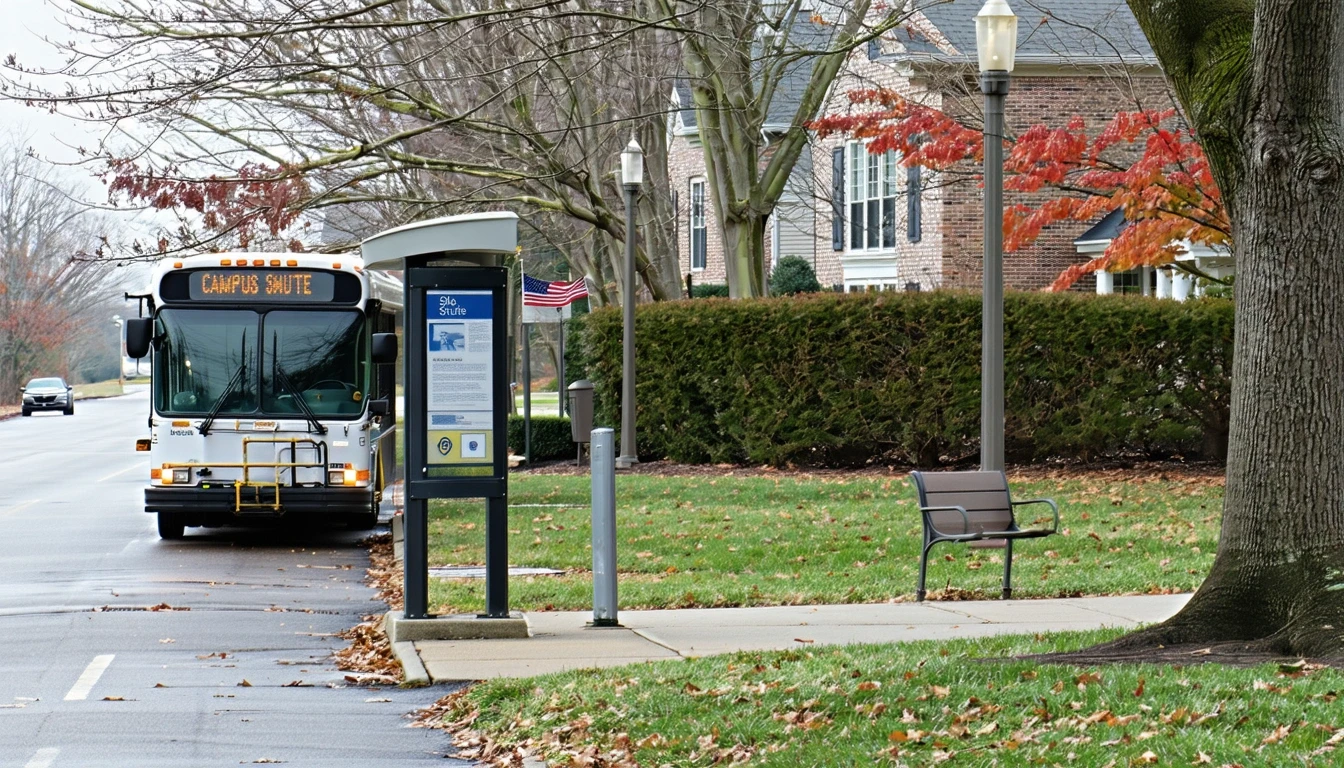
Public Transit Availability in Glastonbury
Public transit does not play a central role in how most Glastonbury residents move through their day. The town’s infrastructure signals indicate a car-oriented layout without the density or connectivity that typically supports frequent, practical transit service. For households evaluating whether they can rely on buses or trains for commuting or errands, the honest answer is that transit is not structured to serve as a primary transportation mode here.
This doesn’t mean transit is entirely absent from the region—Connecticut has systems that connect towns to larger employment centers like Hartford—but Glastonbury itself is not a transit hub. Coverage tends to be limited, and service patterns reflect the town’s role as a residential community where most people drive to work, school, and shopping. If you’re coming from a city where you could navigate daily life without a car, Glastonbury will feel like a significant shift.
The practical implication is that households considering a move here should plan for car ownership. Transit might serve as a supplemental option for specific trips—perhaps a commute into Hartford on certain routes—but it won’t replace the need for a vehicle for groceries, medical appointments, or getting kids to activities. The town’s corridor-clustered layout means even trips within Glastonbury often require driving, and transit schedules are unlikely to align with the flexibility most households need.
Driving & Car Dependence Reality
Driving isn’t just common in Glastonbury—it’s structurally necessary for most households. The town’s development pattern, with commercial services concentrated along main corridors and residential neighborhoods spreading outward, creates a geography where cars provide the flexibility and reach that walking, biking, or transit cannot. This isn’t about preference; it’s about how far apart things are and how the road network is designed.
Parking is generally abundant and free, which removes one of the friction points that makes driving costly or stressful in denser cities. You’re not circling blocks looking for a spot or paying daily garage fees. Instead, parking is embedded into the fabric of daily life—stores have lots, workplaces have dedicated spaces, and homes typically include driveways or garages. This makes car ownership more practical and less burdensome than it would be in a place where parking itself becomes a logistical challenge.
The tradeoff is that driving becomes non-negotiable for most trips. Even if you live in one of the walkable pockets, you’ll still need a car to reach destinations outside that immediate area. Cross-town errands, medical appointments, or visiting friends in neighboring towns all require driving. For households with multiple working adults or children in activities, this often translates into needing more than one vehicle. The town’s layout doesn’t penalize drivers, but it does assume car access as the baseline.
Commuting Patterns & Daily Mobility
Commuting from Glastonbury typically means driving, whether you’re heading into Hartford, to a job elsewhere in the region, or working locally. The town’s position as a residential community means many residents commute outward for employment, and the infrastructure reflects that reality. Roads are designed to move cars efficiently during peak hours, and the lack of dense transit options means most people structure their commutes around personal vehicle schedules, not bus or train timetables.
For households with flexible or remote work arrangements, Glastonbury’s car-dependent layout becomes less of a daily burden. If you’re not commuting five days a week, the need to drive for errands and occasional trips feels more manageable. But for those with traditional office schedules, especially if both adults in a household work outside the home, the commute becomes a fixed cost in time and vehicle wear, and it’s one that can’t easily be avoided or reduced.
Daily mobility beyond commuting follows a similar pattern. Getting kids to school, running errands, or attending evening activities all require driving. The corridor-clustered layout means you might consolidate trips along a single route, but you’re still covering miles in a car rather than walking a few blocks. This creates a rhythm where transportation is less about spontaneous trips and more about planned routes that maximize efficiency.
Who Transit Works For — and Who It Doesn’t
Transit in Glastonbury, to the extent it exists, serves a narrow slice of residents: those whose commute aligns with available routes into regional employment centers and who can tolerate limited frequency and coverage. This might include someone working a standard schedule in Hartford with access to a park-and-ride or a bus route that runs during peak hours. But even for this group, transit is a commute solution, not a comprehensive mobility option—they’ll still need a car for everything else.
For most households, transit doesn’t fit. Families with children, residents working non-traditional hours, or anyone whose job isn’t along a transit corridor will find that buses or trains simply don’t serve their needs. The town’s layout, with services and employment dispersed rather than concentrated, means transit can’t efficiently connect the places people actually need to go. Renters and owners face the same reality here: location within Glastonbury matters for walkability, but it doesn’t change the fact that a car is essential.
The households most likely to feel the limitations of Glastonbury’s transportation structure are those coming from transit-rich cities where car-free living was viable. If you’ve been able to rely on subways, frequent buses, or bike infrastructure to handle daily life, Glastonbury will require a significant adjustment. The walkable pockets provide some relief—you might be able to walk to a few nearby shops—but they don’t substitute for the comprehensive mobility that transit provides in denser places.
Transportation Tradeoffs in Glastonbury
Choosing to drive in Glastonbury isn’t really a choice—it’s the default. The tradeoff you’re making is between the flexibility and control that comes with car ownership and the fixed costs and responsibilities that come with it. Driving gives you the ability to go where you need to, when you need to, without waiting for a bus or planning around a train schedule. You control your route, your timing, and your capacity to carry groceries, kids, or equipment.
The cost of that control is that you’re absorbing all the exposure: fuel prices, maintenance, insurance, and the time spent behind the wheel. In a place with robust transit, you could offload some of that exposure by choosing trains or buses for certain trips. In Glastonbury, that option largely doesn’t exist, so every trip is a car trip, and every car trip adds to your cumulative transportation burden. The town’s infrastructure doesn’t penalize you for driving, but it also doesn’t offer you a way out of it.
For households evaluating Glastonbury, the transportation tradeoff is less about transit versus driving and more about accepting car dependence as part of the [cost structure](/glastonbury-ct/monthly-budget/). The walkable pockets reduce how often you need to drive for immediate errands, but they don’t eliminate the need for a vehicle. The question isn’t whether you’ll drive—it’s whether the town’s other qualities (space, schools, community character) justify the transportation structure that comes with it.
FAQs About Transportation in Glastonbury (2026)
Is public transit usable for daily commuting in Glastonbury?
Public transit in Glastonbury is limited and serves primarily as a commute option for specific routes into regional employment centers like Hartford. It’s not structured to support daily errands, off-peak travel, or comprehensive mobility. Most residents find that even if transit works for a commute, they still need a car for everything else.
Do most people in Glastonbury rely on a car?
Yes. The town’s layout, with services concentrated along corridors and residential areas spread out, makes car ownership essential for most households. Even in the walkable pockets where you can reach some shops on foot, a vehicle is necessary for cross-town trips, commuting, and accessing services outside your immediate area.
Which areas of Glastonbury are easiest to live in without a car?
The areas with the most pedestrian infrastructure and mixed residential-commercial land use offer the best chance of reducing car dependence, but even in these zones, you’ll still need a vehicle for many trips. Walkability in Glastonbury is localized, not town-wide, so living near a commercial corridor helps but doesn’t eliminate the need for driving.
How does commuting in Glastonbury compare to nearby cities?
Glastonbury functions as a residential community where most people commute outward for work. Compared to denser cities with transit infrastructure, commuting here is almost entirely car-based. The town’s roads handle peak-hour traffic, but there’s no substitute for driving if your job is outside town or in a location not served by limited regional transit.
Can you bike for transportation in Glastonbury?
Cycling infrastructure exists in limited areas, but it’s not comprehensive enough to serve as a primary transportation mode for most residents. Biking might work for recreational purposes or short trips within specific corridors, but the town’s layout and distances make it impractical for daily commuting or errands for most households.
How Transportation Fits Into the Cost of Living in Glastonbury
Transportation in Glastonbury isn’t just about how you get from place to place—it’s a structural factor that shapes where you can live, how you spend your time, and what your household needs to function. The town’s car-dependent layout means that vehicle ownership, fuel, and maintenance become fixed costs that every household absorbs, and those costs don’t vary much based on where in town you live. Unlike cities where proximity to transit can reduce transportation expenses, Glastonbury offers limited opportunities to trade location for lower transportation costs.
The walkable pockets provide some relief by reducing the frequency of short trips, but they don’t fundamentally change the equation. You’ll still need a car, and if you have multiple working adults or children in activities, you’ll likely need more than one. This affects housing decisions, too—homes with garages or driveways become more valuable, and proximity to main corridors matters more than proximity to transit stops.
For a fuller picture of how transportation costs fit into your overall budget, including fuel, insurance, and vehicle expenses, see Your Monthly Budget in Glastonbury: Where It Breaks. That article walks through the numeric context and helps you understand how transportation interacts with housing, utilities, and other fixed costs.
The bottom line: Glastonbury’s transportation structure is predictable and manageable, but it’s not flexible. You’ll drive, you’ll need a reliable vehicle, and you’ll plan your life around car access. The town rewards that structure with space, parking, and a layout that doesn’t penalize drivers—but it also means you can’t opt out. If that tradeoff aligns with your household’s needs and priorities, Glastonbury’s transportation reality is straightforward. If you’re hoping to reduce car dependence or rely on transit, this isn’t the place that will support that goal.
How this article was built: In addition to public economic data, this article incorporates location-based experiential signals derived from anonymized geographic patterns—such as access density, walkability, and land-use mix—to reflect how day-to-day living actually feels in Glastonbury, CT.