Getting around Fullerton depends heavily on where you live and where you need to go. The city sits in a geographic middle ground: rail service connects certain corridors to the broader region, walkable pockets support errands on foot, and yet most daily life still revolves around driving. Understanding how these layers interact—and which one applies to your situation—shapes everything from where you choose to live to how much time and flexibility you retain each day.
Fullerton’s transportation reality isn’t uniform. Some neighborhoods offer genuine alternatives to constant car use, while others require a vehicle for nearly every trip. The difference isn’t just convenience—it’s a structural factor that affects housing choice, commute predictability, and the rhythm of daily logistics.
How People Get Around Fullerton
Most residents in Fullerton drive. The city’s layout reflects decades of car-oriented development, with residential neighborhoods spreading outward from a denser, older core. Roads dominate the infrastructure, and parking remains widely available in most areas. For families managing school drop-offs, weekend errands, or jobs in scattered locations, driving offers the control and flexibility that other modes can’t match.
But Fullerton isn’t purely car-dependent. Rail service runs through the city, connecting residents to employment centers and regional destinations. Certain neighborhoods—particularly those near the historic downtown core—support walking for daily errands. Pedestrian infrastructure in these areas exceeds what you’d find in typical suburban sprawl, and the density of food and grocery options makes it possible to handle routine needs without a car.
What newcomers often misunderstand is that getting around Fullerton isn’t a single experience. Your mobility options depend on your specific neighborhood, your job location, and whether your daily routine clusters around transit-accessible corridors or spreads across multiple zones. Someone living near a rail station with a job downtown may rarely need a car during the week. Someone in a peripheral neighborhood with kids in activities across town will drive constantly.
Public Transit Availability in Fullerton
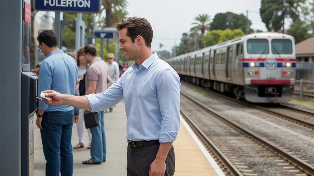
Public transit in Fullerton often centers around systems such as Metrolink and OCTA, though coverage varies by area. Rail service provides a genuine alternative for commuters traveling to Los Angeles, Anaheim, or other regional job centers. Stations serve as anchors for transit-oriented living, and residents near these nodes can structure their routines around scheduled service rather than constant driving.
Bus service exists, but its role is more limited. Routes tend to follow major corridors, and frequency varies throughout the day. Transit works best for linear, predictable commutes—home to work, work to home—rather than multi-stop errands or trips that require flexibility. Late-hour service is sparse, and coverage thins out significantly in residential areas farther from the core.
Where transit tends to work: near rail stations, along commercial corridors, and in denser pockets where destinations cluster within walking distance of stops. Where it falls short: peripheral neighborhoods, late nights, and any trip that requires multiple transfers or doesn’t align with a direct route. Transit in Fullerton is a tool that works well for specific use cases, not a blanket replacement for car ownership.
Driving & Car Dependence Reality
For most households, driving isn’t optional—it’s the default. Fullerton’s geography spreads destinations across a wide area, and many daily needs sit outside walkable or transit-accessible zones. Grocery stores, schools, medical appointments, and social commitments often require a car to reach efficiently.
Parking remains relatively abundant. Street parking exists in older neighborhoods, and most housing includes dedicated spaces. This reduces one of the friction points common in denser cities, where parking scarcity forces tradeoffs. In Fullerton, the tradeoff isn’t parking availability—it’s the time and fuel cost of covering distance.
Car dependence in Fullerton ties directly to the city’s infrastructure. Roads are wide, intersections are spaced for vehicle flow, and development patterns assume car access. Even in walkable pockets, most residents still own a vehicle for trips that fall outside their immediate neighborhood. The question isn’t whether you’ll drive—it’s how often, and whether you can structure your routine to minimize it.
Commuting Patterns & Daily Mobility
Commute patterns in Fullerton reflect its role as both a residential community and a regional connector. About 30 minutes is typical for a one-way commute, though that average masks significant variation. Some residents work locally and face short drives. Others commute to Los Angeles, Irvine, or other job centers, where travel time stretches depending on traffic and route.
Roughly 46.5% of workers face longer commutes, a figure that signals how many residents absorb significant travel time as part of their routine. Remote work has reduced this pressure for some—13.1% work from home—but the majority still travel to a physical workplace.
Daily mobility in Fullerton often involves more than a single commute. Parents manage school runs, errands stack throughout the week, and social or recreational trips add mileage. Multi-stop days favor driving, since transit requires advance planning and doesn’t adapt well to shifting schedules. Proximity to work or school reduces this friction, but only if your housing choice aligns with those destinations.
Who Transit Works For — and Who It Doesn’t
Transit in Fullerton works best for single commuters with jobs near rail-connected destinations. If you live within walking or biking distance of a station and work in downtown Los Angeles, Anaheim, or another stop along the line, rail service offers a predictable, cost-effective alternative to driving. Your commute becomes fixed in time and cost, and you avoid the variability of traffic and fuel prices.
Renters in core neighborhoods also benefit. Walkable access to groceries, restaurants, and services reduces the need for a car on a daily basis, even if you still drive occasionally. Younger professionals, students, and households without children often find this setup manageable.
Transit doesn’t work well for families managing complex logistics. School drop-offs, activity schedules, and weekend errands require flexibility that fixed-route service can’t provide. Peripheral neighborhoods lack the density and coverage to make transit practical for routine needs. And anyone whose job sits outside a transit corridor—most of Orange County’s employment is scattered across suburban office parks—will default to driving regardless of where they live.
The fit depends on alignment. If your home, work, and daily destinations cluster near transit infrastructure, it’s usable. If any one of those sits outside the network, car dependence returns.
Transportation Tradeoffs in Fullerton
Choosing between transit and driving in Fullerton means weighing predictability against flexibility. Transit offers fixed costs and schedules—you know when the train leaves, and your commute expense doesn’t fluctuate with gas prices. But you lose the ability to adapt. A missed connection, a late meeting, or an unplanned errand requires a backup plan.
Driving provides control. You leave when you want, stop where you need, and handle multi-stop days without coordination. But that control comes with exposure. Fuel prices—currently $4.63 per gallon in Fullerton—affect every trip. Traffic delays are common during peak hours. Maintenance, insurance, and parking costs layer onto the base expense of ownership.
For households weighing these tradeoffs, the decision often comes down to routine. If your daily life follows a predictable pattern and aligns with transit routes, the savings and simplicity can justify the loss of flexibility. If your schedule varies, or if you manage dependents with their own commitments, driving remains the more practical choice despite higher costs.
Geography also matters. Living near a rail station in a walkable pocket creates options. Living in a peripheral neighborhood eliminates them. A Month of Expenses in Fullerton: What It Feels Like explores how transportation fits into broader household costs, but the structural choice—where you live relative to transit—precedes the budget impact.
How this article was built: In addition to public economic data, this article incorporates location-based experiential signals derived from anonymized geographic patterns—such as access density, walkability, and land-use mix—to reflect how day-to-day living actually feels in Fullerton, CA.
FAQs About Transportation in Fullerton (2026)
Is public transit usable for daily commuting in Fullerton?
Transit works for daily commuting if your job sits along a rail line and you live near a station. Metrolink connects Fullerton to regional employment centers, and the schedule supports typical work hours. Outside those corridors, transit becomes less practical. Bus service exists but requires more planning and time. Most residents still drive.
Do most people in Fullerton rely on a car?
Yes. The majority of households in Fullerton depend on a car for daily needs. Infrastructure, geography, and development patterns all assume vehicle access. Even residents who use transit for commuting often own a car for errands, weekends, and trips outside the transit network.
Which areas of Fullerton are easiest to live in without a car?
Neighborhoods near the historic downtown core and within walking distance of a rail station offer the most car-free viability. These areas combine transit access with higher density of groceries, restaurants, and services. You can handle daily errands on foot and commute by rail if your job aligns. Peripheral neighborhoods require a car for nearly everything.
How does commuting in Fullerton compare to nearby cities?
Fullerton’s commute patterns reflect its position between Los Angeles and Orange County job markets. Average commute times sit around 30 minutes, and nearly half of workers face longer trips. This is comparable to other suburban cities in the region, though proximity to rail gives Fullerton an advantage for commuters heading to downtown LA or Anaheim.
Can you bike for transportation in Fullerton?
Biking is possible in certain areas, particularly near the core where infrastructure supports it. Bike-to-road ratios indicate some presence of cycling infrastructure, though it’s not widespread. Biking works best for short trips within a neighborhood or to nearby destinations. Longer commutes or trips across the city remain car-dependent for most residents.
How Transportation Fits Into the Cost of Living in Fullerton
Transportation in Fullerton isn’t just a line item—it’s a structural factor that shapes where you live, how much time you control, and what flexibility you retain. Choosing a home near transit or within a walkable pocket reduces car dependence, but those neighborhoods often carry higher rents or home prices. Choosing a peripheral location lowers housing costs but increases driving, fuel expense, and commute time.
The tradeoff isn’t always financial. Time spent commuting, predictability of schedules, and the mental load of managing logistics all factor into quality of life. Some households prioritize minimizing transportation friction, even if it means paying more for location. Others accept longer commutes and car dependence in exchange for more space or lower rent.
Understanding how you’ll actually move through Fullerton—not just how you’d prefer to—clarifies which neighborhoods fit your routine and which will create daily friction. Transportation doesn’t exist in isolation. It connects to housing choice, job location, and household composition. Getting it right means aligning all three.