Can you live in Mountain View without a car? The answer depends less on the city as a whole and more on where you land within it. Mountain View sits in the heart of Silicon Valley, where tech campuses, residential neighborhoods, and regional transit corridors overlap in ways that create pockets of genuine walkability alongside stretches where driving remains the default. Unlike sprawling suburbs where car ownership is non-negotiable, or dense urban cores where transit dominates, Mountain View offers a mixed mobility landscape—one where your daily transportation reality is shaped heavily by proximity to rail, density of services, and the structure of your commute.
This article explains how people actually get around Mountain View, what public transit can and can’t do, and who benefits from alternatives to driving. It’s not about calculating commute costs or comparing fare structures—it’s about understanding how mobility works here, and how that shapes daily life and household logistics.
How People Get Around Mountain View
Mountain View’s transportation pattern reflects its position as a mid-density city with strong rail access and well-developed pedestrian infrastructure in parts of the city. The pedestrian-to-road ratio exceeds high thresholds, meaning sidewalks, crossings, and walking paths are substantially more present relative to the road network than in typical car-oriented suburbs. This doesn’t mean every block is equally walkable—it means the city has invested in pedestrian infrastructure in concentrated areas, particularly around downtown and transit corridors.
Rail service is present, and it plays a meaningful role in how residents move regionally. Bike infrastructure is notable throughout parts of the city, with the bike-to-road ratio also exceeding high thresholds. This combination—walkable pockets, rail access, and cycling infrastructure—creates a mobility environment where alternatives to driving are genuinely viable for some households, but not universally accessible across all neighborhoods.
What newcomers often misunderstand is that Mountain View’s walkability and transit access are geographically concentrated. Living near downtown or along the Caltrain corridor opens up a different set of daily routines than living in the residential neighborhoods farther from these nodes. The city’s layout rewards proximity: those close to rail stations, grocery clusters, and bike lanes can structure their lives around non-car mobility. Those farther out typically drive, not because alternatives don’t exist in the city, but because they don’t extend uniformly to every block.
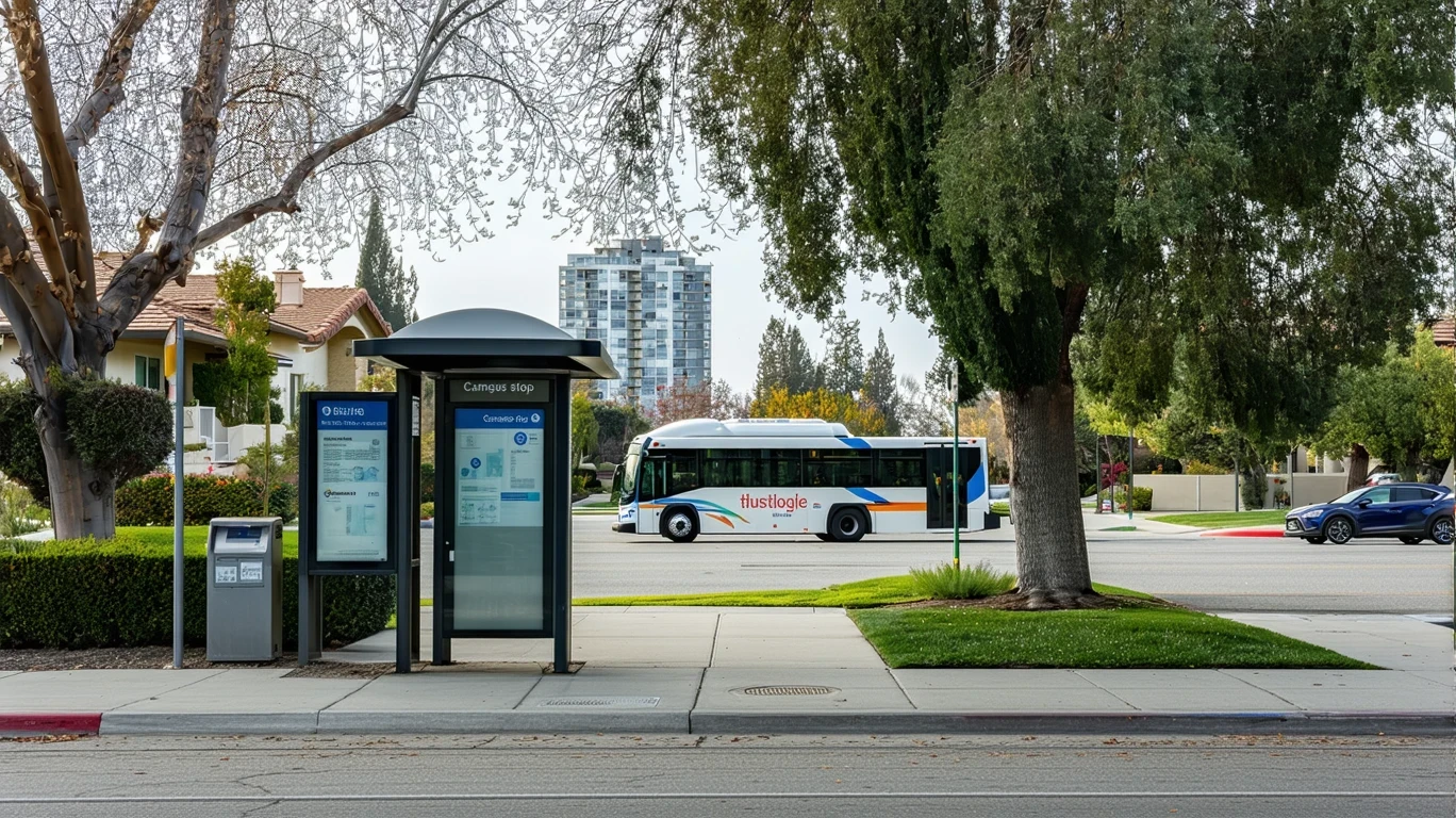
Public Transit Availability in Mountain View
Public transit in Mountain View often centers around systems such as Caltrain and VTA (Santa Clara Valley Transportation Authority), though coverage and usefulness vary by area. Caltrain provides north-south rail service connecting Mountain View to San Francisco, San Jose, and other Peninsula cities, making it a strong option for regional commuters whose destinations align with the rail line. VTA operates bus routes throughout the city and broader Santa Clara County, offering local and express service, though frequency and span of service differ by route.
Transit tends to work best for residents living within walking or biking distance of Caltrain stations—particularly the downtown Mountain View station—and for those commuting to destinations also served by rail or well-connected bus lines. The rail corridor creates a spine of higher transit utility, where car-free or car-light living becomes practical. Errands are broadly accessible in these areas: food and grocery density both exceed high thresholds, meaning daily needs can often be met on foot or by bike.
Where transit falls short is in coverage of residential neighborhoods removed from rail stations, late-night service, and multi-stop trips that don’t align with fixed routes. Bus service exists, but for households managing complex logistics—multiple jobs, childcare pickups, weekend errands across dispersed locations—the lack of frequent, direct connections makes driving far more practical. Transit also becomes less useful for commuters whose workplaces are not near rail stations or bus hubs, a common reality in a region where office parks and tech campuses are often car-oriented by design.
Driving & Car Dependence Reality
Driving remains necessary for a significant portion of daily life in Mountain View, particularly for residents living outside the walkable core or commuting to destinations poorly served by transit. The city’s layout includes both mixed-use corridors and lower-density residential zones, and the latter typically require a car for grocery runs, medical appointments, and non-work errands. Parking is generally available and less constrained than in denser urban centers, which reduces one friction point of car ownership but reinforces the expectation that most households will own at least one vehicle.
Car reliance in Mountain View is tied to geography and infrastructure, not just personal preference. Even in neighborhoods with good pedestrian infrastructure, the distances between home, work, school, and services often exceed what’s practical on foot or by bike for many households. Families with children, in particular, face logistical complexity: school drop-offs, after-school activities, and weekend commitments create multi-stop trip chains that are difficult to manage without a car, even when individual destinations are technically transit-accessible.
For those who do drive regularly, gas prices in the area stand at $5.79 per gallon, reflecting California’s higher fuel costs. This doesn’t make driving prohibitively expensive for most households, but it does mean that commute length and frequency matter more here than in regions with cheaper fuel. The tradeoff isn’t whether to drive—it’s how much driving your household can structure out of daily routines by choosing housing near work, transit, or services.
Commuting Patterns & Daily Mobility
Commuting in Mountain View varies widely depending on where you live, where you work, and whether your job allows flexibility. Single-destination commuters whose workplaces sit along the Caltrain line or near VTA routes can often rely on transit, particularly if they live near a station. This group includes tech workers commuting to San Francisco or other Peninsula cities, as well as residents working in Mountain View’s own office clusters near transit nodes.
For others, commuting involves driving—either the full distance or part of it. Park-and-ride behavior is common: some residents drive to a Caltrain station and take the train for the longer regional leg of the commute. This hybrid approach reduces time spent in traffic and avoids parking costs in expensive job centers, but it still requires car access and adds complexity to the daily routine.
Households managing multiple jobs, childcare, or errands on top of work commutes face the most friction. Transit works well for linear, predictable trips, but it struggles with the kind of multi-stop, time-sensitive logistics that define many families’ daily lives. Proximity becomes the key variable: living close to work, school, and services reduces the need for a car, but achieving that proximity often comes with higher housing costs, creating a financial tradeoff between transportation flexibility and rent or mortgage payments.
Who Transit Works For — and Who It Doesn’t
Transit in Mountain View works best for renters and homeowners living in or near downtown, along the Caltrain corridor, or in neighborhoods with high food and grocery density. These residents benefit from the city’s walkable pockets, rail access, and cycling infrastructure. Single adults and couples without children are particularly well-positioned to live car-free or car-light, especially if their commutes align with rail service and their daily errands fall within walking or biking distance.
Families with children face a different reality. School density in Mountain View exceeds high thresholds, and playground density falls in the medium band, indicating that family infrastructure is present but not uniformly distributed. Even when schools and parks are nearby, the need to manage multiple schedules, activities, and trips often makes car ownership the more practical choice. Transit can supplement driving for some trips, but it rarely replaces it entirely for households with complex logistics.
Peripheral neighborhoods—those farther from rail stations and outside the densest commercial corridors—tilt heavily toward car dependence. Residents in these areas may still bike or walk for some errands, particularly given the city’s notable bike infrastructure, but longer trips and regional commutes almost always require driving. The tradeoff here is space and quieter surroundings in exchange for less mobility flexibility.
Transportation Tradeoffs in Mountain View
Choosing between transit and driving in Mountain View is less about cost and more about control, predictability, and time. Transit offers lower ongoing expenses and eliminates parking hassles, but it requires living near stations and aligning your schedule with fixed routes and service hours. Driving provides flexibility and speed, particularly for multi-stop trips, but it comes with fuel costs, parking considerations, and the need to own and maintain a vehicle.
For households weighing these tradeoffs, location within the city is the primary lever. Living near a Caltrain station or within the walkable downtown core makes transit and biking genuinely viable, reducing or eliminating the need for a car. Living farther out shifts the balance toward driving, even if you occasionally use transit for regional trips. The city’s mixed urban form—with both residential and commercial land use detected—means that some neighborhoods support car-light living, while others assume car access as the baseline.
Predictability also matters. Transit schedules are fixed, and delays or service changes can disrupt commutes. Driving offers more control over timing, but it exposes you to traffic variability and parking constraints at your destination. Biking, where infrastructure supports it, splits the difference: it’s flexible and low-cost, but limited by distance, weather, and physical ability.
FAQs About Transportation in Mountain View (2026)
Is public transit usable for daily commuting in Mountain View?
Yes, if you live near a Caltrain station and your commute destination is also rail-accessible. Transit works well for linear, regional trips along the Peninsula corridor. For commutes within Mountain View or to destinations not near transit, driving or biking is usually more practical.
Do most people in Mountain View rely on a car?
Many do, particularly those living outside the downtown core or commuting to car-oriented job sites. However, a meaningful share of residents—especially those near rail and in walkable neighborhoods—use transit, bikes, or walking for at least part of their daily mobility.
Which areas of Mountain View are easiest to live in without a car?
Downtown Mountain View and neighborhoods within walking or biking distance of Caltrain stations offer the most car-free viability. These areas combine rail access, high grocery and food density, and strong pedestrian and bike infrastructure.
How does commuting in Mountain View compare to nearby cities?
Mountain View offers better rail access than many Silicon Valley suburbs, but less transit density than San Francisco or Oakland. It sits in the middle: more transit-viable than purely car-dependent suburbs, but still requiring a car for many residents depending on where they live and work.
Can you bike safely in Mountain View?
Bike infrastructure is notable throughout parts of the city, with the bike-to-road ratio exceeding high thresholds. This means protected lanes, bike paths, and crossings are more present than in typical suburban areas. Safety and comfort vary by route, but the infrastructure exists to support regular cycling for those willing to use it.
How Transportation Fits Into the Cost of Living in Mountain View
Transportation in Mountain View isn’t just a line item—it’s a structural factor that shapes where you can afford to live, how much time you spend commuting, and how much flexibility you have in daily life. Choosing housing near transit or work can reduce or eliminate car expenses, but that proximity often comes with higher rent or home prices. Choosing a car-dependent neighborhood may lower housing costs but increases fuel, maintenance, and time spent driving.
The city’s mixed mobility landscape means these tradeoffs are real and consequential. A household living downtown and relying on Caltrain and bikes will experience a different cost structure than one living farther out and driving daily. Neither is inherently better—it depends on your priorities, household composition, and where your job and daily needs are located.
For a fuller picture of how transportation expenses interact with housing, utilities, and other costs, the Monthly Budget article provides numeric context. This article has focused on access, structure, and tradeoffs—the factors that determine whether transit, driving, or biking makes sense for your household in Mountain View. Understanding how people actually move through the city, and why, is the first step in deciding where to live and how to structure your daily routines.
How this article was built: In addition to public economic data, this article incorporates location-based experiential signals derived from anonymized geographic patterns—such as access density, walkability, and land-use mix—to reflect how day-to-day living actually feels in Mountain View, CA.