Can you live in Atlanta without a car? For most people, the answer depends less on willingness and more on where you land. Atlanta’s transportation landscape is shaped by a sprawling metro footprint, a rail system that serves specific corridors well, and neighborhoods where pedestrian infrastructure and transit access create pockets of genuine walkability. Understanding how people actually get around here—and who benefits from transit versus who relies on driving—matters as much as any line item in a budget.
How People Get Around Atlanta
Atlanta is a car-dominant city, but not uniformly so. The metro area stretches across multiple counties, and transportation options in Atlanta vary sharply depending on proximity to the urban core and rail corridors. In neighborhoods with high pedestrian infrastructure and mixed land use, residents can walk to groceries, restaurants, and transit stops without planning every trip around a vehicle. Outside those pockets, driving becomes the default for nearly everything—commuting, errands, and social life.
What newcomers often misunderstand is that Atlanta’s walkable areas are real but geographically limited. The city’s development pattern favors low-density suburbs connected by highways, with transit and pedestrian infrastructure concentrated in specific zones. If you’re evaluating a move here, the question isn’t whether Atlanta has transit—it does—but whether the neighborhood you’re considering actually connects to it in a way that reduces car dependence.
Public Transit Availability in Atlanta
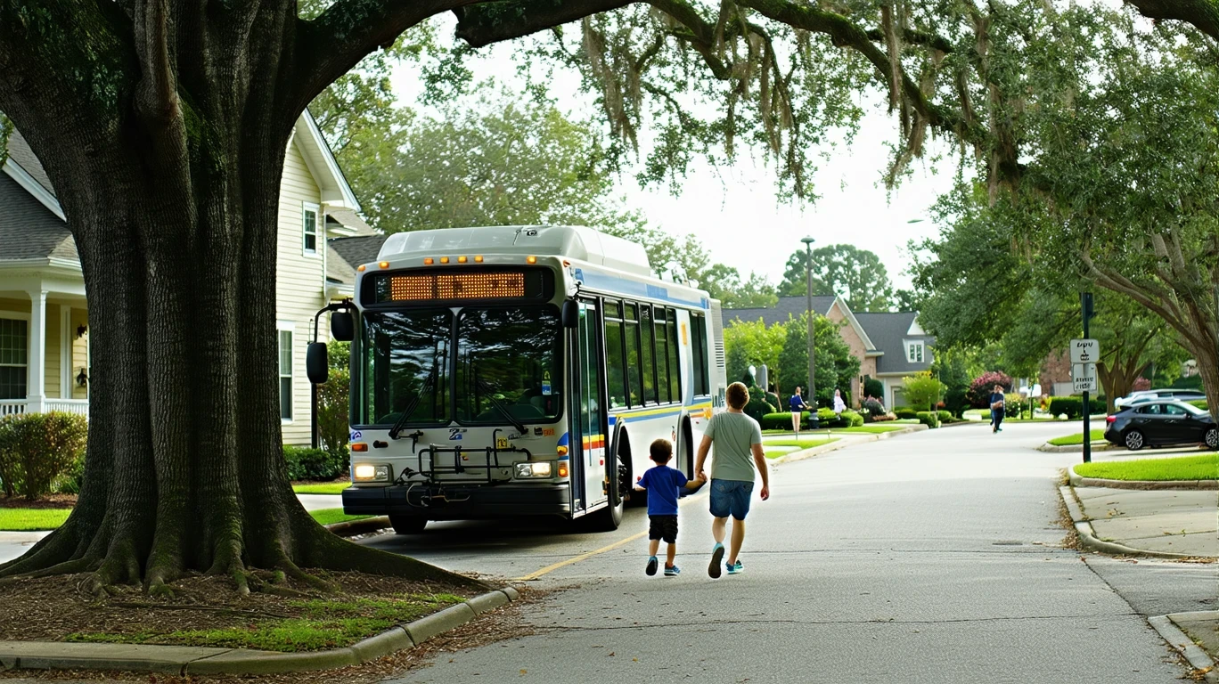
Public transit in Atlanta often centers around systems such as MARTA (Metropolitan Atlanta Rapid Transit Authority), which operates rail and bus service across parts of the metro. Rail service is present and plays a meaningful role for residents living near stations, particularly along north-south and east-west corridors that connect downtown, Midtown, and key employment centers. Where rail access exists, it offers predictable, traffic-independent commuting for those whose destinations align with the network.
Transit works best in the urban core and along established corridors where density, mixed land use, and pedestrian infrastructure support multimodal living. In these areas, residents can combine rail, walking, and occasional rideshare or bus service to handle daily errands and commuting. Outside these zones—particularly in suburban areas beyond the rail footprint—transit coverage thins quickly. Bus service exists but often requires longer travel times and transfers, making it less practical for households with tight schedules or multi-stop routines.
Late-night and weekend service is more limited than weekday peak hours, and geographic gaps mean that many neighborhoods have no direct rail access at all. For residents in those areas, transit becomes a secondary option rather than a primary tool.
Driving & Car Dependence Reality
For most Atlanta residents, driving isn’t optional—it’s structural. The metro’s sprawling layout, highway-centric development, and limited transit reach mean that daily life outside the core requires a car. Grocery runs, school drop-offs, medical appointments, and social plans often involve distances and destinations that transit doesn’t serve efficiently.
Parking availability is generally high, especially in suburban areas, and traffic congestion—while present during peak hours—is less about whether you can drive and more about how long it takes. The tradeoff is control and flexibility: driving lets you move on your own schedule, handle multiple stops in one trip, and reach destinations that aren’t on a rail line. That flexibility comes with exposure to fuel costs, maintenance, insurance, and the time cost of longer commutes, but for many households, it’s the only practical way to function here.
In neighborhoods with strong pedestrian infrastructure and high food and grocery density, car dependence softens. Residents in these areas can walk to daily errands and use transit for work trips, reserving driving for less frequent needs. But these neighborhoods represent a small share of the metro’s total housing stock, and competition for housing in walkable zones often drives up rent and purchase prices.
Commuting Patterns & Daily Mobility
Commuting in Atlanta reflects the metro’s geography. The average commute is 27 minutes, and 37.6% of workers face long commutes, defined as exceeding typical thresholds for one-way travel time. Only 8.6% of workers work from home, meaning the vast majority of employed residents are moving through the city regularly.
For those living near rail stations and working along transit corridors, commuting by rail is both practical and predictable. These commuters avoid traffic variability and benefit from the ability to read, work, or rest during travel. For everyone else—particularly those in suburban areas or with jobs in office parks, industrial zones, or dispersed employment centers—driving is the norm. Multi-stop commutes (dropping kids at school, running an errand on the way home) further tilt the balance toward car dependence.
Proximity to work or transit doesn’t just affect commute time—it shapes daily logistics. Households that can walk to groceries, access rail easily, and live near schools or parks experience less friction in daily routines. Those farther out trade longer travel times and car dependence for more space and often lower housing costs.
Who Transit Works For — and Who It Doesn’t
Transit in Atlanta works best for renters and owners in core neighborhoods with direct rail access, high pedestrian infrastructure, and mixed land use. These residents can structure their lives around walking and rail, using cars occasionally rather than constantly. Single commuters or couples without school-age children benefit most, as their daily routines involve fewer stops and more predictable destinations.
Transit is less viable for families with children, especially those managing school runs, after-school activities, and weekend logistics. It also falls short for residents in suburban areas where rail doesn’t reach and bus service requires long travel times or multiple transfers. Households with irregular work hours, jobs in non-downtown locations, or frequent need for multi-stop trips will find transit limiting.
The fit question isn’t about preference—it’s about alignment. If your work, home, and daily destinations all sit along a rail corridor in a walkable neighborhood, transit can genuinely reduce car dependence. If any one of those elements falls outside the transit footprint, driving becomes necessary, and the value of proximity to transit drops sharply.
Transportation Tradeoffs in Atlanta
Choosing between transit-oriented and car-dependent living in Atlanta involves tradeoffs in predictability, control, and flexibility. Transit offers freedom from traffic variability and the ability to avoid driving costs and parking hassles, but it limits where you can live and work while maintaining reasonable commute times. Driving provides door-to-door control and access to the full metro area, but it exposes you to fuel costs, maintenance, traffic delays, and the time cost of longer commutes.
Walkable, transit-accessible neighborhoods reduce daily friction and allow households to function without constant car use, but housing in these areas is more competitive and often more expensive. Suburban areas offer more space and lower housing costs but require car ownership and longer travel times for most activities.
The decision isn’t about optimizing transportation costs—it’s about understanding how mobility shapes daily life, time, and flexibility. Where you live determines how you move, and how you move determines how much control you have over your schedule and routine.
In practice, Atlanta’s transportation reality is lived at the neighborhood level. Residents in areas with high pedestrian infrastructure and rail access—places where sidewalks connect to transit stops, groceries are within walking distance, and mixed-use development puts daily needs close by—experience a fundamentally different city than those in car-dependent suburbs. The former can leave the car parked for days; the latter plan every outing around driving. That structural difference doesn’t just affect transportation costs—it shapes time, routine, and the mental load of managing a household. Families in walkable pockets near rail can send a teenager to grab groceries on foot or let a non-driving partner handle errands independently. Families farther out coordinate car schedules, plan routes, and absorb the friction of distance. Atlanta’s mobility landscape isn’t binary, but it is geographic: where you live determines whether transit is a tool or an aspiration.
FAQs About Transportation in Atlanta (2026)
Is public transit usable for daily commuting in Atlanta?
Yes, but only if you live and work near rail corridors. Residents in core neighborhoods with direct access to rail stations can commute predictably and avoid traffic. Outside those areas, transit becomes less practical, and most commuters rely on driving.
Do most people in Atlanta rely on a car?
Yes. The metro’s sprawling layout and limited transit reach mean that most residents depend on cars for commuting, errands, and daily logistics. Only those in specific walkable, transit-accessible neighborhoods can function without regular car use.
Which areas of Atlanta are easiest to live in without a car?
Neighborhoods with direct rail access, high pedestrian infrastructure, and mixed land use—typically in the urban core and along established transit corridors—are the most viable for car-free or car-light living. These areas allow residents to walk to groceries and transit stops and rely on rail for commuting.
How does commuting in Atlanta compare to nearby cities?
Atlanta’s average commute time is 27 minutes, and 37.6% of workers face long commutes. Compared to other Southeastern metros, Atlanta’s sprawl and highway-centric layout create longer travel times for suburban residents, while core neighborhoods with rail access offer more predictable commuting.
Can you live in Atlanta without owning a car?
It’s possible in a small number of neighborhoods with strong transit access and walkable infrastructure, but it requires careful location selection and limits housing options. For most residents, especially families or those working outside downtown, car ownership is necessary.
How Transportation Fits Into the Cost of Living in Atlanta
Transportation in Atlanta isn’t just a budget line—it’s a structural factor that shapes housing choice, time, and daily flexibility. Choosing a neighborhood close to rail and walkable amenities may mean higher rent or purchase prices, but it reduces car dependence and the associated costs of fuel, maintenance, and parking. Choosing a suburban location with more space and lower housing costs typically requires car ownership and longer commutes, shifting expenses from housing to transportation and time.
The decision isn’t about minimizing one category—it’s about understanding how mobility, housing, and time interact. Proximity to transit and walkable errands doesn’t eliminate transportation costs, but it changes their structure and reduces daily friction. For a fuller picture of how where money goes and how transportation fits into the broader cost structure, see A Month of Expenses in Atlanta: What It Feels Like.
Atlanta’s transportation landscape rewards location decisions made with eyes open. If you’re evaluating neighborhoods, start by mapping your work location, daily destinations, and household logistics against the rail network and walkable zones. The city offers real options for reducing car dependence, but they’re geographically specific. Understand the tradeoffs, choose the fit that matches your priorities, and you’ll navigate Atlanta’s mobility reality with confidence.
How this article was built: In addition to public economic data, this article incorporates location-based experiential signals derived from anonymized geographic patterns—such as access density, walkability, and land-use mix—to reflect how day-to-day living actually feels in Atlanta, GA.