Picture two households earning the same salary, one renting in Baytown for $1,207 per month, the other in The Woodlands for $1,723. At the grocery store, both pay $2.71 per dozen eggs, $4.05 for a half-gallon of milk, and $6.69 per pound of ground beef. Derived estimate based on national baseline adjusted by regional price parity; not an observed local price. The line items look nearly identical—until you zoom out and see where each household’s money actually goes, and how the structure of daily life shapes what feels manageable versus what feels tight.
Baytown and The Woodlands sit within the same Houston metro area, share the same utility providers, and face the same Gulf Coast heat. But the cost experience in each city is driven by fundamentally different pressures: Baytown offers a lower entry barrier but requires more logistical planning due to sparse daily errands accessibility, while The Woodlands commands a significantly higher upfront cost but attracts households with incomes structured to absorb that baseline. The decision between them in 2026 isn’t about which city is “cheaper”—it’s about which cost structure aligns with your household’s income composition, transportation needs, and tolerance for friction in day-to-day logistics.
This comparison explains where cost pressure concentrates in each city, how the same income feels different depending on what you’re paying for, and which households find stability in Baytown versus The Woodlands. It’s not a race to the bottom—it’s a guide to understanding which tradeoffs matter most when your paycheck, your commute, and your daily errands all have to fit together.
Housing Costs: Entry Barrier vs Ongoing Obligation
The most visible difference between Baytown and The Woodlands is housing. Baytown’s median home value sits at $162,200, while The Woodlands’ reaches $456,400—a gap of nearly $294,200 that fundamentally shapes who can enter each market and what kind of household income is required to sustain ownership. For renters, the pattern holds: Baytown’s median gross rent is $1,207 per month, compared to $1,723 per month in The Woodlands. That $516 monthly difference isn’t just a line item—it’s the margin that determines whether a single income can cover rent and utilities, or whether a household needs dual earners just to meet baseline obligations.
In Baytown, the lower entry point opens the door to homeownership for first-time buyers and single-income households who might be priced out of other Houston-area suburbs. The housing stock reflects a mix of building heights and both residential and commercial land use, creating pockets where apartments, townhomes, and single-family homes coexist. This mix can offer flexibility for renters looking to transition to ownership without leaving the city, but it also means that housing quality, lot size, and neighborhood character vary widely. For families prioritizing space over walkability, Baytown’s lower prices can translate into more square footage or a yard—but the tradeoff often comes in the form of older housing stock, which can introduce higher maintenance and utility exposure over time.
The Woodlands, by contrast, is structured around a higher baseline. The median household income here is $142,384 per year—more than double Baytown’s $61,158—and the housing market reflects that income distribution. Buyers and renters in The Woodlands are more likely to be dual-income professionals, established families, or households with significant equity from prior home sales. The higher rent and purchase prices aren’t just about location—they often correlate with newer construction, planned community amenities, and lower deferred maintenance risk. For households that can clear the entry threshold, the ongoing cost may feel more predictable, with less volatility from unexpected repairs or aging infrastructure.
For renters, the decision hinges on income stability and household composition. A single adult earning near Baytown’s median income can cover rent and still have breathing room for other expenses, but in The Woodlands, that same income would be stretched thin or insufficient. Dual-income couples may find Baytown’s rent manageable enough to prioritize savings or discretionary spending, while in The Woodlands, rent becomes the dominant fixed cost, requiring careful budgeting elsewhere. Families with kids face a more complex calculus: Baytown’s lower rent frees up cash for childcare or groceries, but the city’s limited family infrastructure—school and playground density both fall below thresholds—means parents may spend more time and fuel driving to parks, activities, or higher-rated school zones. The Woodlands’ higher rent may come bundled with proximity to amenities that reduce those logistical costs, though that convenience isn’t guaranteed and depends heavily on neighborhood.
Housing takeaway: Baytown fits households where income is the binding constraint and where lower monthly obligations create flexibility for other priorities. The Woodlands fits households where income can absorb higher baseline costs and where predictability, newer housing stock, and reduced maintenance risk justify the premium. The choice isn’t about which city is more affordable in absolute terms—it’s about whether your household is more exposed to entry barriers or to ongoing volatility, and whether you value cash flexibility now or structural predictability later.
Utilities and Energy Costs: Same Rates, Different Exposure
Both Baytown and The Woodlands pull from the same regional energy grid, paying identical rates: 16.11¢ per kWh for electricity and $30.71 per MCF for natural gas. On paper, utility costs should be indistinguishable. In practice, how those rates translate into monthly bills depends entirely on housing type, home age, square footage, and cooling demands—and those factors vary significantly between the two cities.
Baytown’s housing stock skews older and more varied, with a mix of single-family homes, apartments, and townhomes built across several decades. Older homes in the Gulf Coast climate often lack modern insulation, have single-pane windows, and rely on aging HVAC systems that run longer and harder during the extended cooling season. Even a modest-sized home can see elevated electricity usage during summer months when temperatures regularly push into the 90s and humidity makes it feel even hotter. Apartments may offer some relief through shared walls and smaller square footage, but units in older complexes can still experience poor airflow and inefficient cooling. The result is that utility bills in Baytown are less about the rate and more about how much energy a household has to consume just to stay comfortable. Families in larger, older homes face the highest exposure, while single adults or couples in newer apartments may see more predictable, moderate bills.
The Woodlands, with its higher home values and more recent development, tends to feature newer construction with better insulation, programmable thermostats, and more efficient HVAC systems. Larger homes—common in this price range—do consume more energy in absolute terms, but the efficiency gains often mean that cooling costs don’t scale linearly with square footage. Families in The Woodlands may run air conditioning for the same number of months as those in Baytown, but the cost per degree of comfort is often lower due to better building performance. That said, larger homes with vaulted ceilings, multiple zones, or poor landscaping (lack of shade trees) can still see significant summer spikes, particularly if the household prioritizes comfort over conservation.
Natural gas usage in both cities is minimal outside of winter months, when occasional cold snaps may require heating. The Gulf Coast doesn’t experience prolonged freezing, so gas bills remain low and predictable for most of the year. The bigger variable is electricity, and the biggest driver of electricity cost is cooling duration and home efficiency. Households in Baytown who rent or own older homes should budget for higher seasonal volatility, with summer bills potentially doubling or tripling compared to mild months. In The Woodlands, the volatility is still present but often less extreme, particularly in homes built after 2000.
For single adults, utility exposure is manageable in both cities if living in a smaller, well-insulated space. Couples in Baytown may face moderate bills in apartments but higher costs in older single-family rentals. Families with kids—especially those in larger homes—experience the sharpest divergence: in Baytown, older housing stock can mean consistently high summer bills with little control beyond thermostat discipline, while in The Woodlands, newer homes offer more levers (zoned cooling, better windows, smart thermostats) to manage costs without sacrificing comfort.
Utility takeaway: Baytown households face higher utility volatility due to older housing stock and less efficient cooling infrastructure, with exposure concentrated among families in single-family homes. The Woodlands households benefit from newer construction and better efficiency, but larger home sizes can still drive significant seasonal costs. The primary difference isn’t the rate—it’s the efficiency of the housing consuming that energy, and how much control a household has over usage without compromising livability.
Groceries and Daily Expenses: Same Prices, Different Access Patterns

Grocery prices in Baytown and The Woodlands are nearly identical, shaped by the same regional supply chains and retail competition across the Houston metro. A pound of chicken costs $2.02, a dozen eggs $2.71, and a half-gallon of milk $4.05 in both cities. Derived estimate based on national baseline adjusted by regional price parity; not an observed local price. The line-item costs don’t differ—but how households access those groceries, how often they rely on convenience options, and how much time and fuel they spend getting to stores can shift the effective cost of feeding a family or stocking a kitchen.
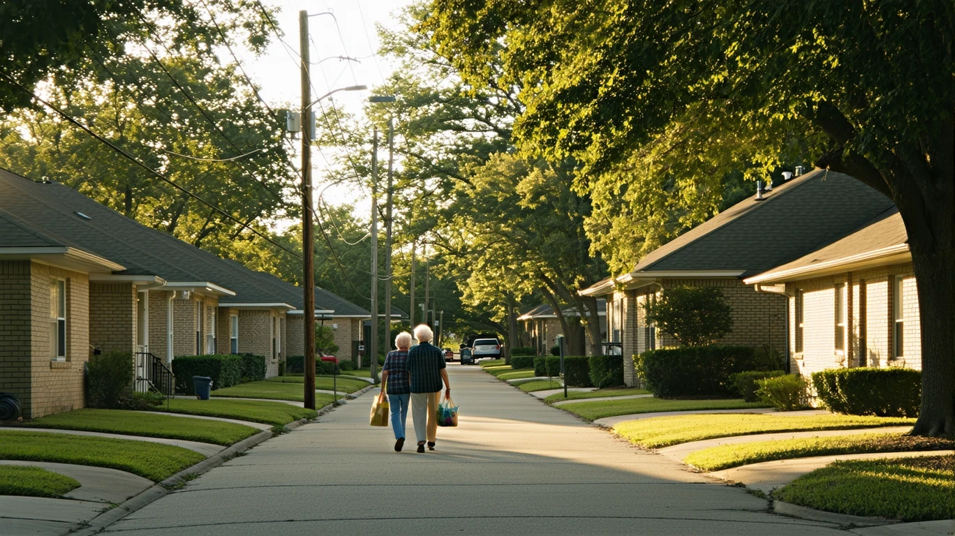
Baytown’s daily errands accessibility is sparse, with food establishment density falling below typical thresholds and grocery density sitting in a moderate band. This doesn’t mean stores don’t exist—it means they’re more spread out, clustered along specific corridors, and less likely to be within a quick walk or short drive from residential areas. For households without a car, or with only one vehicle shared among multiple adults, grocery runs require more planning. For families managing school pickups, work schedules, and meal prep, the lack of nearby options can lead to longer trips, consolidation of errands into weekend runs, or increased reliance on convenience stores and fast food when time is tight. Single adults and couples may adapt by shopping less frequently and buying in bulk, but that strategy requires upfront cash, storage space, and reliable transportation—luxuries not every household has.
The Woodlands lacks detailed experiential signals in the available data, but its higher income base and planned community structure typically correlate with more concentrated retail corridors, including grocery anchors, specialty stores, and prepared food options. Households here are more likely to have multiple grocery options within a reasonable drive, and higher incomes create more flexibility to choose between discount chains, organic markets, or premium grocers based on preference rather than proximity. The tradeoff is that convenience and variety often come with higher price tags on prepared foods, deli items, and specialty products—and households with more disposable income are more likely to absorb those costs without feeling the pinch.
Dining out and convenience spending follow a similar pattern. In Baytown, limited food establishment density means fewer casual dining options within easy reach, which can reduce spontaneous takeout spending but also increase reliance on fast food or chain restaurants when eating out does happen. Families trying to stretch a grocery budget may find that cooking at home is the default, not by choice but by necessity. In The Woodlands, the density of restaurants, coffee shops, and prepared meal services is typically higher, and households with dual incomes or higher earnings are more likely to treat dining out as a regular expense rather than an occasional splurge. Over time, that convenience creep—grabbing coffee on the way to work, picking up dinner instead of cooking, ordering delivery—can add hundreds of dollars per month to a household budget, even when grocery staples cost the same.
For single adults, Baytown’s sparse accessibility can mean fewer temptations to overspend on convenience, but it also means more time spent driving to stock a kitchen. Couples may split errands more easily but still face the friction of limited nearby options. Families with kids feel the difference most acutely: in Baytown, grocery trips become longer, more deliberate, and harder to squeeze into a weeknight, while in The Woodlands, proximity to stores and prepared food options can reduce time pressure but increase the temptation to spend more for convenience.
Groceries takeaway: Baytown and The Woodlands share the same grocery prices, but the cost of feeding a household is shaped by access patterns, time availability, and income flexibility. Baytown households face more logistical friction, requiring more planning and driving to access food options, which can reduce convenience spending but increase time and fuel costs. The Woodlands households benefit from denser retail access and higher incomes that support more frequent convenience purchases, but that ease can quietly inflate monthly food spending beyond the grocery cart. The difference isn’t what food costs—it’s how much effort and cash it takes to get it on the table.
Taxes and Fees: Predictable Baseline, Variable Add-Ons
Texas has no state income tax, so both Baytown and The Woodlands households avoid that particular line item. Instead, the tax burden falls primarily on property taxes and sales taxes, with additional fees layered in depending on housing type, neighborhood, and municipal services. The structural difference between the two cities isn’t the tax rates themselves—it’s the scale of the property being taxed and the prevalence of fees that come bundled with different housing markets.
Property taxes in Texas are assessed as a percentage of home value, and while exact rates vary by county, school district, and municipal boundaries, the practical impact is straightforward: higher home values mean higher annual tax bills. In Baytown, where the median home value is $162,200, a household might expect property taxes in the range typical for Harris County and local districts, but the absolute dollar amount remains moderate compared to more expensive suburbs. For renters, property taxes are baked into the landlord’s costs and indirectly reflected in rent, but they don’t appear as a separate bill. For homeowners, property taxes are a predictable annual obligation, though they can increase over time as home values rise or local districts adjust rates to fund schools and infrastructure.
In The Woodlands, where the median home value reaches $456,400, property taxes scale accordingly. Even at the same effective rate, a household here pays significantly more in absolute dollars each year. For long-term residents who bought years ago at lower prices, the tax burden may have grown steadily as home values appreciated. For recent buyers, the property tax bill is a known cost factored into affordability calculations from day one. Renters in The Woodlands face the same indirect exposure, with landlords passing through higher property tax costs in the form of elevated rents. The predictability is the same—property taxes don’t fluctuate month to month—but the magnitude is much higher, and that difference compounds over years of ownership.
Sales taxes apply equally across both cities, affecting groceries (where applicable), dining out, gas, and other retail purchases. Since both cities sit within the same metro and share similar sales tax structures, this isn’t a meaningful differentiator. The bigger variable is consumption level: households in The Woodlands, with higher median incomes, are more likely to spend more on taxable goods and services, which means they pay more in sales tax in absolute terms even though the rate is the same.
Fees introduce more variability. Homeowners’ association (HOA) fees are common in planned communities and newer subdivisions, and The Woodlands is known for its master-planned structure, which often includes mandatory HOA dues covering landscaping, amenities, and shared infrastructure. These fees can range from modest monthly charges to several hundred dollars, depending on the neighborhood and services included. In Baytown, HOA fees are less universal—older neighborhoods and standalone homes often have none, while newer townhome or condo developments may impose them. For households on tight budgets, the presence or absence of an HOA fee can be the difference between manageable monthly costs and financial strain.
Other recurring fees—trash collection, water, sewer—are typically billed separately in both cities, though some landlords bundle them into rent. The costs are comparable, driven more by usage and household size than by city. Homeowners in both cities should budget for these as baseline obligations, while renters need to clarify upfront whether utilities and fees are included or billed separately.
Taxes and fees takeaway: Baytown homeowners face lower absolute property tax bills due to lower home values, and HOA fees are less common, reducing recurring obligations. The Woodlands homeowners pay significantly more in property taxes due to higher home values, and HOA fees are more prevalent, adding another layer of monthly cost. Renters in both cities face indirect exposure through rent, but the magnitude differs based on the landlord’s cost structure. The primary difference is scale and predictability: Baytown offers lower baseline tax obligations with fewer mandatory fees, while The Woodlands imposes higher taxes and more structured fee schedules that reflect its planned community model.
How People Actually Move Around Baytown and The Woodlands
Both Baytown and The Woodlands are car-dependent cities, but the texture of that dependence—and the friction it creates—differs in ways that shape daily routines, time budgets, and fuel spending. Commute data isn’t available for either city, but the structure of mobility and access patterns tells a clear story about how households navigate work, errands, and family logistics.
Baytown shows a mixed mobility texture, with pedestrian infrastructure present but not dominant relative to the road network. The pedestrian-to-road ratio sits in a moderate band, meaning some neighborhoods have sidewalks, crosswalks, and pathways, but they’re not comprehensive or well-connected enough to replace car trips for most daily needs. Bike infrastructure is minimal, with the bike-to-road ratio falling below typical thresholds. In practice, this means walking or biking is possible for short, localized trips—maybe to a nearby park or within a residential cluster—but getting to work, school, or the grocery store almost always requires a car. The sparse daily errands accessibility reinforces this: with food and grocery establishments spread out and clustered along corridors rather than distributed evenly, households can’t easily walk to stock a pantry or grab a quick meal. Even if a family wanted to reduce car dependence, the infrastructure and density aren’t there to support it.
For single adults in Baytown, this means owning and maintaining a car is non-negotiable unless work and home are unusually close. Couples may be able to share one vehicle if their schedules align, but that requires coordination and limits flexibility. Families with kids face the steepest logistical burden: school drop-offs, after-school activities, grocery runs, and healthcare appointments all require driving, often multiple trips per day. The limited family infrastructure—school and playground density both below thresholds—means parents can’t rely on nearby options and instead spend more time shuttling kids across town. That time cost doesn’t show up on a budget spreadsheet, but it compounds with fuel costs, vehicle wear, and the mental load of managing a car-dependent household.
The Woodlands lacks detailed experiential signals, so specific claims about walkability or transit can’t be made. However, its planned community structure and higher income base typically correlate with more internal pathway networks, golf cart accessibility in some neighborhoods, and denser clustering of retail and services within master-planned villages. That doesn’t eliminate car dependence—most households still drive to work, especially if commuting into Houston—but it can reduce the number of short trips that require a car. Families in The Woodlands may find that parks, schools, and some errands are reachable without leaving the neighborhood, reducing daily fuel consumption and time spent in the car, even if the household still relies on vehicles for commuting and longer trips.
Gas prices are identical in both cities—$2.41 per gallon—so the cost difference comes down to how many miles a household drives each week. In Baytown, sparse accessibility and limited nearby options mean more driving for the same set of errands. In The Woodlands, denser internal infrastructure may reduce short trips, but longer commutes into Houston (common for professionals in the area) can offset those savings. The net effect depends on where each household works, how many drivers share a vehicle, and how much time they’re willing to trade for fuel savings.
Transportation takeaway: Baytown’s mixed mobility texture and sparse errands accessibility create a high baseline of car dependence, with households driving more frequently for daily needs and facing limited alternatives. The Woodlands likely offers more internal walkability and clustered amenities, reducing short trips but not eliminating car dependence, especially for commuters. The cost difference isn’t the price of gas—it’s how many miles a household has to drive to meet basic needs, and how much time and flexibility they lose in the process.
Cost Structure Comparison: Where Pressure Concentrates
Housing dominates the cost experience in both cities, but the nature of that dominance differs sharply. In Baytown, housing costs are low enough that they don’t crowd out other spending categories—a household earning near the median can cover rent or a mortgage and still have room for groceries, utilities, and transportation. The pressure here isn’t about affording shelter; it’s about managing the friction costs that come with sparse accessibility and older infrastructure. In The Woodlands, housing costs are the binding constraint for most households, requiring significantly higher income just to clear the entry threshold. Once that threshold is met, the remaining budget may feel more predictable, but the margin for error is narrower, and any income disruption hits harder.
Utilities introduce more volatility in Baytown due to older housing stock and less efficient cooling systems. Families in single-family homes face the highest exposure, with summer electricity bills spiking unpredictably depending on heat intensity and home condition. In The Woodlands, newer construction and better insulation reduce that volatility, though larger homes can still see significant seasonal swings. The difference is that Baytown households have less control over their utility costs without major home improvements, while The Woodlands households often have more levers—programmable thermostats, zoned cooling, better windows—to manage consumption without sacrificing comfort.
Transportation patterns matter more in Baytown, where sparse daily errands accessibility forces households to drive more frequently and over longer distances for routine needs. The time cost compounds with fuel spending and vehicle maintenance, creating a steady drain that doesn’t show up as a single line item but accumulates across weeks and months. In The Woodlands, denser internal infrastructure and higher incomes may reduce the frequency of short trips, but longer commutes into Houston can offset those gains. The difference is less about total miles driven and more about whether those miles are discretionary or unavoidable.
Groceries and daily expenses cost roughly the same in both cities at the register, but the effective cost diverges based on access and income. Baytown households spend more time and fuel getting to stores, which can reduce convenience spending but increase logistical burden. The Woodlands households benefit from denser retail access and higher incomes that support more frequent convenience purchases, but that ease can quietly inflate monthly spending beyond the grocery cart. For households sensitive to time pressure, The Woodlands’ convenience may justify the higher baseline costs; for households sensitive to cash flow, Baytown’s lower entry point may outweigh the added friction.
The better choice depends on which costs dominate the household. For households where income is the primary constraint, Baytown’s lower housing entry and moderate baseline costs create breathing room, even if daily logistics require more planning. For households where time, predictability, and reduced friction matter more than monthly savings, The Woodlands’ higher costs may deliver a structure that feels more sustainable, even if the absolute dollar amounts are larger. The decision isn’t about which city is cheaper—it’s about which cost structure aligns with your household’s income, priorities, and tolerance for logistical complexity.
How the Same Income Feels in Baytown vs The Woodlands
Single Adult
In Baytown, housing costs stay low enough that a single income can cover rent, utilities, and transportation without constant budget stress. The challenge is time: sparse errands accessibility means more driving, more planning, and fewer nearby options for quick meals or last-minute needs. Flexibility exists in the budget, but daily logistics require more effort. In The Woodlands, the same income struggles to cover rent alone, let alone utilities and groceries. Even if employment is stable, the margin for discretionary spending disappears, and any unexpected cost—car repair, medical bill—creates immediate strain. The predictability of newer housing and denser amenities doesn’t help if the baseline is unaffordable.
Dual-Income Couple
In Baytown, two incomes create comfortable breathing room, with housing costs leaving space for savings, dining out, or travel. The friction comes from coordinating errands and managing a car-dependent routine, especially if both partners work different schedules. Grocery runs and household tasks require more deliberate planning, but the financial pressure is low. In The Woodlands, two incomes can cover the higher rent or mortgage, but the margin tightens. The couple can afford the baseline, but less is left over for discretionary spending or emergency savings. The tradeoff is convenience: denser retail access and newer housing reduce time spent on logistics, but the financial cushion is thinner, and any income disruption—job loss, reduced hours—immediately shifts the household into stress.
Family with Kids
In Baytown, lower housing costs free up cash for childcare, groceries, and school expenses, but the limited family infrastructure creates a logistics nightmare. School and playground density fall below thresholds, meaning parents drive more for activities, playdates, and extracurriculars. Time becomes the non-negotiable cost: managing school drop-offs, errands, and household tasks requires constant coordination and a reliable vehicle. The cash flexibility is real, but the time cost is high. In The Woodlands, higher housing costs dominate the budget, requiring dual incomes or a single high earner just to stay stable. Once that threshold is met, proximity to schools, parks, and services can reduce the daily driving burden, freeing up time even if cash is tighter. The question is whether the household can clear the entry barrier—and whether the convenience justifies the ongoing financial pressure.
Decision Matrix: Which City Fits Which Household?
| Decision factor | If you’re sensitive to this… | Baytown tends to fit when… | The Woodlands tends to fit when… |
|---|---|---|---|
| Housing entry + space needs | You need to minimize upfront costs or monthly obligations to preserve cash flow | Your income is the binding constraint and lower rent or mortgage frees up budget for other priorities | Your income can absorb higher baseline costs and you prioritize newer construction and reduced maintenance risk |
| Transportation dependence + commute friction | You want to reduce daily driving or avoid long commutes into Houston | You can tolerate more frequent car trips for errands and don’t mind logistical planning | You value denser internal infrastructure that reduces short trips even if commuting remains car-dependent |
| Utility variability + home size exposure | You want predictable energy bills and control over seasonal spikes | You’re willing to accept higher volatility in exchange for lower baseline housing costs | You prioritize newer, more efficient housing that reduces cooling costs despite larger square footage |
| Grocery strategy + convenience spending creep | You want to avoid lifestyle inflation and keep food costs disciplined | You’re comfortable with less frequent shopping trips and limited nearby dining options | You value proximity to diverse food options and can budget for higher convenience spending |
| Fees + friction costs (HOA, services, upkeep) | You want to minimize recurring fees and maintain flexibility over household spending | You prefer older neighborhoods with fewer mandatory fees and more control over maintenance timing | You’re willing to pay HOA fees in exchange for bundled services and reduced individual upkeep burden |
| Time budget (schedule flexibility, errands, logistics) | You need to minimize time spent driving and coordinating household tasks | You have schedule flexibility and can consolidate errands into planned trips | You prioritize reducing daily logistics complexity even if it means higher baseline costs |
Lifestyle Fit: What Daily Life Actually Looks Like
Baytown and The Woodlands offer different textures of suburban life, shaped by infrastructure, income composition, and the density of amenities that make daily routines