The alarm goes off at 6:15 a.m. in a mid-rise apartment near downtown Houston. By 6:50, you’re walking three blocks to the rail platform, coffee in hand, watching the early light cut across glass towers and older brick facades. The train pulls in on time. You board with a mix of hospital staff, office workers, and students heading to the medical center. No traffic to fight. No parking to hunt. Just a seat, a podcast, and 25 minutes of someone else doing the driving. You step off near your building, walk two blocks, and you’re at your desk by 7:30—no sweat, no road rage, no surprise delays.
That version of Houston exists. But it’s not the version most people live.
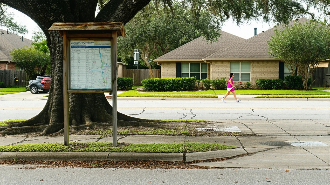
For the majority of Houston residents, getting around means getting behind the wheel. The city’s sheer geographic scale, dispersed employment centers, and historically car-oriented development pattern make driving the default for most households. Yet Houston is not a transportation monoculture. Rail service is present. Walkable pockets with high pedestrian infrastructure density exist in parts of the city. Bike infrastructure shows up notably in certain corridors. And in neighborhoods where food and grocery density exceeds high thresholds, some residents manage daily errands on foot or by transit without major friction.
Understanding transportation options in Houston means recognizing both what’s available and where it actually works. This article explains how people get around, what public transit can and can’t do, who benefits from alternatives to driving, and how mobility shapes daily life and household logistics across the city.
How People Get Around Houston
Houston operates as a car-first city with selective transit support. The dominant mobility pattern is driving, and that reflects both infrastructure investment history and the city’s sprawling footprint. Employment centers are dispersed. Residential neighborhoods stretch across hundreds of square miles. For most households, a personal vehicle is not a convenience—it’s a necessity.
But within that car-dominant framework, pockets of multimodal access have emerged. Rail transit is present and serves key corridors connecting downtown, the Texas Medical Center, and surrounding neighborhoods. Pedestrian infrastructure density is high in certain areas, supporting walkability for those who live and work within those zones. Bike-to-road ratios exceed high thresholds in parts of the city, indicating that cycling infrastructure exists and is used, though it remains geographically limited.
What newcomers often misunderstand is that Houston’s transportation reality is not uniform. Living near a rail line in a walkable pocket creates a fundamentally different daily experience than living in a suburban neighborhood ten miles from the nearest transit stop. The city’s layout rewards proximity. If your home, workplace, and daily errands align with transit corridors or dense, mixed-use areas, you can reduce or eliminate car dependence. If they don’t, driving becomes unavoidable.
The average commute in Houston is 27 minutes, and 44.1% of workers face long commutes. Only 7.3% work from home, meaning the vast majority of residents must physically travel to work. How that travel happens—and how much friction it involves—depends heavily on where you live and where you’re going.
Public Transit Availability in Houston
Public transit in Houston often centers around systems such as METRO, which operates bus and rail service across the region. Rail service is present and connects major employment hubs, medical facilities, universities, and downtown. For residents living along these corridors, rail provides a reliable, predictable alternative to driving during peak hours.
Transit works best in Houston’s core areas and along established corridors where density, land-use mix, and pedestrian infrastructure align. Residents in walkable pockets near rail stations can structure their lives around transit, using it for commuting and supplementing it with walking or biking for errands. In these zones, transit is not just available—it’s practical.
But coverage is uneven. Suburban areas, particularly those developed in the past few decades, often lack convenient transit access. Bus service may exist, but routes can be infrequent, and travel times lengthen significantly when multiple transfers are required. Late-night and weekend service is more limited, which affects shift workers, service industry employees, and anyone whose schedule doesn’t align with traditional commute hours.
Transit in Houston is not a citywide solution. It’s a corridor-based system that serves specific populations well and leaves others dependent on cars. Whether it works for you depends on where you live, where you work, and how much flexibility your schedule allows.
Driving & Car Dependence Reality
For most Houston residents, driving is not optional. The city’s development pattern prioritizes road infrastructure, and distances between home, work, schools, and services often exceed what’s practical for walking, biking, or transit. Parking is widely available, both at workplaces and in residential areas, which reinforces car use as the path of least resistance.
Sprawl is not just a geographic fact—it’s a daily logistics reality. Families managing school drop-offs, grocery runs, medical appointments, and extracurricular activities across dispersed locations face a coordination challenge that transit cannot solve. Even in areas with decent bus service, the time cost of multi-stop errands via transit often makes driving the only viable option.
Car dependence also brings tradeoffs. Driving offers flexibility, control, and the ability to move on your own schedule. But it also means exposure to traffic variability, maintenance costs, fuel price fluctuations, and the need to own, insure, and park at least one vehicle per working adult. For households stretching budgets, that exposure is significant.
Houston’s road network supports high volumes, but congestion is real, particularly during peak hours on major highways and corridors. The 44.1% long commute rate reflects not just distance, but time spent navigating traffic. Driving may be necessary, but it’s not always fast or predictable.
Commuting Patterns & Daily Mobility
Commuting in Houston is shaped by the city’s polycentric employment structure. Downtown, the Texas Medical Center, the Energy Corridor, and Greenway Plaza all function as major job hubs, but many residents work in smaller office parks, retail centers, or industrial zones scattered across the metro area. This dispersion means commute patterns vary widely.
Single-destination commuters—those traveling from home to one workplace and back—have the most options. If that workplace sits along a rail line or in a walkable core area, transit becomes viable. If it’s in a suburban office park, driving is usually the only practical choice.
Multi-stop commuters face greater friction. Parents dropping kids at school before heading to work, workers covering multiple job sites, or households managing errands alongside employment all require the flexibility that only a personal vehicle provides. Transit works for linear, predictable trips. It struggles with complexity.
Proximity matters intensely in Houston. Living close to work—or close to a transit line that reaches work—dramatically reduces commute friction. Living far from both means absorbing time, fuel, and schedule risk daily. The city’s geography does not forgive misalignment between home and workplace.
Who Transit Works For—and Who It Doesn’t
Transit in Houston works best for single adults or couples without school-age children, living in walkable pockets near rail lines, commuting to jobs in core employment zones. For this group, transit offers lower transportation costs, predictable travel times, and freedom from parking logistics. Renters in mid-rise buildings near downtown, the museum district, or the medical center often fit this profile.
Transit works less well for families managing multi-stop logistics, residents in suburban neighborhoods outside rail corridors, and workers whose jobs require travel to dispersed sites or non-standard hours. For these households, the time cost and coordination complexity of transit use outweigh any savings from reduced car ownership.
Homeowners in established suburban neighborhoods typically own at least one vehicle per adult, and many own two. This reflects both necessity and the structure of daily life in areas where errands, schools, and services are spread across miles of low-density development. Transit is not absent in these areas, but it’s not competitive with driving for most trips.
The fit question is not whether Houston has transit. It does. The question is whether your specific household pattern—where you live, where you work, how you manage errands, and what your schedule demands—aligns with where transit actually operates and how frequently it runs.
Transportation Tradeoffs in Houston
Choosing between transit and driving in Houston is not a simple cost comparison. It’s a tradeoff between predictability and flexibility, between lower ownership costs and greater logistical control.
Transit offers schedule predictability during peak hours, eliminates parking hassles, and reduces exposure to fuel price swings and maintenance surprises. For households able to structure their lives around transit corridors, it can meaningfully lower monthly expenses. But it also requires proximity, limits spontaneity, and adds time to trips that involve transfers or off-peak travel.
Driving offers door-to-door convenience, the ability to handle complex errands in a single trip, and independence from fixed schedules. But it also means absorbing the full cost of vehicle ownership, navigating traffic variability, and managing parking in denser areas. For families, driving is often non-negotiable simply because the alternative cannot accommodate the logistics of daily life.
The tradeoff is not universal. It’s specific to your household, your location, and your daily pattern. Houston’s transportation structure rewards alignment and penalizes mismatch. If your life fits the transit grid, you gain options. If it doesn’t, you drive.
FAQs About Transportation in Houston (2026)
Is public transit usable for daily commuting in Houston?
Yes, if you live near a rail line and work in a core employment zone such as downtown or the Texas Medical Center. Rail service is present and serves key corridors reliably during peak hours. For residents outside these areas, transit becomes less practical due to longer travel times, transfers, and limited coverage.
Do most people in Houston rely on a car?
Yes. The majority of Houston residents drive as their primary mode of transportation. The city’s geographic scale, dispersed employment centers, and historically car-oriented infrastructure make driving the default for most households, particularly those with families or living in suburban areas.
Which areas of Houston are easiest to live in without a car?
Walkable pockets near rail lines, particularly in and around downtown, the museum district, and the Texas Medical Center, offer the best conditions for car-free or car-light living. These areas combine high pedestrian infrastructure density, access to rail transit, and broadly accessible food and grocery options.
How does commuting in Houston compare to nearby cities?
Houston’s average commute of 27 minutes is moderate, but the 44.1% long commute rate indicates significant variability. Compared to more compact cities, Houston’s sprawl increases commute distances and limits transit competitiveness. Compared to other large Texas metros, Houston offers more rail transit options but still leans heavily on driving.
Can you bike for transportation in Houston?
Bike infrastructure is notably present in parts of Houston, with bike-to-road ratios exceeding high thresholds in certain areas. Cycling is viable for short trips in neighborhoods with protected lanes and lower traffic speeds, but it remains geographically limited and less practical for longer commutes or areas with high-speed arterials.
How Transportation Fits Into the Cost of Living in Houston
Transportation is not just a line item—it’s a structural factor that shapes where you can live, how much time you spend commuting, and how much flexibility you have in daily life. In Houston, mobility decisions ripple through housing choice, household logistics, and long-term financial exposure.
Living near transit or in a walkable pocket may allow you to reduce or eliminate car ownership, lowering insurance, maintenance, and fuel costs. But those neighborhoods often come with higher rents or home prices, reflecting the premium placed on access. Living farther out may reduce housing costs but increases transportation time and expense, particularly if multiple vehicles are required.
The real cost of transportation in Houston is not just what you spend on gas or transit passes. It’s the time absorbed by long commutes, the logistical complexity of managing errands across dispersed locations, and the exposure to volatility when fuel prices shift or vehicles need repair.
Houston’s transportation structure is not broken, but it is selective. It rewards proximity and punishes distance. It offers real alternatives in certain corridors and forces car dependence in others. Understanding how you move through the city—and what that movement costs in time, money, and flexibility—is essential to making informed decisions about where to live and how to structure your household.
How this article was built: In addition to public economic data, this article incorporates location-based experiential signals derived from anonymized geographic patterns—such as access density, walkability, and land-use mix—to reflect how day-to-day living actually feels in Houston, TX.