It’s 7:15 on a Tuesday morning in Brandon, and Maya is standing under the small shelter at a bus stop on State Road 60, backpack slung over one shoulder, watching eastbound traffic thicken as the sun climbs. She’s headed to her shift at a medical office near downtown Tampa—a trip that takes about 50 minutes door-to-door when the bus runs on time. She doesn’t mind the wait or the transfer; she’s done this route enough times to know which stops have shade and which mornings bring delays. But she also knows most of her neighbors don’t ride the bus. The parking lots around her apartment complex are full by 8 a.m., and the roads are crowded with solo drivers heading in every direction. Brandon is a place where the car is king, and public transit plays a supporting role—useful for some, invisible to most.
Understanding transportation options in Brandon means recognizing that this is a community built around driving. The street grid sprawls across suburban corridors, shopping centers anchor major intersections, and residential neighborhoods stretch outward in low-rise subdivisions. Public transit exists, but it serves a narrow slice of residents—those whose commutes align with fixed routes, whose schedules allow for longer travel times, and who live near the corridors where buses actually run. For everyone else, getting around Brandon means owning a car, managing fuel costs, and absorbing the time and friction that comes with traffic, parking, and distance.
This article explains how people actually move through Brandon: what transit is available, where driving becomes non-negotiable, and how the city’s layout shapes daily mobility and commute reality in 2026.
How People Get Around Brandon
Brandon operates as a car-first community. The dominant mobility pattern is solo driving, and the infrastructure reflects that priority. Roads are wide, parking is abundant, and most errands, commutes, and social trips assume access to a personal vehicle. Public transit exists in the form of bus service, but it functions as a supplemental option rather than a primary system. There is no rail, no light rail under construction, and no regional transit hub within city limits.
What newcomers often misunderstand is that Brandon’s walkable pockets—areas where pedestrian infrastructure is denser and errands feel more accessible—don’t eliminate the need for a car. These pockets exist along commercial corridors where grocery density is high and food establishments cluster, but they represent islands of convenience rather than a connected network. Outside these zones, residential streets are quiet, sidewalks are inconsistent, and distances between home, work, and services stretch beyond comfortable walking range.
The city’s layout reinforces car dependence. Brandon developed as a suburban extension of the Tampa metro area, and its low-rise building character, mixed land use, and corridor-based commercial clustering all point to a place designed for driving. Even in neighborhoods where walking feels pleasant, most residents still drive to work, drive to school, and drive to access anything beyond their immediate surroundings.
Public Transit Availability in Brandon
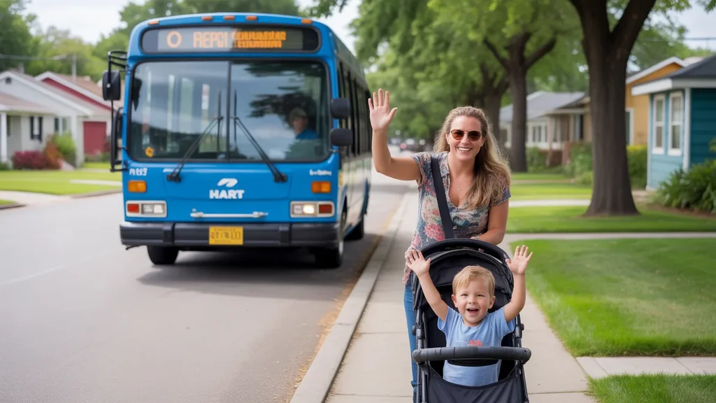
Public transit in Brandon centers around bus service. Routes connect residential areas to commercial corridors, employment centers in Tampa, and regional destinations, but coverage is limited and frequency varies by time of day. Transit works best for residents who live near major roads—State Road 60, Brandon Boulevard, Bloomingdale Avenue—and whose destinations align with established routes. For these riders, the bus provides a viable alternative to driving, especially for single-destination commutes during peak hours.
Where transit falls short is in reach and flexibility. Peripheral neighborhoods, especially those tucked into residential subdivisions away from main corridors, see little to no service. Late-night and weekend coverage is sparse, making transit impractical for shift workers, evening activities, or errands that don’t fit a 9-to-5 schedule. Transfers add time and complexity, and the system doesn’t accommodate multi-stop trips well—picking up groceries, dropping off kids, and getting to work all in one loop is difficult without a car.
Brandon’s transit role is supplemental. It serves a specific population—commuters with fixed schedules, households trying to reduce car dependency, and residents who live along well-served corridors—but it doesn’t function as a comprehensive mobility solution for the broader community.
Driving & Car Dependence Reality
Driving is the default mode of transportation in Brandon, and the city’s infrastructure assumes it. Parking is plentiful and usually free, roads are designed to move traffic efficiently, and most destinations—whether a grocery store, a doctor’s office, or a school—are easiest to reach by car. For families, multi-stop commuters, and anyone living outside the commercial corridors, driving isn’t a preference; it’s a necessity.
Car dependence brings predictability and control. Residents can leave when they want, take the most direct route, and handle complex errands without waiting for transfers or checking schedules. But it also brings exposure: to fuel price swings, to traffic congestion during peak hours, and to the ongoing costs of maintenance, insurance, and parking (even when parking itself is free, the cost of owning and operating a vehicle remains constant).
Brandon’s sprawl amplifies car reliance. The distance between home and work, between neighborhoods and services, and between daily destinations means that even short trips add up. Commuters traveling to Tampa face longer drives, and those working locally still navigate a landscape where walking or biking isn’t practical for most trips. The city’s low-rise, spread-out form makes density-dependent transit difficult to justify, and the result is a community where the car is not just convenient—it’s essential.
Commuting Patterns & Daily Mobility
Commuting in Brandon typically means driving, often alone, and often toward Tampa or other parts of Hillsborough County. The average commute is 28 minutes, and 44.0% of workers face what’s considered a long commute—a reflection of the city’s role as a bedroom community within a larger metro area. Only 7.8% of residents work from home, which means the vast majority are on the road daily, navigating traffic, managing time, and absorbing the friction that comes with distance.
For single-job commuters with predictable schedules, the routine becomes manageable. The same route, the same timing, the same parking spot. But for households juggling multiple jobs, school drop-offs, childcare pickups, and errands, the lack of transit flexibility and the city’s car-oriented layout create logistical complexity. Brandon’s limited family infrastructure—school and playground density both fall below thresholds—means parents often drive farther to access quality schools or recreational spaces, adding miles and time to an already car-dependent day.
Daily mobility in Brandon is structured around the car, and the city’s transportation options reflect that reality. Transit riders exist, but they’re the exception. Most people drive, and most people drive alone.
Who Transit Works For — and Who It Doesn’t
Public transit in Brandon works for a narrow group: renters living near major corridors, commuters with single-destination jobs, and households willing to trade time for the cost savings of not owning a second (or first) car. These residents benefit from proximity to bus stops, from schedules that align with peak service hours, and from commutes that don’t require multiple stops or late-night travel.
Transit doesn’t work well for families. The combination of limited coverage, infrequent service outside peak hours, and the logistical demands of managing school, childcare, and errands makes car ownership nearly unavoidable. It also doesn’t work for residents in peripheral neighborhoods, where bus service is sparse or nonexistent, or for workers with irregular schedules—retail, hospitality, healthcare—who need mobility outside the 7 a.m. to 7 p.m. window.
Homeowners in Brandon overwhelmingly rely on cars. The city’s layout, the distance between residential areas and employment centers, and the lack of rail or frequent transit all point toward driving as the default. Even in walkable pockets, where errands feel more accessible, most residents still drive to work, reinforcing the car-first pattern that defines Brandon’s transportation landscape.
Transportation Tradeoffs in Brandon
Choosing between transit and driving in Brandon isn’t a question of cost alone—it’s a question of control, predictability, and time. Driving offers flexibility: the ability to leave on your own schedule, to handle multi-stop trips efficiently, and to avoid the delays and transfers that come with bus travel. But it also means absorbing fuel price volatility (gas in Brandon is currently $2.78 per gallon), managing vehicle maintenance, and navigating traffic congestion during peak hours.
Transit offers a different tradeoff. For those who can make it work, the bus reduces the need for car ownership and the fixed costs that come with it. But it requires patience, schedule alignment, and proximity to well-served routes. It’s slower, less flexible, and less practical for households with complex logistics or irregular hours.
The real tradeoff in Brandon is between mobility and cost exposure. Driving gives you access to the entire metro area, but it ties your monthly budget to fuel prices, maintenance cycles, and insurance premiums. Transit limits where you can go and when, but it reduces dependence on a depreciating asset and the ongoing costs that come with it. Most residents choose driving, not because it’s cheaper, but because it’s the only option that fits the city’s geography and their daily demands.
FAQs About Transportation in Brandon (2026)
Is public transit usable for daily commuting in Brandon?
Public transit is usable for some daily commuters, particularly those living near major corridors like State Road 60 or Brandon Boulevard and traveling to fixed destinations during peak hours. For residents in peripheral neighborhoods or those with multi-stop commutes, transit becomes impractical. The system is bus-only, with no rail service, and coverage is limited outside core routes.
Do most people in Brandon rely on a car?
Yes. The vast majority of Brandon residents rely on a car for daily transportation. The city’s layout, low-rise development pattern, and limited transit coverage make driving the default mode for commuting, errands, and family logistics. Even in areas with better pedestrian infrastructure, car ownership remains the norm.
Which areas of Brandon are easiest to live in without a car?
The easiest areas to live without a car are those near commercial corridors where grocery density is high and bus service is frequent. Residents in these zones can walk to some errands and access transit for commuting, but even in these pockets, most daily trips still require a car. Living car-free in Brandon is difficult and limits access to jobs, services, and social opportunities.
How does commuting in Brandon compare to nearby cities?
Brandon’s average commute time of 28 minutes is typical for suburban communities in the Tampa metro area, but the high percentage of long commutes—44.0%—reflects the city’s role as a residential hub for workers traveling to Tampa and beyond. Compared to denser urban centers with rail transit, Brandon offers less commuting flexibility and greater reliance on driving.
Does Brandon have bike infrastructure?
Brandon has some cycling infrastructure, with bike-to-road ratios in the medium band, indicating presence in limited areas. However, cycling is not a primary mode of transportation for most residents. The city’s sprawl, traffic speeds, and gaps in connected bike lanes make biking practical only for recreational use or very short trips in specific neighborhoods.
How Transportation Fits Into the Cost of Living in Brandon
Transportation in Brandon is a structural factor, not just a budget line. The city’s car dependence shapes where people live, how they access work, and what tradeoffs they make between time, convenience, and cost. Households that can afford proximity to commercial corridors gain walkable access to groceries and some services, but they still drive for most trips. Those living farther out face longer commutes, higher fuel exposure, and fewer alternatives.
The cost of transportation in Brandon isn’t just about gas prices or bus fares—it’s about the fixed costs of car ownership, the time lost to commuting, and the flexibility (or lack thereof) that comes with the city’s transit options. For most residents, driving is unavoidable, and that reality affects housing choice, job access, and daily logistics in ways that ripple through every part of household planning.
Brandon’s transportation landscape is clear: cars dominate, transit serves a narrow slice, and the city’s layout reinforces that pattern. Understanding how you’ll get around—and what it will cost in time, money, and flexibility—is essential to understanding what it means to live here.
How this article was built: In addition to public economic data, this article incorporates location-based experiential signals derived from anonymized geographic patterns—such as access density, walkability, and land-use mix—to reflect how day-to-day living actually feels in Brandon, FL.